photo free
Home Images Vectors Videos

Stock image Strait Of Malacca page 2

stock image Malacca Straits Mosque (Masjid Selat Melaka), Malacca, Malaysia

Malacca Straits Mosque (Masjid Selat Melaka), Malacca, Malaysia

Image, 3.66MB, 3200 × 2126 jpg
stock image Langkawi Sky Bridge, Langkawi island, Malaysia

Langkawi Sky Bridge, Langkawi Island, Malaysia

Image, 5.38MB, 3888 × 2592 jpg
stock vector Administrative vector map of the Indonesian province of North Sumatra, Sumatra, Indonesia

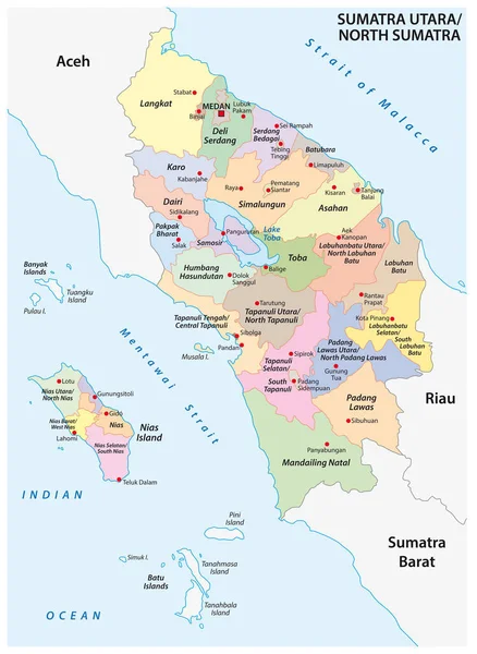
Administrative Vector Map Of The Indonesian Province Of North Sumatra, Sumatra, Indonesia

Vector, 1.4MB, 3100 × 4244 eps
stock image Rooftop view downtown area at dusk,with light trails from traffic and afterglow of sun behind distant hills, from the Observatory Deck of George Town's tallest building and prominent city landmark.

Rooftop View Downtown Area At Dusk,with Light Trails From Traffic And Afterglow Of Sun Behind Distant Hills, From The Observatory Deck Of George Town's Tallest Building And Prominent City Landmark.

Image, 24.24MB, 5979 × 6700 jpg
stock image Aeriel view of the downtown area,with light trails from traffic below,and afterglow of sun behind distant hills, from the Observatory Deck of George Town's tallest building and prominent landmark.

Aeriel View Of The Downtown Area,with Light Trails From Traffic Below,and Afterglow Of Sun Behind Distant Hills, From The Observatory Deck Of George Town's Tallest Building And Prominent Landmark.

Image, 21.54MB, 5362 × 6700 jpg
stock image Stunning views of the city and Malacca Strait, from the rooftop and Skywalk of George Town's tallest building and prominent landmark,with mainland Malaysia in the background,as sunset approaches.

Stunning Views Of The City And Malacca Strait, From The Rooftop And Skywalk Of George Town's Tallest Building And Prominent Landmark,with Mainland Malaysia In The Background,as Sunset Approaches.

Image, 20.5MB, 6700 × 4670 jpg
stock image Stunning views of the city and Malacca Strait,from the rooftop of George Town's tallest building and prominent landmark,with dramatic clouds over mainland Malaysia in the background,close to sunset.

Stunning Views Of The City And Malacca Strait,from The Rooftop Of George Town's Tallest Building And Prominent Landmark,with Dramatic Clouds Over Mainland Malaysia In The Background,close To Sunset.

Image, 13.38MB, 6700 × 4102 jpg
stock image Stunning views of the downtown central city area and Malacca Strait,from the rooftop of George Town's tallest building and prominent landmark,close to sunset.

Stunning Views Of The Downtown Central City Area And Malacca Strait,from The Rooftop Of George Town's Tallest Building And Prominent Landmark,close To Sunset.

Image, 13.81MB, 6700 × 4007 jpg
stock image One of the Chinese Clan Jetties,popular with tourists.Pretty potted plants in the foreground,next to calm sea water,a small jetty boardwalk in background,a fiishing boat and Malaysian mainland beyond.

One Of The Chinese Clan Jetties,popular With Tourists.Pretty Potted Plants In The Foreground,next To Calm Sea Water,a Small Jetty Boardwalk In Background,a Fiishing Boat And Malaysian Mainland Beyond.

Image, 18.53MB, 6700 × 4587 jpg
stock image The beautiful Clan Piers of Penang and Floating Village,wooden structures built on stilts,in the calm waters of the Mallaca Strait,where the immigrant Chinese Clans live,a UNESCO World Heritage site.

The Beautiful Clan Piers Of Penang And Floating Village,wooden Structures Built On Stilts,in The Calm Waters Of The Mallaca Strait,where The Immigrant Chinese Clans Live,a UNESCO World Heritage Site.

Image, 17.4MB, 6700 × 4443 jpg
stock image The beautiful Clan Piers of Penang and Floating Village,wooden structures built on stilts,in the calm waters of the Mallaca Strait,where the immigrant Chinese Clans live,a UNESCO World Heritage site.

The Beautiful Clan Piers Of Penang And Floating Village,wooden Structures Built On Stilts,in The Calm Waters Of The Mallaca Strait,where The Immigrant Chinese Clans Live,a UNESCO World Heritage Site.

Image, 13.65MB, 4335 × 6700 jpg
stock image The beautiful Clan Piers or and Floating Village,wooden structures built on stilts,surrounded by calm waters of the Mallaca Strait,where the immigrant Chinese Clans live,a UNESCO World Heritage site.

The Beautiful Clan Piers Or And Floating Village,wooden Structures Built On Stilts,surrounded By Calm Waters Of The Mallaca Strait,where The Immigrant Chinese Clans Live,a UNESCO World Heritage Site.

Image, 14.77MB, 5183 × 6700 jpg
stock image Penang,Malasia-April 30 2023:This ornate Clan Jetty,decorated with Chinese symbols and lined with shops and eateries,is built on stilts,at the edge of the Mallaca Strait,a UNESCO World Heritage site.

Penang,Malasia-April 30 2023:This Ornate Clan Jetty,decorated With Chinese Symbols And Lined With Shops And Eateries,is Built On Stilts,at The Edge Of The Mallaca Strait,a UNESCO World Heritage Site.

Image, 17.51MB, 4472 × 6700 jpg
stock image The beautiful Clan Piers of Penang and Floating Village,wooden structures built on stilts,in the calm waters of the Mallaca Strait,where the immigrant Chinese Clans live,a UNESCO World Heritage site.

The Beautiful Clan Piers Of Penang And Floating Village,wooden Structures Built On Stilts,in The Calm Waters Of The Mallaca Strait,where The Immigrant Chinese Clans Live,a UNESCO World Heritage Site.

Image, 13.36MB, 6700 × 3793 jpg
stock image Penang Island,Malaysia-April 26 2023:Atop George Town's tallest building,the transparent Skywalk,extended outward from level 68,is popular with tourists,but not recommended for vertigo sufferers.

Penang Island,Malaysia-April 26 2023:Atop George Town's Tallest Building,the Transparent Skywalk,extended Outward From Level 68,is Popular With Tourists,but Not Recommended For Vertigo Sufferers.

Image, 16.51MB, 6700 × 5084 jpg
stock image Ko Adang Island in the Malacca Strait on a satellite image taken in April 11, 2023

Ko Adang Island In The Malacca Strait On A Satellite Image Taken In April 11, 2023

Image, 4.32MB, 2880 × 1620 jpg
stock image Ko Yao Yai Island in the Malacca Strait on a topographic, OSM Humanitarian style map

Ko Yao Yai Island In The Malacca Strait On A Topographic, OSM Humanitarian Style Map

Image, 2.52MB, 2880 × 1620 jpg
stock image Pulau Rantau in the Malacca Strait on a topographic, OSM Humanitarian style map

Pulau Rantau In The Malacca Strait On A Topographic, OSM Humanitarian Style Map

Image, 3.17MB, 2880 × 1620 jpg
stock image Sumatra Island in the Java Sea - belonging to Indonesia. Described location diagram with yellow shape of the island and sample maps of its surroundings

Sumatra Island In The Java Sea - Belonging To Indonesia. Described Location Diagram With Yellow Shape Of The Island And Sample Maps Of Its Surroundings

Image, 2.87MB, 3840 × 2160 jpg
stock image Pulau Samosir in the Lake Toba - belonging to Indonesia. Described location diagram with yellow shape of the island and sample maps of its surroundings

Pulau Samosir In The Lake Toba - Belonging To Indonesia. Described Location Diagram With Yellow Shape Of The Island And Sample Maps Of Its Surroundings

Image, 3.29MB, 3840 × 2160 jpg
stock image Pulau Pandang in the Malacca Strait, belonging to Indonesia, isolated on a topographic, OSM Humanitarian style map, with distance scale

Pulau Pandang In The Malacca Strait, Belonging To Indonesia, Isolated On A Topographic, OSM Humanitarian Style Map, With Distance Scale

Image, 0.61MB, 2160 × 2160 jpg
stock image Ko Adang Island in the Malacca Strait, belonging to Thailand, isolated on a satellite image taken in March 2, 2021, with distance scale

Ko Adang Island In The Malacca Strait, Belonging To Thailand, Isolated On A Satellite Image Taken In March 2, 2021, With Distance Scale

Image, 1.87MB, 2160 × 2160 jpg
stock image Pulau Dayang Bunting in the Malacca Strait on a colored elevation map

Pulau Dayang Bunting In The Malacca Strait On A Colored Elevation Map

Image, 1.06MB, 2880 × 1620 jpg
stock image Pulau Batu Kawan in the Malacca Strait, belonging to Malaysia, isolated on a topographic, OSM Humanitarian style map, with distance scale

Pulau Batu Kawan In The Malacca Strait, Belonging To Malaysia, Isolated On A Topographic, OSM Humanitarian Style Map, With Distance Scale

Image, 1.07MB, 2160 × 2160 jpg
stock image Ko Rawi Island in the Malacca Strait, belonging to Thailand, isolated on a topographic, OSM Humanitarian style map, with distance scale

Ko Rawi Island In The Malacca Strait, Belonging To Thailand, Isolated On A Topographic, OSM Humanitarian Style Map, With Distance Scale

Image, 0.28MB, 2160 × 2160 jpg
stock image Ko Adang Island in the Malacca Strait, belonging to Thailand, isolated on a topographic, OSM Humanitarian style map, with distance scale

Ko Adang Island In The Malacca Strait, Belonging To Thailand, Isolated On A Topographic, OSM Humanitarian Style Map, With Distance Scale

Image, 0.27MB, 2160 × 2160 jpg
stock image Pulau Pasir Hitam in the Malacca Strait on a satellite image taken in February 12, 2024

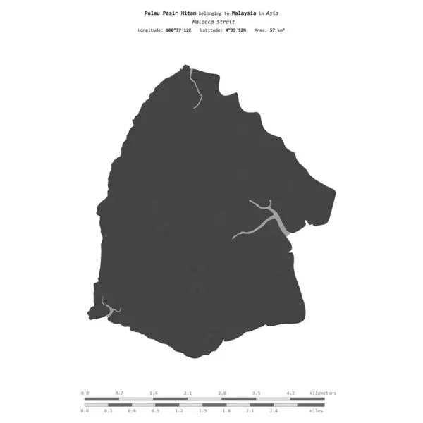
Pulau Pasir Hitam In The Malacca Strait On A Satellite Image Taken In February 12, 2024

Image, 5.07MB, 2880 × 1620 jpg
stock image Pulau Pasir Hitam in the Malacca Strait, belonging to Malaysia, isolated on a bilevel elevation map, with distance scale

Pulau Pasir Hitam In The Malacca Strait, Belonging To Malaysia, Isolated On A Bilevel Elevation Map, With Distance Scale

Image, 0.31MB, 2160 × 2160 jpg
stock image Ko Rawi Island in the Malacca Strait, belonging to Thailand, isolated on a bilevel elevation map, with distance scale

Ko Rawi Island In The Malacca Strait, Belonging To Thailand, Isolated On A Bilevel Elevation Map, With Distance Scale

Image, 0.29MB, 2160 × 2160 jpg
stock image Pulau Batu Kawan in the Malacca Strait on a satellite image taken in December 4, 2023

Pulau Batu Kawan In The Malacca Strait On A Satellite Image Taken In December 4, 2023

Image, 6.42MB, 2880 × 1620 jpg
stock image Ko Phi Phi Lee island is in the Phi Phi archipelago, in the Strait of Malacca. It is in Krabi Province of Thailand and it's the second large island in the arcipelago.

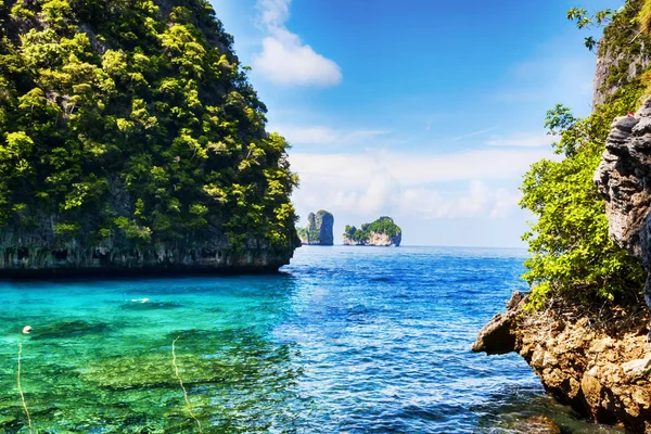
Ko Phi Phi Lee Island Is In The Phi Phi Archipelago, In The Strait Of Malacca. It Is In Krabi Province Of Thailand And It's The Second Large Island In The Arcipelago.

Image, 9.47MB, 3888 × 2592 jpg
stock image Langkawi island landscape, Malaysia

Langkawi Island Landscape, Malaysia

Image, 25MB, 7994 × 3300 jpg
stock image Tanker Ships in Singapore Strait

Tanker Ships In Singapore Strait

Image, 6.4MB, 4288 × 2848 jpg
stock image Malacca Straits Mosque (Masjid Selat Melaka), Malacca, Malaysia

Malacca Straits Mosque (Masjid Selat Melaka), Malacca, Malaysia

Image, 3.11MB, 4228 × 2800 jpg
stock image Sky Bridge cable car, Langkawi island, Malaysia

Sky Bridge Cable Car, Langkawi Island, Malaysia

Image, 4.86MB, 3888 × 2592 jpg
stock image Malacca Straits Mosque (Masjid Selat Melaka), Malacca, Malaysia

Malacca Straits Mosque (Masjid Selat Melaka), Malacca, Malaysia

Image, 5MB, 4000 × 2650 jpg
stock vector Road map of the indonesian island sumatra

Road Map Of The Indonesian Island Sumatra

Vector, 1.81MB, 3373 × 3100 eps
stock vector Indo-Pacific major energy SLOCs, political map. Geopolitically critical Sea Lines Of Communication. Primary maritime routes between ports, used for trade, logistics and naval forces. Illustration.

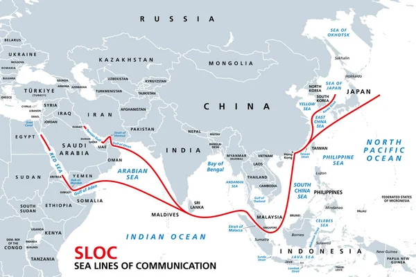
Indo-Pacific Major Energy SLOCs, Political Map. Geopolitically Critical Sea Lines Of Communication. Primary Maritime Routes Between Ports, Used For Trade, Logistics And Naval Forces. Illustration.

Vector, 3.03MB, 9000 × 6000 eps
stock vector Administrative vector map of the Indonesian province of Aceh, Sumatra, Indonesia

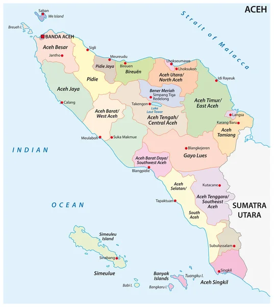
Administrative Vector Map Of The Indonesian Province Of Aceh, Sumatra, Indonesia

Vector, 0.99MB, 3100 × 3458 eps
stock image Stunning views of the city and Malacca Strait at dusk,from the rooftop of George Town's tallest building and prominent landmark,with dramatic clouds over mainland Malaysia in the background.

Stunning Views Of The City And Malacca Strait At Dusk,from The Rooftop Of George Town's Tallest Building And Prominent Landmark,with Dramatic Clouds Over Mainland Malaysia In The Background.

Image, 20.43MB, 6700 × 4472 jpg
stock image Stunning views of the city and Malacca Strait,from the rooftop of George Town's tallest building and prominent landmark,with dramatic clouds over mainland Malaysia in the background,close to sunset.

Stunning Views Of The City And Malacca Strait,from The Rooftop Of George Town's Tallest Building And Prominent Landmark,with Dramatic Clouds Over Mainland Malaysia In The Background,close To Sunset.

Image, 19.12MB, 6700 × 5632 jpg
stock image Penang Island,Malaysia-April 25 2023: Along the old Clan Jetty boardwalks,near sunset,visitors stand, sit and take photos by the waterside,with motor boats in the waters of the Malacca Strait.

Penang Island,Malaysia-April 25 2023: Along The Old Clan Jetty Boardwalks,near Sunset,visitors Stand, Sit And Take Photos By The Waterside,with Motor Boats In The Waters Of The Malacca Strait.

Image, 14.27MB, 6700 × 4275 jpg
stock image Penang Island,Malaysia-April 26 2023: At sunset on George Town's tallest building,called 'The Top',with bar,restaurant and Skywalk,at 252 metres high on floor level 68,a popular tourist destination.

Penang Island,Malaysia-April 26 2023: At Sunset On George Town's Tallest Building,called 'The Top',with Bar,restaurant And Skywalk,at 252 Metres High On Floor Level 68,a Popular Tourist Destination.

Image, 15.32MB, 6700 × 4270 jpg
stock image The beautiful Clan Piers of Penang and Floating Village,wooden structures built on stilts,in the calm waters of the Mallaca Strait,where the immigrant Chinese Clans live,a UNESCO World Heritage site.

The Beautiful Clan Piers Of Penang And Floating Village,wooden Structures Built On Stilts,in The Calm Waters Of The Mallaca Strait,where The Immigrant Chinese Clans Live,a UNESCO World Heritage Site.

Image, 15.92MB, 6700 × 4825 jpg
stock image Perdana Quay Light House is a lighthouse on the west coast of Langkawi Island in Kedah, Malaysia. It is sited on a promontory at the entrance to Telaga Harbour Park.

Perdana Quay Light House Is A Lighthouse On The West Coast Of Langkawi Island In Kedah, Malaysia. It Is Sited On A Promontory At The Entrance To Telaga Harbour Park.

Image, 12.69MB, 5000 × 3750 jpg
stock image Perdana Quay Light House is a lighthouse on the west coast of Langkawi Island in Kedah, Malaysia. It is sited on a promontory at the entrance to Telaga Harbour Park.

Perdana Quay Light House Is A Lighthouse On The West Coast Of Langkawi Island In Kedah, Malaysia. It Is Sited On A Promontory At The Entrance To Telaga Harbour Park.

Image, 12.52MB, 5000 × 3750 jpg
stock image Perdana Quay Light House is a lighthouse on the west coast of Langkawi Island in Kedah, Malaysia. It is sited on a promontory at the entrance to Telaga Harbour Park.

Perdana Quay Light House Is A Lighthouse On The West Coast Of Langkawi Island In Kedah, Malaysia. It Is Sited On A Promontory At The Entrance To Telaga Harbour Park.

Image, 12.77MB, 5000 × 3750 jpg
stock image Perdana Quay Light House is a lighthouse on the west coast of Langkawi Island in Kedah, Malaysia. It is sited on a promontory at the entrance to Telaga Harbour Park.

Perdana Quay Light House Is A Lighthouse On The West Coast Of Langkawi Island In Kedah, Malaysia. It Is Sited On A Promontory At The Entrance To Telaga Harbour Park.

Image, 13.15MB, 5000 × 3750 jpg
stock image Historic commercial buildings on Jalan Kampung Pantai Street in historic city center of Melaka, Malaysia. Historic cities of the Straits of Malacca is a UNESCO World Heritage Site.

Historic Commercial Buildings On Jalan Kampung Pantai Street In Historic City Center Of Melaka, Malaysia. Historic Cities Of The Straits Of Malacca Is A UNESCO World Heritage Site.

Image, 20.14MB, 8256 × 5504 jpg
stock image Pulau Indah in the Malacca Strait on a colored elevation map

Pulau Indah In The Malacca Strait On A Colored Elevation Map

Image, 1.47MB, 2880 × 1620 jpg
Previous << Page 2 >> Next