
Stock image Svalbard Map

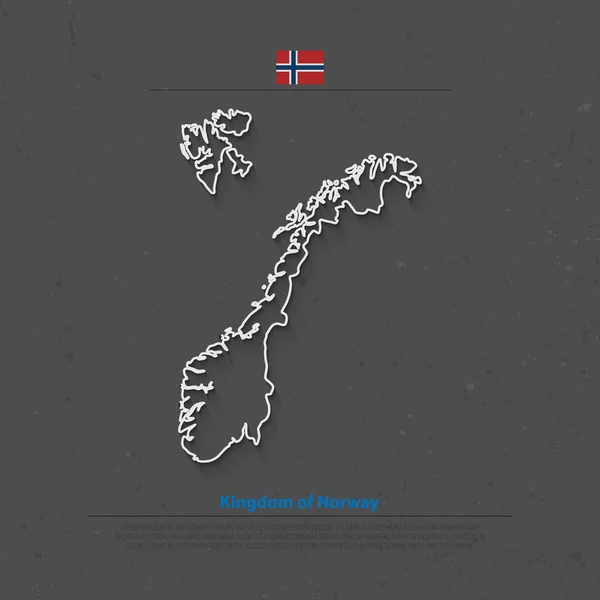
Kingdom Of Norway Isolated Map And Official Flag Icons. Vector Norwegian Political Maps Icon. Scandinavian Country Geographic Banner Template. Travel And Business Concept Maps
Vector, 0.84MB, 6000 × 4000 eps


Close-up Of Svalbard And Its Location In The Region And In The Center Of A Large-scale World Map. Color Physical Map
Image, 2.07MB, 2880 × 1620 jpg

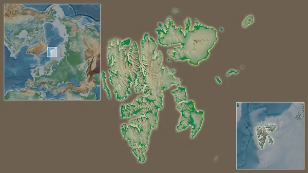
The Area Of Svalbard Centered In The Circle Surrounding Its Continent On The Desaturated Background. Capital Georeferences And Names Given. Satellite Imagery
Image, 1.95MB, 2880 × 1620 jpg

Vector Illustration Of Detailed Map Of Norway And Svalbard Island Cut Out Of Craft Paper Or Cardboard
Vector, 1.83MB, 5417 × 5417 eps


Map Of Norway Vector Dotted, With Flag And Map Marker. Vector Illustration
Vector, 2.91MB, 5669 × 5669 eps
Kingdom Of Norway Isolated Map And Official Flag Icons. Vector Norwegian Political Map Thin Line Icon. Scandinavian Country Geographic Banner Template. Travel And Business Concept Maps
Vector, 4.88MB, 4000 × 4000 eps

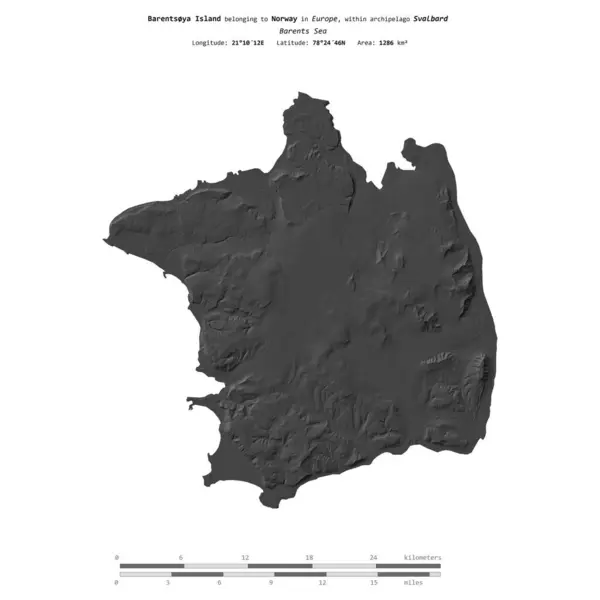
Barentsya Island In The Barents Sea - Belonging To Norway. Described Location Diagram With Yellow Shape Of The Island And Sample Maps Of Its Surroundings
Image, 2.39MB, 3840 × 2160 jpg

Symbol Map Of The Territory Svalbard (Norway) Showing The Territory With Concentric Circles In Rainbow Colors Like A Shooting Target
Vector, 0.61MB, 4597 × 6000 eps

Symbol Map Of The Territory Svalbard (Norway). Abstract Map Showing The State/province With Horizontal Parallel Lines In Rainbow Colors
Vector, 0.58MB, 4707 × 6000 eps

Symbol Map Of The Territory Svalbard (Norway) Showing The State/province With A Pattern Of Black Circles
Vector, 0.89MB, 4597 × 6000 eps

Barentsya Island In The Barents Sea On A Topographic, OSM Humanitarian Style Map
Image, 0.37MB, 2880 × 1620 jpg
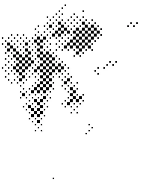
Symbol Map Of The Territory Svalbard (Norway). Abstract Map Showing The State/province With A Pattern Of Black And White Squares Like A Chessboard
Vector, 0.61MB, 4597 × 6000 eps
Barentsya Island In The Barents Sea On A Satellite Image Taken In August 23, 2020
Image, 4.94MB, 2880 × 1620 jpg

Symbol Map Of The Territory Svalbard (Norway). Abstract Map Showing The State/province With A Pattern Of Overlapping Colorful Squares Like Candies
Vector, 0.6MB, 4707 × 6000 eps
Barentsya Island In The Barents Sea, Belonging To Norway, Isolated On A Bilevel Elevation Map, With Distance Scale
Image, 0.62MB, 2160 × 2160 jpg

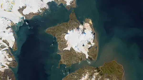
Barentsya Island In The Barents Sea, Belonging To Norway, Isolated On A Satellite Image Taken In August 2, 2017, With Distance Scale
Image, 1.96MB, 2160 × 2160 jpg
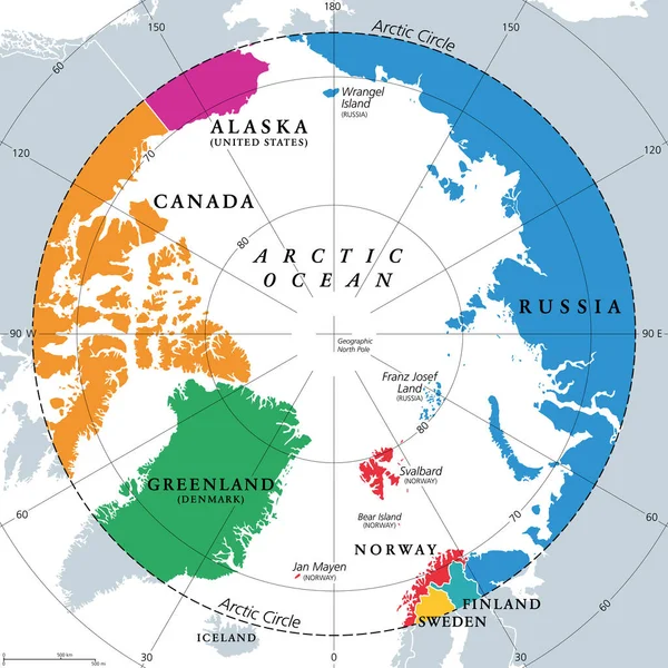
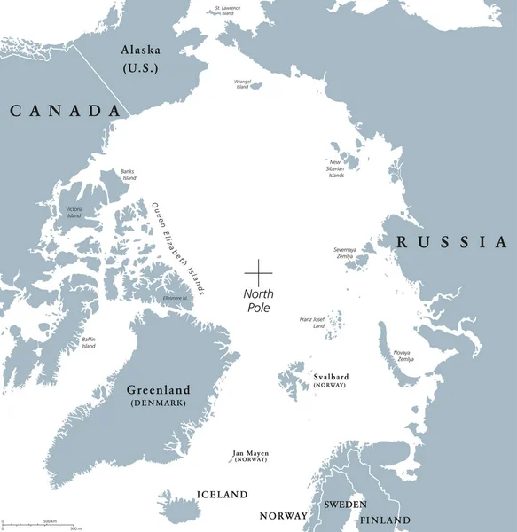
Countries Within The Arctic Circle, Political Map. Countries Within About 66 Degrees North The Equator And North Pole. Alaska (U.S.), Canada, Finland, Greenland (Denmark), Norway, Sweden And Russia.
Vector, 4MB, 6000 × 6000 eps

Symbol Map Of The Territory Svalbard (Norway) Showing The State/province With A Pattern Of Randomly Distributed Colorful Squares Of Different Sizes
Vector, 0.69MB, 4707 × 6000 eps


Barentsya Island In The Barents Sea, Belonging To Norway, Isolated On A Topographic, OSM Humanitarian Style Map, With Distance Scale
Image, 0.26MB, 2160 × 2160 jpg
Page 1 >> Next