
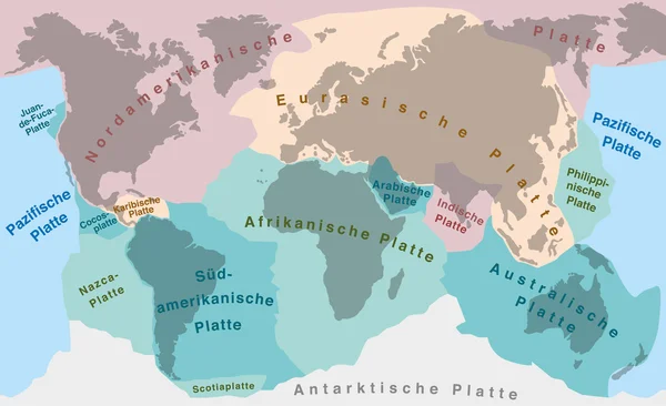
Stock image Tectonic Plates page 2
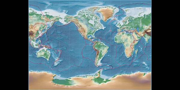
World Map In The Miller Cylindrical Projection Centered On 90 West Longitude. Colored Shader, Elevation Map - Composite Of Raster With Graticule And Tectonic Plates Borders. 3D Illustration
Image, 7.56MB, 4000 × 2000 jpg
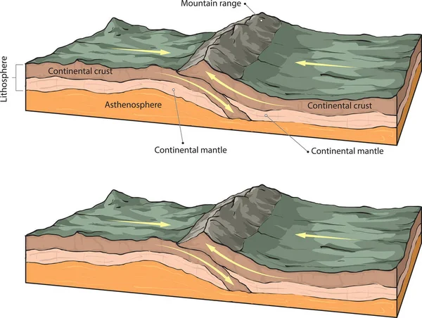
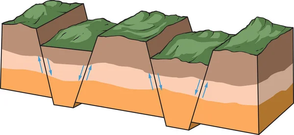
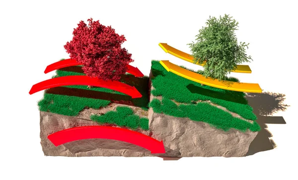
Vector Illustration Shows The Basic Forming Of Fault-block Mountains.
Vector, 5.37MB, 5437 × 2500 eps

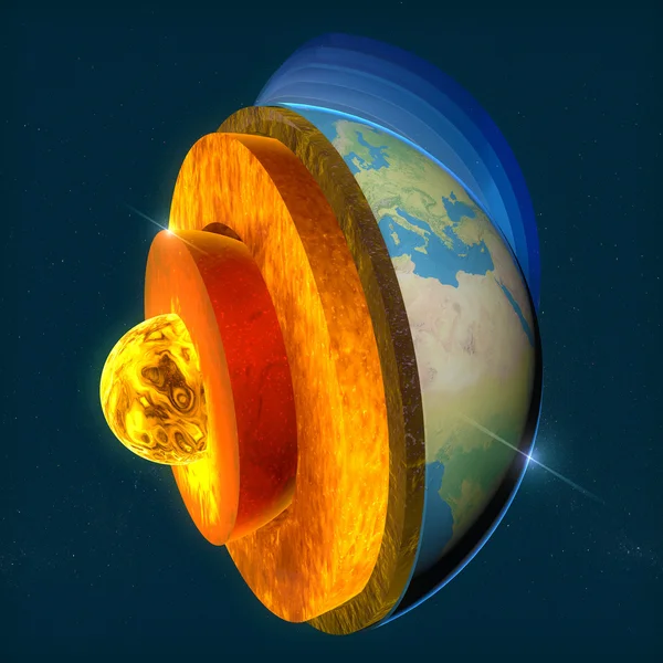
Tectonic Plates Move Constantly, Making New Areas Of Ocean Floor, Building Mountains, Causing Earthquakes, And Creating Volcanoes. 3d Rendering. Map. Element Of This Image Are Furnished By Nasa
Image, 9.22MB, 5014 × 5010 jpg
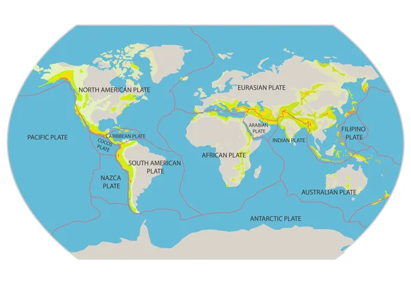
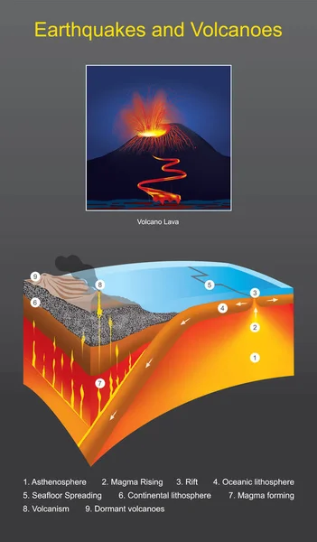
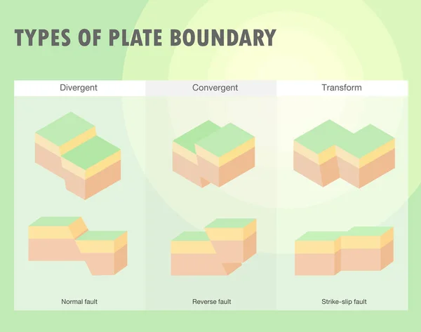
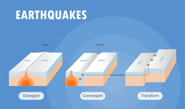
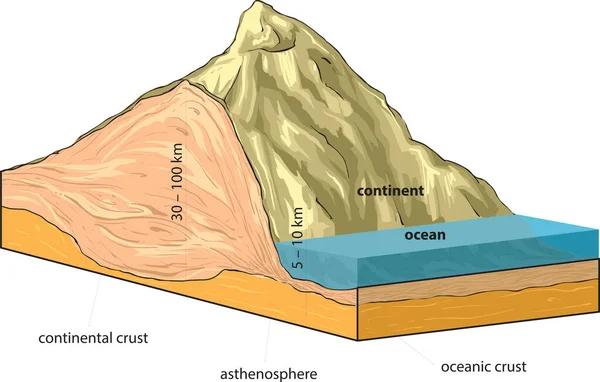
Types Of Plate Boundaries. Convergent Boundaries (Destructive) (or Active Margins) Occur Where Two Plates Slide Toward Each Other To Form Either A Subduction Zone (one Plate Moving Underneath The Other) Or A Continental Collision. 3d Rendering
Image, 6.07MB, 4675 × 3100 jpg
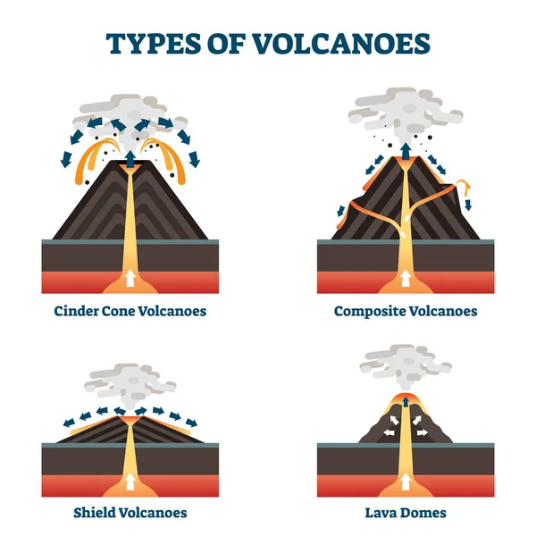
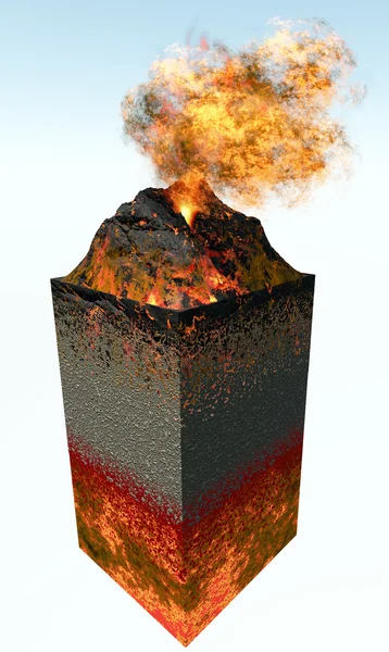
Types Of Volcanoes Vector Illustration. Labeled Geological Classification.
Vector, 5.67MB, 4000 × 4000 eps


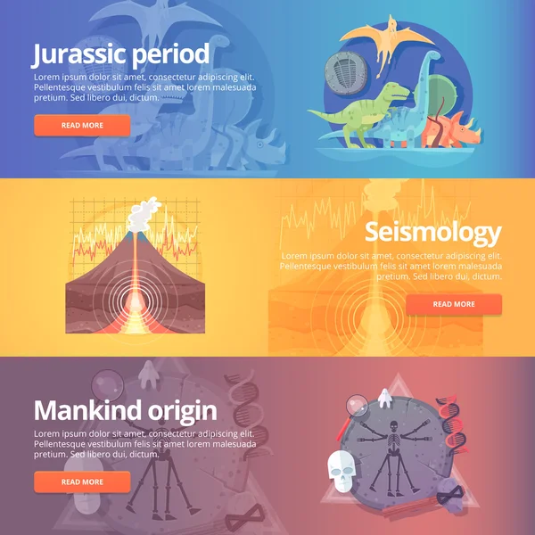
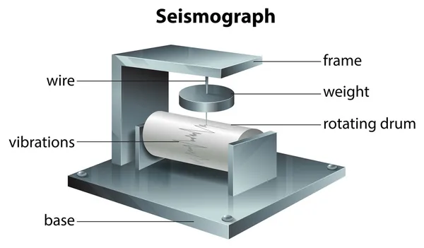
Jurassic Period. Dinosaur Age. Seismography Science. Volcano Erruption. Mankind Origin. Anthropology. Science Of Life. Earthquake Studying. Education And Science Banners Set. Vector Design Concept.
Vector, 8.1MB, 5000 × 5000 eps
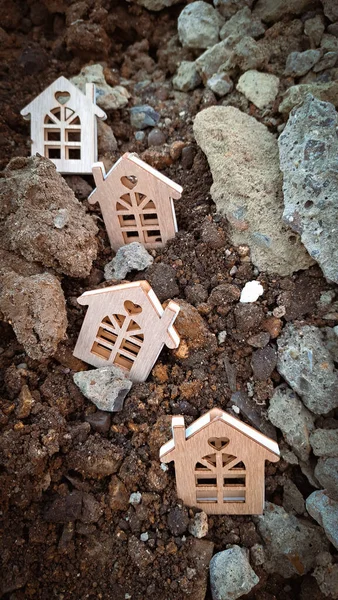
Small Wooden Houses On The Ground And Stones,earthquake Concept 2023. Copy Space
Image, 5.27MB, 2604 × 4624 jpg

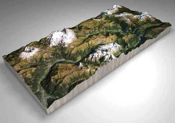
Terrain Section, Canazei, Val Di Fassa, Trentino Alto Adige, Italy. Mountains And Hills, Peaks Of The Dolomites, Sassolungo, Marmolada, Sella Group. Alpine Tourism.
Image, 9MB, 4724 × 3333 jpg
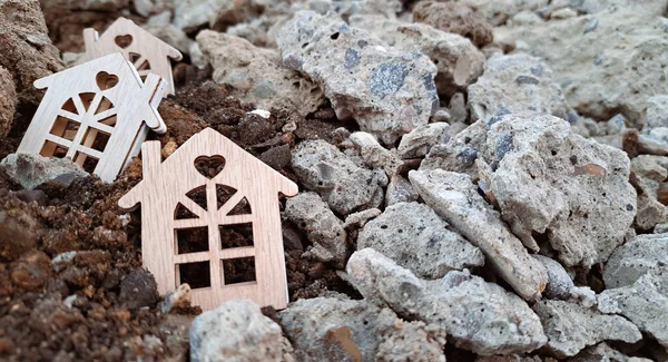
Small Wooden Houses On The Ground And Stones,earthquake Concept 2023. Copy Space
Image, 4.27MB, 4550 × 2465 jpg
Terrain Section, Canazei, Val Di Fassa, Trentino Alto Adige, Italy. Mountains And Hills, Peaks Of The Dolomites, Sassolungo, Marmolada, Sella Group. Alpine Tourism.
Image, 9.46MB, 4724 × 3333 jpg

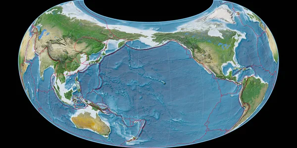
World Map In The Mcbryde (Continents) Projection Centered On 0 East Longitude. Satellite Imagery A - Composite Of Raster With Graticule And Tectonic Plates Borders. 3D Illustration
Image, 8.15MB, 4000 × 2000 jpg

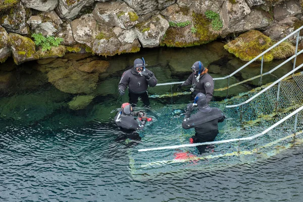
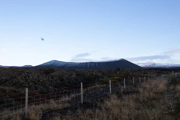
Reykjavik, Iceland - July 4, 2022 An Interior Educational Exhibit In The Perlan, A Prominent Museum In The Icelandic Capital Of Reykjavik.
Image, 3.35MB, 3000 × 2000 jpg
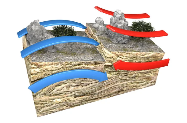
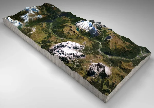
Different Types Of Plate Boundaries: Convergent Boundaries, Terrain Section, 3d Render. Tectonic Plates, Side Sliding Margin, Earthquake
Image, 11.27MB, 5511 × 3324 jpg


World Map In The Raisz-Armadillo Projection Centered On 170 West Longitude. Satellite Imagery A - Composite Of Raster With Graticule And Tectonic Plates Borders. 3D Illustration
Image, 8.78MB, 4000 × 2000 jpg

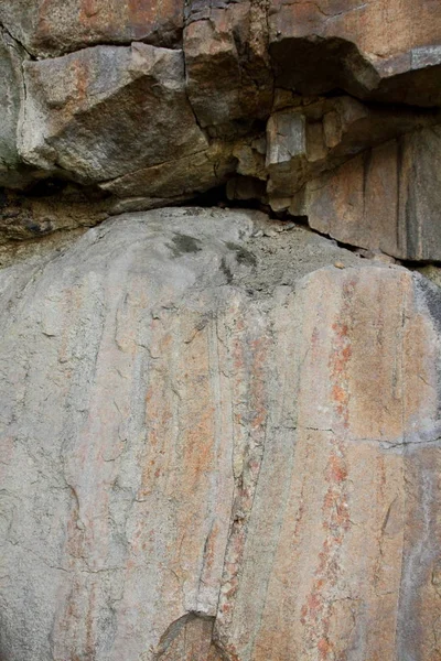
Granite Background, Plants In Stone, Abstract Stone Texture, Environmental Problems, Tectonic Plate Fracture, Earthquake Consequences, Cracks In Granite Rocks
Image, 18.85MB, 5184 × 3456 jpg


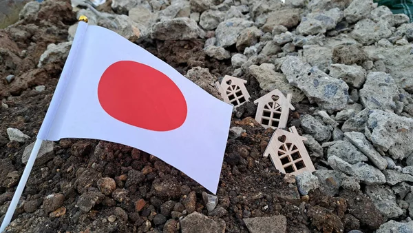
National Flag Of Japan On The Cracked Ground,earthquake Concept 2023 Tragedy . High Quality Photo
Image, 4.39MB, 4624 × 2604 jpg
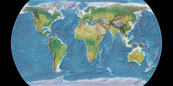
World Map In The Canters Pseudocylindric Projection Centered On 11 East Longitude. Main Physiographic Landscape Features - Composite Of Raster With Graticule And Tectonic Plates Borders. 3D Illustration
Image, 9.85MB, 4000 × 2000 jpg
Granite Background, Plants In Stone, Abstract Stone Texture, Environmental Problems, Tectonic Plate Fracture, Earthquake Consequences, Cracks In Granite Rocks
Image, 12.98MB, 3320 × 4980 jpg

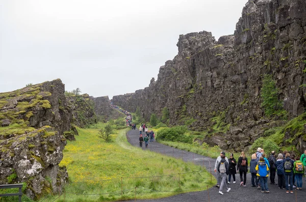
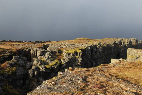
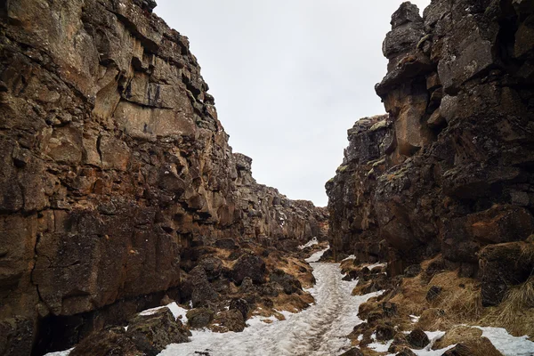
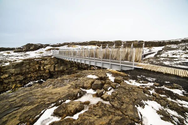
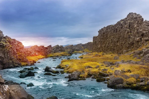
Thingvellir, Iceland - July 19, 2017: Tourists Walk Through The Almannagja Fault Line In The Mid-atlantic Ridge North American Plate In Thingvellir National Park. Iceland
Image, 13.83MB, 5644 × 3740 jpg
Previous << Page 2 >> Next