
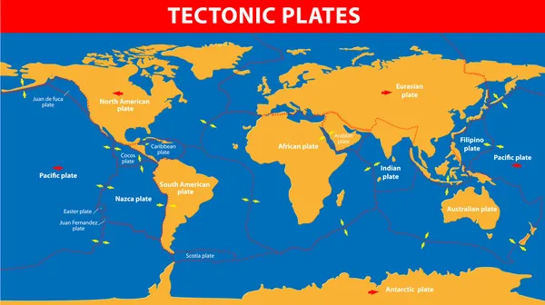
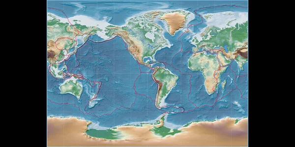
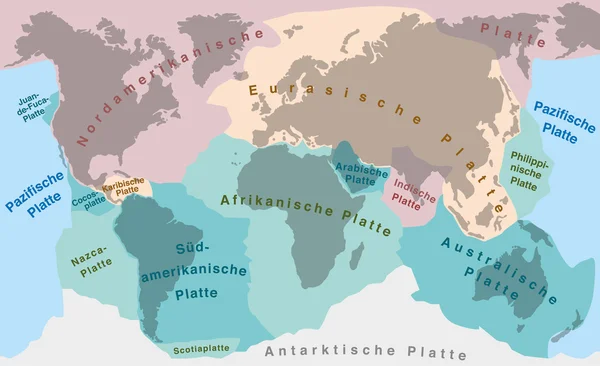
Stock image Tectonic Plates
Layers Of Tectonic Plates Concept. Lithosphere And The Structure Of The Earth. Soil And Limestone. Geography Geology Background. The Scheme Of The Formation Of Mountains.
Vector, 8.92MB, 6000 × 3600 eps
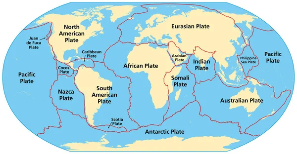
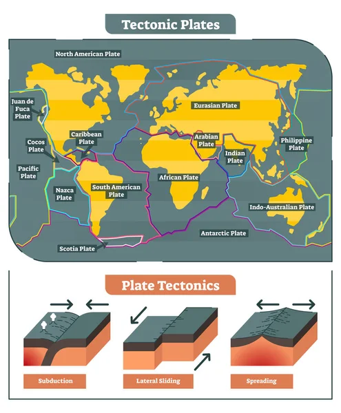
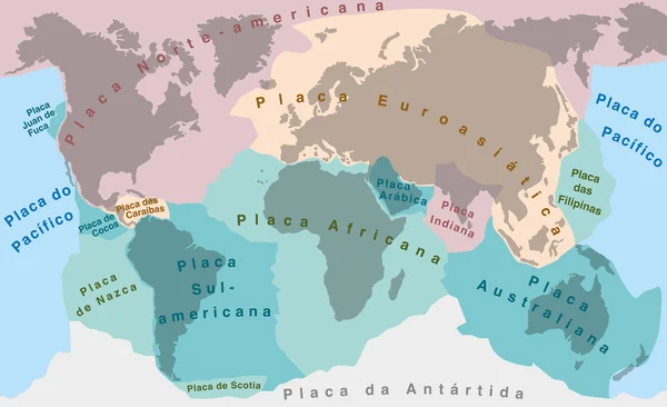
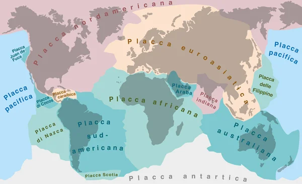
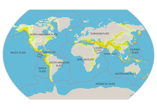
Map Of The Principal Tectonic Plates Of The Earth. The Sixteen Major Pieces Of Crust And Uppermost Mantle Of The Earth, Called The Lithosphere, And Consisting Of Oceanic And Continental Crust. Vector
Vector, 4.27MB, 9000 × 4681 eps

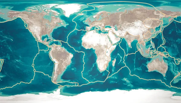
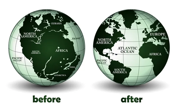
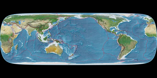
Tectonic Plates Move Constantly, Making New Areas Of Ocean Floor, Building Mountains, Causing Earthquakes, And Creating Volcanoes. 3d Rendering. Map. Element Of This Image Are Furnished By Nasa
Image, 16.33MB, 6675 × 3800 jpg
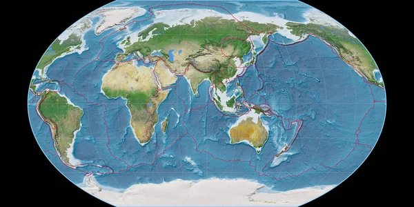
World Map In The Tobler G1 Projection Centered On 170 West Longitude. Satellite Imagery A - Composite Of Raster With Graticule And Tectonic Plates Borders. 3D Illustration
Image, 7.98MB, 4000 × 2000 jpg
World Map In The Kavraisky VII Projection Centered On 90 East Longitude. Satellite Imagery A - Composite Of Raster With Graticule And Tectonic Plates Borders. 3D Illustration
Image, 8.84MB, 4000 × 2000 jpg

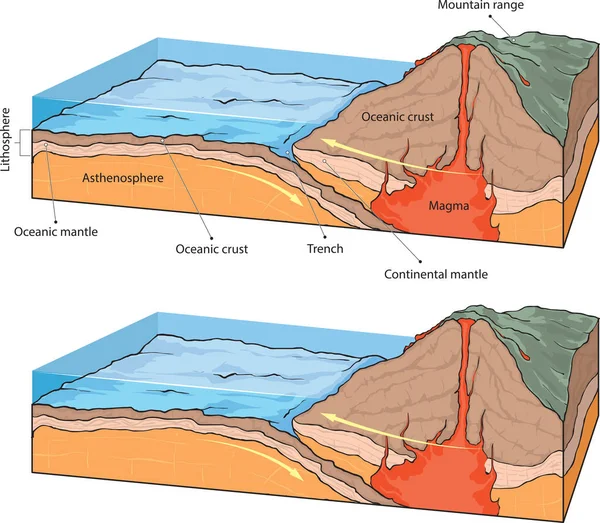
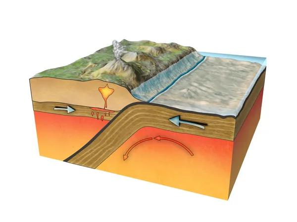
Vestor Illustratiion Shows Collision Of Oceanic And Continental Plates
Vector, 6.32MB, 4588 × 4000 eps
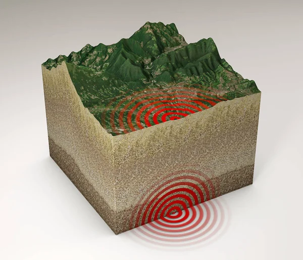
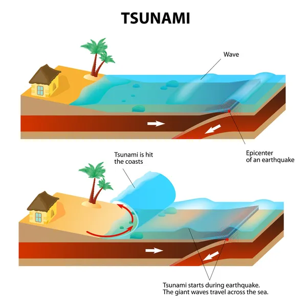
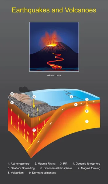
Earthquake Ground Section, Shake, Epicenter And Subsoil, Elements Of This Image Are Furnished By NASA. 3d Rendering
Image, 18.86MB, 5511 × 4724 jpg

World Map In The Miller Cylindrical Projection Centered On 90 East Longitude. Main Physiographic Landscape Features - Composite Of Raster With Graticule And Tectonic Plates Borders. 3D Illustration
Image, 7.71MB, 4000 × 2000 jpg

World Map In The Miller Cylindrical Projection Centered On 90 West Longitude. Colored Shader, Elevation Map - Composite Of Raster With Graticule And Tectonic Plates Borders. 3D Illustration
Image, 7.56MB, 4000 × 2000 jpg
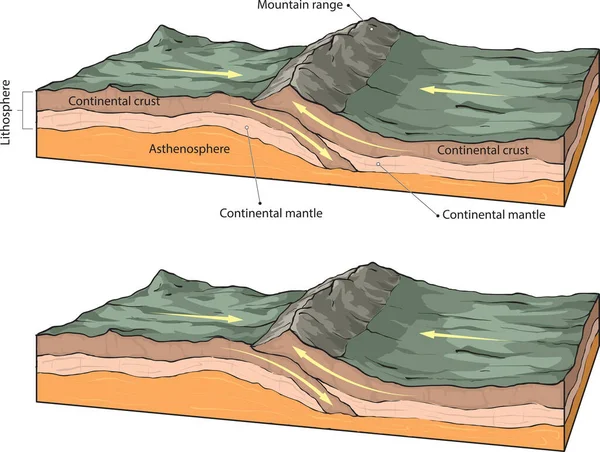
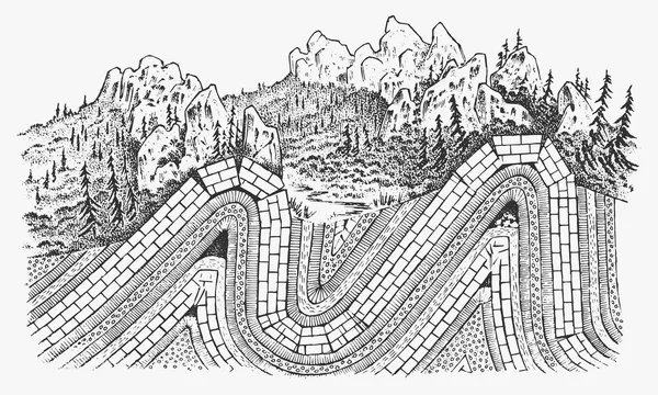
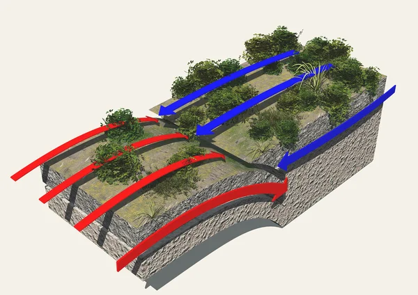
Vector Illustration Shows The Basic Forming Of Fault-block Mountains.
Vector, 5.37MB, 5437 × 2500 eps

Tectonic Plates Move Constantly, Making New Areas Of Ocean Floor, Building Mountains, Causing Earthquakes, And Creating Volcanoes. 3d Rendering. Map. Element Of This Image Are Furnished By Nasa
Image, 9.22MB, 5014 × 5010 jpg
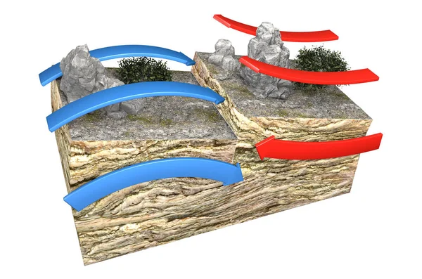
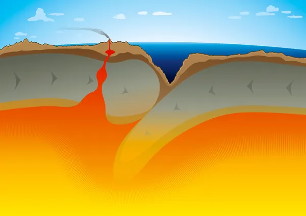
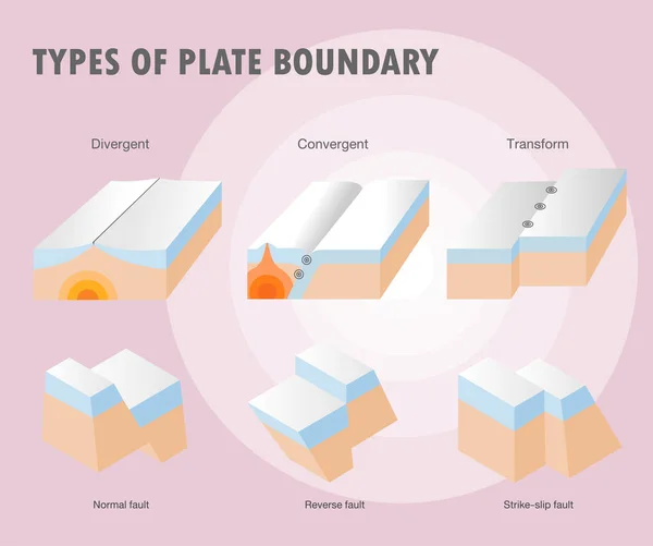
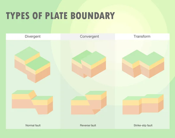
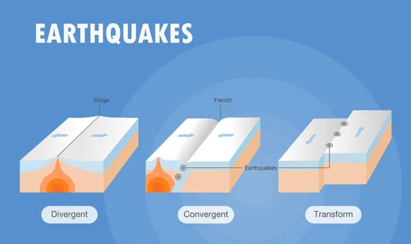
Types Of Plate Boundaries. Convergent Boundaries (Destructive) (or Active Margins) Occur Where Two Plates Slide Toward Each Other To Form Either A Subduction Zone (one Plate Moving Underneath The Other) Or A Continental Collision. 3d Rendering
Image, 6.07MB, 4675 × 3100 jpg
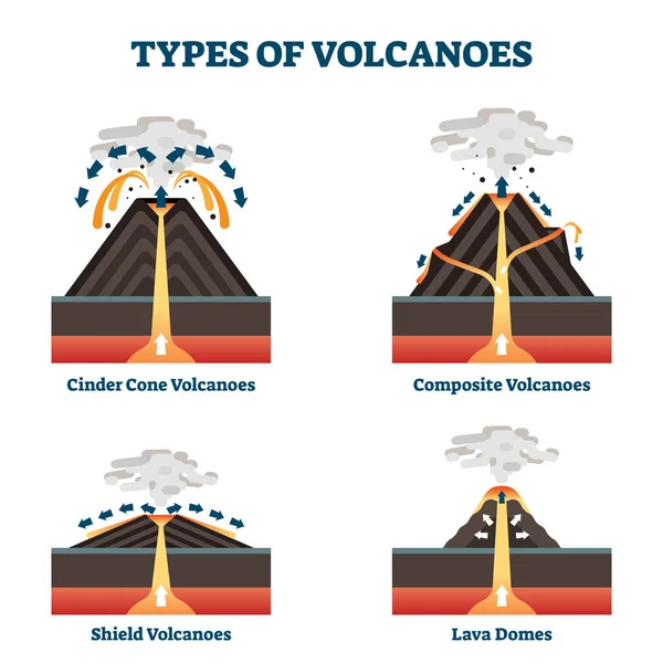
Types Of Volcanoes Vector Illustration. Labeled Geological Classification.
Vector, 5.67MB, 4000 × 4000 eps


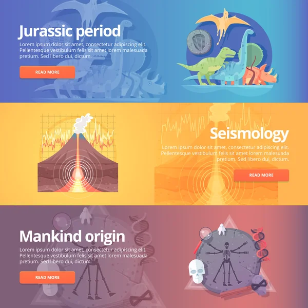
Jurassic Period. Dinosaur Age. Seismography Science. Volcano Erruption. Mankind Origin. Anthropology. Science Of Life. Earthquake Studying. Education And Science Banners Set. Vector Design Concept.
Vector, 8.1MB, 5000 × 5000 eps
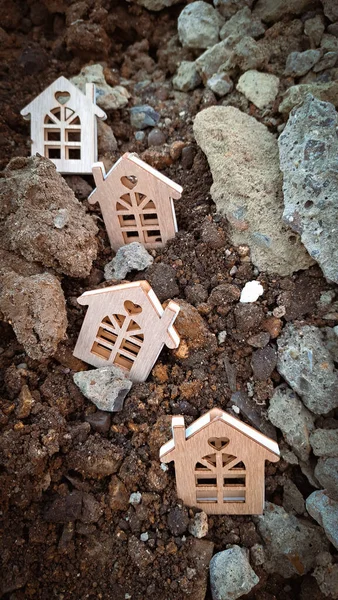
Small Wooden Houses On The Ground And Stones,earthquake Concept 2023. Copy Space
Image, 5.27MB, 2604 × 4624 jpg

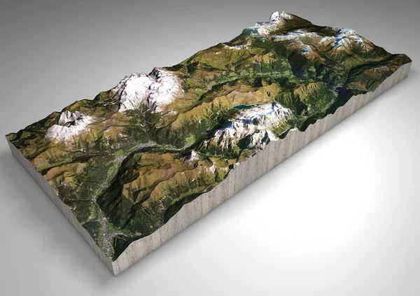
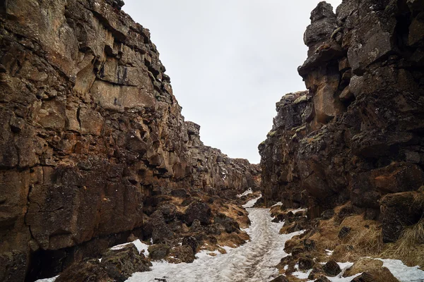
Terrain Section, Canazei, Val Di Fassa, Trentino Alto Adige, Italy. Mountains And Hills, Peaks Of The Dolomites, Sassolungo, Marmolada, Sella Group. Alpine Tourism.
Image, 9MB, 4724 × 3333 jpg

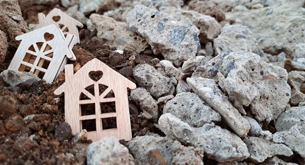
Small Wooden Houses On The Ground And Stones,earthquake Concept 2023. Copy Space
Image, 4.27MB, 4550 × 2465 jpg
Page 1 >> Next