photo free
Home Images Vectors Videos

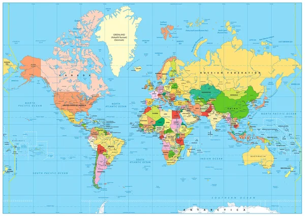
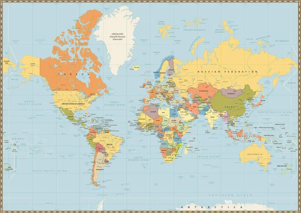
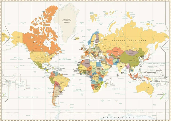
Stock image Usa Mercator

stock vector Highly detailed political World map with labeling

Highly Detailed Political World Map With Labeling

Vector, 13.11MB, 8192 × 5817 eps
stock vector Map of United state of America Mercator. High detailed vector map - United state of America Mercator.

Map Of United State Of America Mercator. High Detailed Vector Map - United State Of America Mercator.

Vector, 5.85MB, 5000 × 3500 eps
stock image Nevada(USA) map

Nevada(USA) Map

Image, 1.45MB, 3280 × 3957 jpg
stock vector Delaware State map with US flag inside and Map pointer with American flag.

Delaware State Map With US Flag Inside And Map Pointer With American Flag.

Vector, 1.31MB, 4005 × 4005 eps
stock image California(USA) map

California(USA) Map

Image, 1.09MB, 2954 × 3531 jpg
stock image Nebraska(USA) map

Nebraska(USA) Map

Image, 1.66MB, 4468 × 3192 jpg
stock image North Dakota (USA) map

North Dakota (USA) Map

Image, 2.15MB, 3938 × 3286 jpg
stock image Massachusetts(USA) map

Massachusetts(USA) Map

Image, 1.15MB, 3891 × 3299 jpg
stock image Montana (USA) map

Montana (USA) Map

Image, 1.91MB, 4074 × 3251 jpg
stock image Maryland (USA) map

Maryland (USA) Map

Image, 1.45MB, 4220 × 3221 jpg
stock image Nevada (USA) map

Nevada (USA) Map

Image, 1.74MB, 3280 × 3957 jpg
stock image Alabama (USA) map

Alabama (USA) Map

Image, 1.88MB, 3254 × 4061 jpg
stock image Mississippi (USA) map

Mississippi (USA) Map

Image, 1.78MB, 3247 × 4094 jpg
stock image North Dakota(USA) map

North Dakota(USA) Map

Image, 1.88MB, 3938 × 3286 jpg
stock image Oklahoma(USA) map

Oklahoma(USA) Map

Image, 1.35MB, 4363 × 3202 jpg
stock image Arkansas(USA) map

Arkansas(USA) Map

Image, 1.6MB, 3378 × 3086 jpg
stock image Connecticut (USA) map

Connecticut (USA) Map

Image, 1.72MB, 3628 × 2877 jpg
stock image North Carolina (USA) map

North Carolina (USA) Map

Image, 1.63MB, 4872 × 3188 jpg
stock image Ohio(USA) map

Ohio(USA) Map

Image, 1.54MB, 3041 × 3428 jpg
stock image North Carolina(USA) map

North Carolina(USA) Map

Image, 1.38MB, 4872 × 3188 jpg
stock image Mississippi(USA) map

Mississippi(USA) Map

Image, 1.55MB, 3247 × 4094 jpg
stock image Louisiana (USA) map

Louisiana (USA) Map

Image, 1.73MB, 3279 × 3178 jpg
stock image Montana(USA) map

Montana(USA) Map

Image, 1.61MB, 4074 × 3251 jpg
stock image Maryland(USA) map

Maryland(USA) Map

Image, 1.29MB, 4220 × 3221 jpg
stock image Minnesota(USA) map

Minnesota(USA) Map

Image, 1.28MB, 3018 × 3454 jpg
stock image Nebraska (USA) map

Nebraska (USA) Map

Image, 1.95MB, 4468 × 3192 jpg
stock vector Political World Map isolated on vintage blue color

Political World Map Isolated On Vintage Blue Color

Vector, 13.24MB, 8177 × 5803 eps
stock vector Outline map of Alabama white background. USA state,  vector map with contour.

Outline Map Of Alabama White Background. USA State, Vector Map With Contour.

Vector, 5.67MB, 4000 × 4000 eps
stock image Rhode Island (USA) map

Rhode Island (USA) Map

Image, 1.49MB, 3280 × 3961 jpg
stock vector World Map isolated on retro white color background with labeling

World Map Isolated On Retro White Color Background With Labeling

Vector, 13.24MB, 8178 × 5802 eps
stock image Missouri (USA) map

Missouri (USA) Map

Image, 1.52MB, 3338 × 3122 jpg
stock vector Colored World Map isolated on white with labeling

Colored World Map Isolated On White With Labeling

Vector, 13.11MB, 8192 × 5817 eps
stock vector Detailed Physical World Map with labeling. No bathymetry

Detailed Physical World Map With Labeling. No Bathymetry

Vector, 16.51MB, 8192 × 5812 eps
stock image Alabama (USA) outline map with shadow

Alabama (USA) Outline Map With Shadow

Image, 0.44MB, 3254 × 4061 jpg
stock image New York (USA) map

New York (USA) Map

Image, 1.19MB, 3524 × 2960 jpg
stock image Arkansas (USA) map

Arkansas (USA) Map

Image, 1.85MB, 3378 × 3086 jpg
stock image Georgia (USA) map

Georgia (USA) Map

Image, 1.66MB, 2960 × 3524 jpg
stock image Connecticut(USA) outline map with shadow

Connecticut(USA) Outline Map With Shadow

Image, 0.42MB, 3628 × 2877 jpg
stock image Delaware (USA) map

Delaware (USA) Map

Image, 1.53MB, 3192 × 4943 jpg
stock vector Political World Map vintage color with lakes and rivers

Political World Map Vintage Color With Lakes And Rivers

Vector, 17.75MB, 8172 × 5797 eps
stock image Arizona(USA) map

Arizona(USA) Map

Image, 1.76MB, 2926 × 3566 jpg
stock vector New Jersey map vector silhouette illustration isolated on white background. High detailed. United state of America country. New Jersey line contour map with separated county borders.

New Jersey Map Vector Silhouette Illustration Isolated On White Background. High Detailed. United State Of America Country. New Jersey Line Contour Map With Separated County Borders.

Vector, 0.64MB, 4057 × 6061 eps
stock vector Political World map isolated on white. No text

Political World Map Isolated On White. No Text

Vector, 7.85MB, 8192 × 5817 eps
stock vector World Map spot colored illustration

World Map Spot Colored Illustration

Vector, 13.22MB, 8192 × 5817 eps
stock image United States map

United States Map

Image, 1.2MB, 3344 × 2056 jpg
stock image Arizona (USA) map

Arizona (USA) Map

Image, 2.02MB, 2926 × 3566 jpg
stock image Iowa (USA) map

Iowa (USA) Map

Image, 1.87MB, 3825 × 3321 jpg
stock image Idaho (USA) map

Idaho (USA) Map

Image, 1.45MB, 3246 × 4092 jpg
stock vector Physical World Map isolated on white with labeling

Physical World Map Isolated On White With Labeling

Vector, 16.51MB, 8192 × 5812 eps
stock vector Political World Map retro color with lakes and rivers and labeli

Political World Map Retro Color With Lakes And Rivers And Labeli

Vector, 17.79MB, 8178 × 5802 eps
Page 1 >> Next