
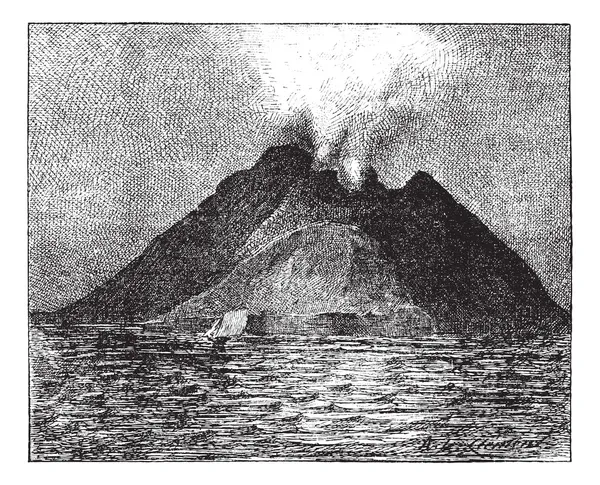
Stock image Volcanic Arc


Spring Sunset From Peloritani Mountains Looking Towards Gesso Town; Small Volcanic Arc Of Aeolian Islands On Horizon. Tyrthenian Sea, Sicily, Italy
Image, 5.51MB, 4270 × 2868 jpg

South Aegean Volcanic Arc Map. Chain Of Volcanoes Formed By Plate Tectonics, Caused By Subduction Of The African Beneath The Eurasian Plate, Raising The Aegean Arc Across What Is Now The Aegean Sea.
Vector, 1.39MB, 9000 × 6000 eps
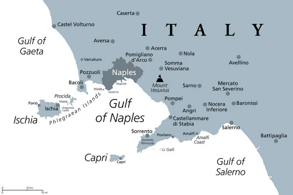
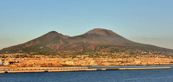
Gulf Of Naples, Gray Political Map. Bay Of Naples, Located Along South-western Coast Of Italy, Opening To The Tyrrhenian Sea. Campanian Volcanic Arc With Islands Ischia And Capri, And Mount Vesuvius.
Vector, 1.59MB, 9000 × 6000 eps
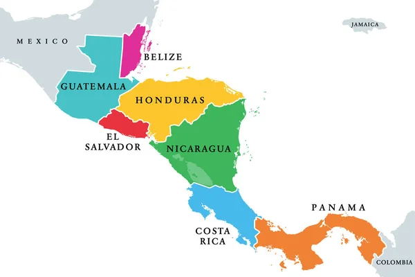
Central America Countries, Colored Political Map. Subregion Of The Americas, Between Mexico And Colombia, Consisting Of Belize, Guatemala, Honduras, El Salvador, Nicaragua, Costa Rica And Panama.
Vector, 2.39MB, 8999 × 6000 eps
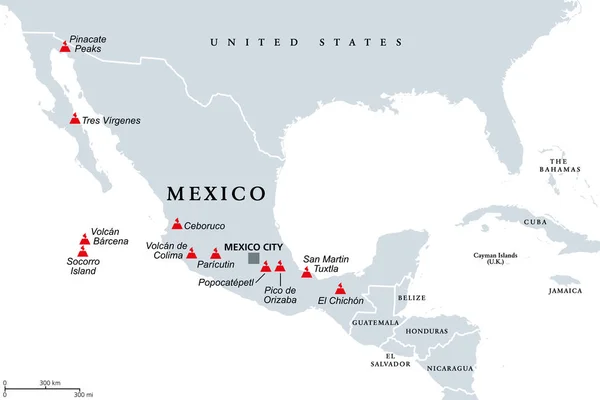
Trans-Mexican Volcanic Belt, Map With The Major Active Volcanoes Of Mexico. Also Known As Transvolcanic Belt And Locally As Sierra Nevada. Active Volcanic Belt, That Covers Central-southern Mexico.
Vector, 1.46MB, 9000 × 6000 eps
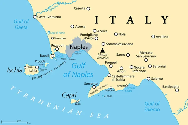
Gulf Of Naples, Political Map. Also Bay Of Naples, Located Along South-western Coast Of Italy, Opening To The Tyrrhenian Sea. Campanian Volcanic Arc With Islands Ischia And Capri And Mount Vesuvius.
Vector, 1.79MB, 9000 × 6000 eps


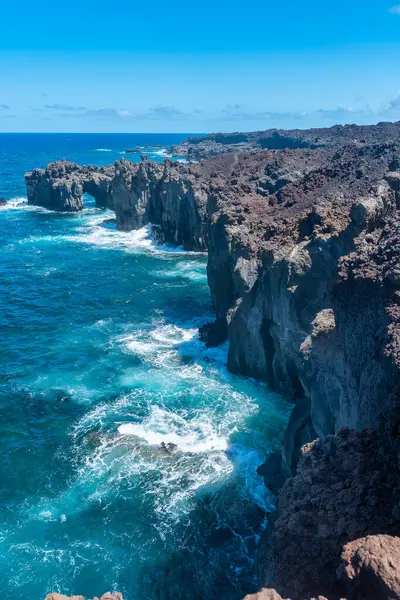
Volcanic Seascape. Rocks Formation In Tamaduste. El Hierro . Canary Islands
Image, 14.01MB, 5787 × 3858 jpg

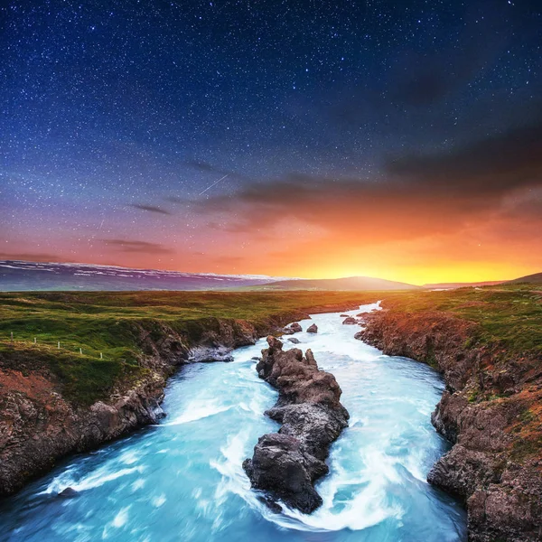
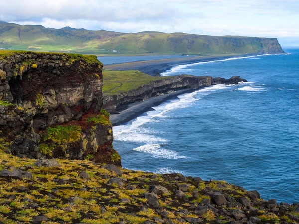
Fantastic Views Of The Landscape. Starry Sky And The Milky Way. Iceland.
Image, 13.98MB, 4500 × 4500 jpg


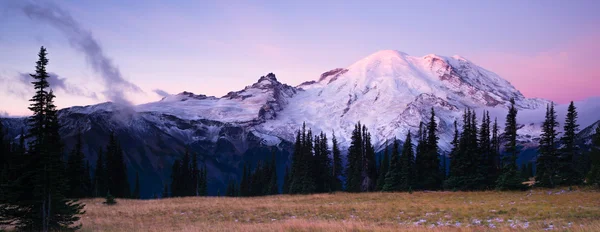

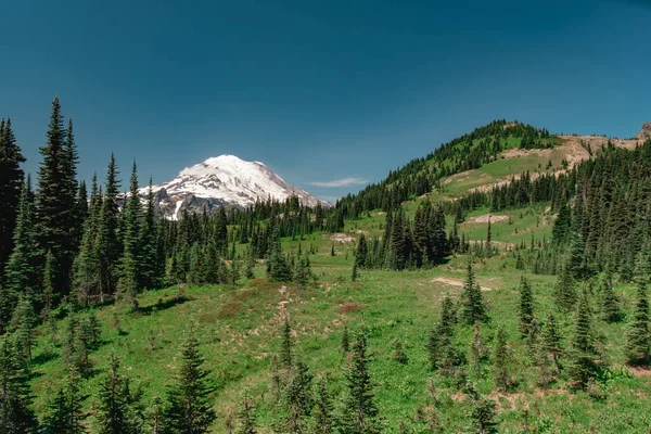
View Of Mt. Rainier On The Naches Peak Loop Trail In Mt. Rainier National Park.
Image, 16.47MB, 6240 × 4160 jpg

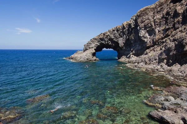


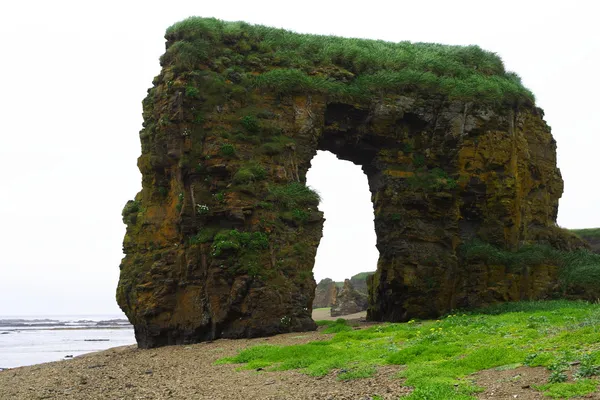
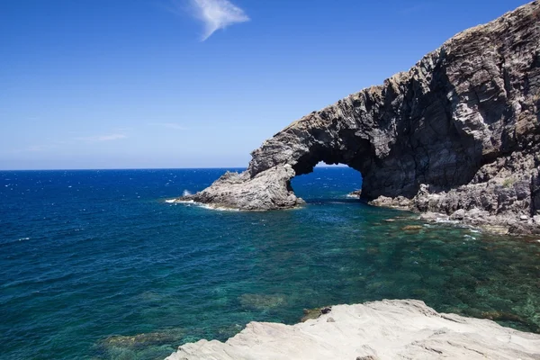
Tosca Arch. Volcanic Formation In The Dehesa. El Hierro Island. Santa Cruz De Tenerife. Spain
Image, 10.67MB, 4000 × 2667 jpg

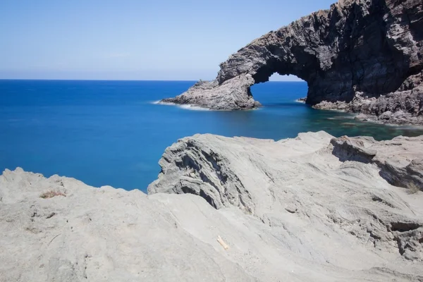
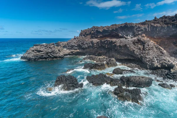
Ocky Beach With A Natural Arch In Las Puntas. El Hierro Island. Canary Islands
Image, 9.21MB, 2667 × 4000 jpg


Seascape. Waves Beating Against The Rocks In El Golfo. Sabinosa. El Hierro Island. Canary Islands
Image, 6.85MB, 4000 × 2667 jpg

South Sandwich Islands, Gray Political Map. Part Of The British Overseas Territory South Georgia And The South Sandwich Islands. Group Of Islands In The South Atlantic Ocean And Scotia Sea. Vector
Vector, 2.29MB, 6000 × 8460 eps

Rocky Beach With A Natural Arch In Las Puntas. El Hierro Island. Canary Islands
Image, 9.88MB, 4000 × 2667 jpg

Tosca Arch. Volcanic Formation In The Dehesa. El Hierro Island. Santa Cruz De Tenerife. Spain
Image, 10.21MB, 4000 × 2667 jpg

Seascape. Waves Beating Against The Rocks In El Golfo. Sabinosa. El Hierro Island. Canary Islands
Image, 6.68MB, 4000 × 2667 jpg
Volcanic Landscape In La Dehesa. El Hierro Island. Santa Cruz De Tenerife. Spain
Image, 6.57MB, 5984 × 3989 jpg


Rocky Beach With A Natural Arch In Las Puntas. El Hierro Island. Canary Islands
Image, 9.74MB, 4000 × 2667 jpg

Seascape. Waves Beating Against The Rocks In El Golfo. Sabinosa. El Hierro Island. Canary Islands
Image, 8.22MB, 4000 × 2667 jpg


Rocky Beach With A Natural Arch In Las Puntas. El Hierro Island. Canary Islands
Image, 10.79MB, 4000 × 2667 jpg

Abstract Stamp Or Emblem With The Name Of Mount Hood, Oregon, Vector Illustration
Vector, 0.7MB, 4724 × 4724 ai

Seascape. Waves Beating Against The Rocks In El Golfo. Sabinosa. El Hierro Island. Canary Islands
Image, 7.45MB, 4000 × 2667 jpg
Page 1 >> Next