photo free
Home Images Vectors Videos

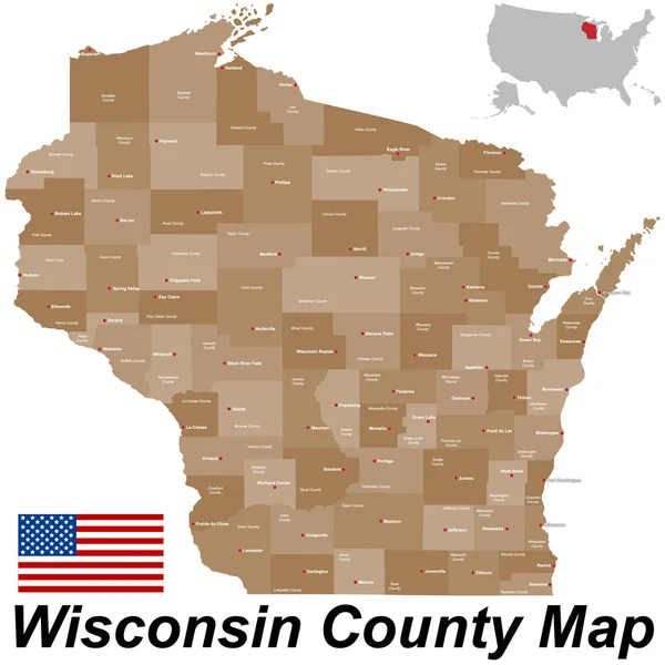
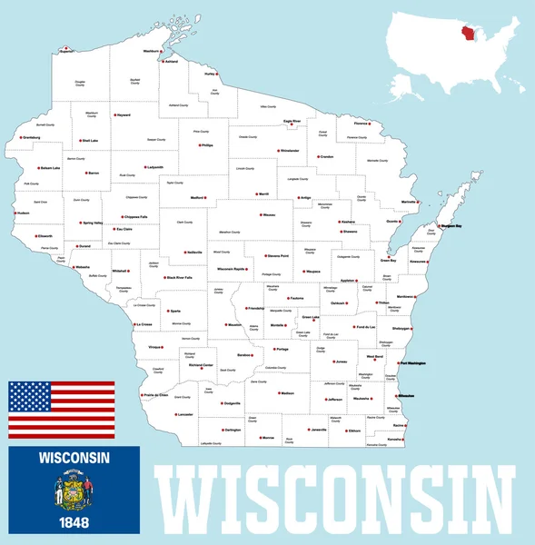
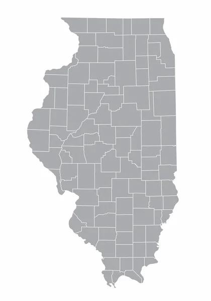
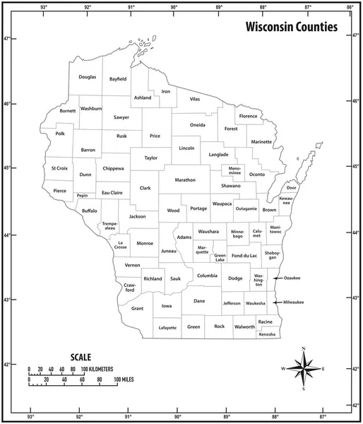
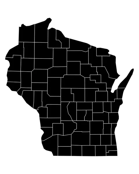
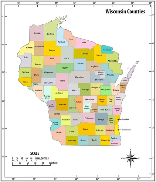
Stock image Wisconsin County Map

stock vector Wisconsin County Map

Wisconsin County Map

Vector, 0.93MB, 5000 × 5000 ai
stock vector Map of Wisconsin state

Map Of Wisconsin State

Vector, 1.31MB, 8060 × 5855 eps
stock vector The Wisconsin state map and its counties

The Wisconsin State Map And Its Counties

Vector, 8.14MB, 5000 × 5000 eps
stock vector Yellow map of Wisconsin with indication of largest cities

Yellow Map Of Wisconsin With Indication Of Largest Cities

Vector, 1.68MB, 4000 × 4000 eps
stock image US State Maps Set II

US State Maps Set II

Image, 22MB, 7500 × 7500 jpg
stock vector colorful geometric Wisconsin map- vector illustration

Colorful Geometric Wisconsin Map- Vector Illustration

Vector, 5.91MB, 4000 × 4000 eps
stock image Wisconsin Map

Wisconsin Map

Image, 1.12MB, 2000 × 2000 jpg
stock vector Wisconsin state map silhouette icon

Wisconsin State Map Silhouette Icon

Vector, 0.4MB, 5000 × 5000 eps
stock vector blue abstract outline of Wisconsin map

Blue Abstract Outline Of Wisconsin Map

Vector, 1.55MB, 4000 × 4000 eps
stock vector Map of Wisconsin

Map Of Wisconsin

Vector, 0.99MB, 4911 × 5000 ai
stock vector Map of Richland in Wisconsin

Map Of Richland In Wisconsin

Vector, 0.24MB, 4000 × 5000 eps
stock vector Wisconsin map

Wisconsin Map

Vector, 4.24MB, 4358 × 5502 eps
stock vector USA map with abbreviated state names. United States of America cartography with colored states. Vector illustration.

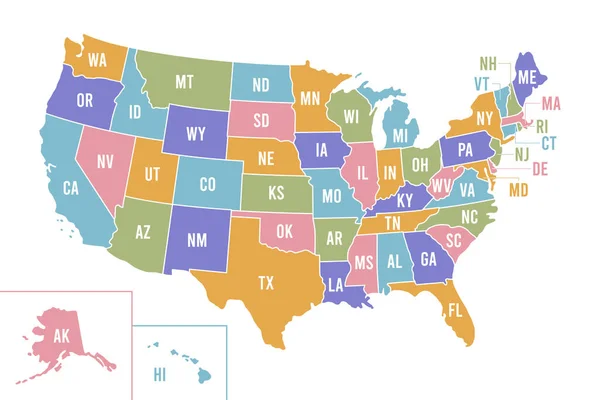
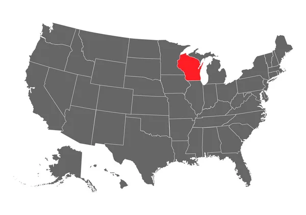
USA Map With Abbreviated State Names. United States Of America Cartography With Colored States. Vector Illustration.

Vector, 0.68MB, 6250 × 4167 eps
stock vector vector map of United States with indication of Wisconsin

Vector Map Of United States With Indication Of Wisconsin

Vector, 2.22MB, 4600 × 3450 eps
stock vector Highly detailed vector silhouettes of US state maps, Division United States into counties, political and geographic subdivisions of a states, The Great Lakes region - Minnesota, Wisconsin,  Michigan - set 5 of 17

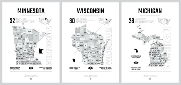
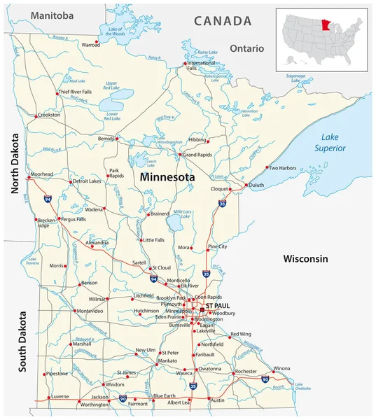
Highly Detailed Vector Silhouettes Of US State Maps, Division United States Into Counties, Political And Geographic Subdivisions Of A States, The Great Lakes Region - Minnesota, Wisconsin, Michigan - Set 5 Of 17

Vector, 13.02MB, 9608 × 4501 eps
stock vector Modern City Map - Milwaukee Wisconsin city of the USA with neighborhoods and titles outline map

Modern City Map - Milwaukee Wisconsin City Of The USA With Neighborhoods And Titles Outline Map

Vector, 13.76MB, 5000 × 7976 eps
stock vector Milwaukee Wisconsin city map with neighborhoods grey illustration silhouette shape

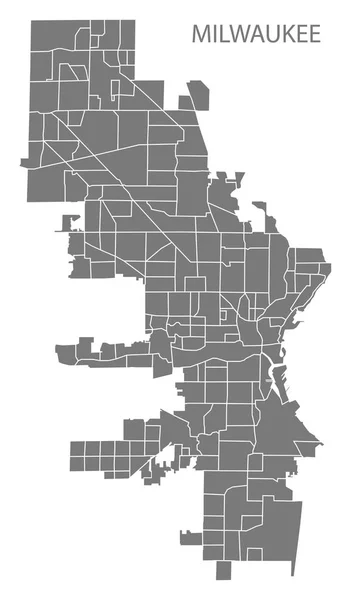
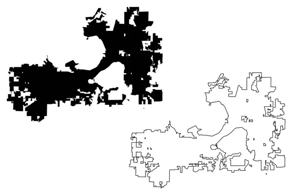
Milwaukee Wisconsin City Map With Neighborhoods Grey Illustration Silhouette Shape

Vector, 3.66MB, 5000 × 8538 eps
stock vector Wisconsin State vector map high detailed silhouette isolated on white background

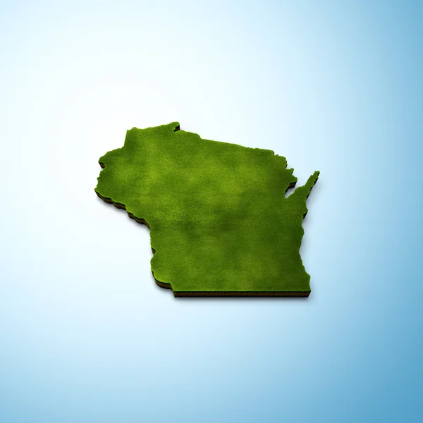
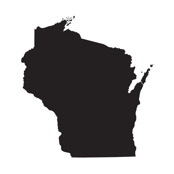
Wisconsin State Vector Map High Detailed Silhouette Isolated On White Background

Vector, 1.37MB, 5000 × 3531 eps
stock vector Modern City Map - Milwaukee Wisconsin city of the USA with neighborhoods and titles

Modern City Map - Milwaukee Wisconsin City Of The USA With Neighborhoods And Titles

Vector, 13.86MB, 5000 × 8239 eps
stock vector Minnesota state detailed editable map

Minnesota State Detailed Editable Map

Vector, 1.27MB, 5583 × 6000 eps
stock vector Modern City Map - Milwaukee Wisconsin city of the USA with neighborhoods

Modern City Map - Milwaukee Wisconsin City Of The USA With Neighborhoods

Vector, 7.68MB, 5000 × 8239 eps
stock vector Illinois counties map

Illinois Counties Map

Vector, 8.16MB, 3504 × 5004 eps
stock vector Vector set 6 of 10 Highly detailed silhouettes of US state maps, divided into counties with names and territory nicknames

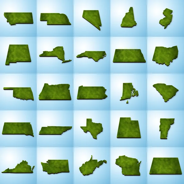
Vector Set 6 Of 10 Highly Detailed Silhouettes Of US State Maps, Divided Into Counties With Names And Territory Nicknames

Vector, 8.22MB, 9585 × 3348 eps
stock vector wisconsin state outline administrative and political vector map in black and white

Wisconsin State Outline Administrative And Political Vector Map In Black And White

Vector, 0.99MB, 3100 × 3613 eps
stock vector road map of the US American State of Montana

Road Map Of The US American State Of Montana

Vector, 2.24MB, 5939 × 3100 eps
stock vector The Wisconsin state map and its counties with labels

The Wisconsin State Map And Its Counties With Labels

Vector, 9.43MB, 5000 × 5000 eps
stock vector High Quality map of Wisconsin is a state of United States of America with borders of the counties

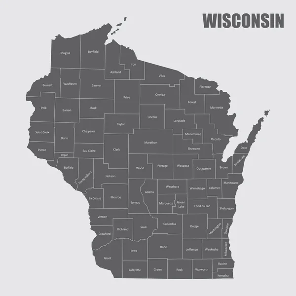
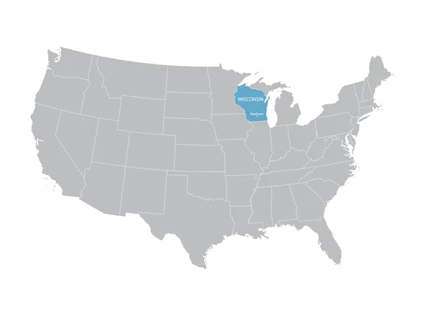
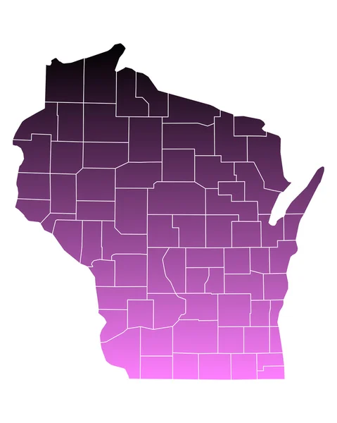
High Quality Map Of Wisconsin Is A State Of United States Of America With Borders Of The Counties

Vector, 1.18MB, 4000 × 4000 eps
stock vector Outline map of Wisconsin white background. USA state,  vector map with contour.

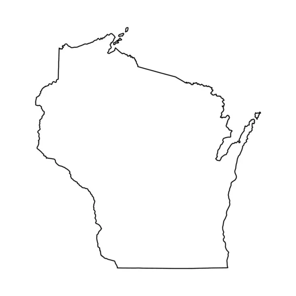
Outline Map Of Wisconsin White Background. USA State, Vector Map With Contour.

Vector, 5.56MB, 4000 × 4000 eps
stock vector Wisconsin state detailed editable map

Wisconsin State Detailed Editable Map

Vector, 1.12MB, 5743 × 6000 eps
stock image Wisconsin

Wisconsin

Image, 2.29MB, 4992 × 4992 jpg
stock vector Illinois counties map

Illinois Counties Map

Vector, 9.9MB, 3504 × 5004 eps
stock vector Black map of Wisconsin

Black Map Of Wisconsin

Vector, 1.58MB, 4000 × 4000 eps
stock vector Accurate map of Wisconsin

Accurate Map Of Wisconsin

Vector, 0.66MB, 4000 × 5000 eps
stock vector Wisconsin map

Wisconsin Map

Vector, 7.65MB, 7002 × 7002 eps
stock vector Accurate map of Wisconsin

Accurate Map Of Wisconsin

Vector, 0.65MB, 4000 × 5000 eps
stock vector Accurate map of Wisconsin

Accurate Map Of Wisconsin

Vector, 0.69MB, 4000 × 5000 eps
stock vector road map of the US American State of Minnesota

Road Map Of The US American State Of Minnesota

Vector, 1.77MB, 3100 × 3463 eps
stock vector Accurate map of Wisconsin

Accurate Map Of Wisconsin

Vector, 0.68MB, 4000 × 5000 eps
stock vector Grey map of Wisconsin

Grey Map Of Wisconsin

Vector, 1.58MB, 4000 × 4000 eps
stock vector Accurate map of Wisconsin

Accurate Map Of Wisconsin

Vector, 0.66MB, 4000 × 5000 eps
stock vector wisconsin state outline administrative and political vector map

Wisconsin State Outline Administrative And Political Vector Map

Vector, 1.09MB, 3111 × 3626 eps
stock vector Gray vector administrative map of the Federal State of Wisconsin, USA with white borders of its counties

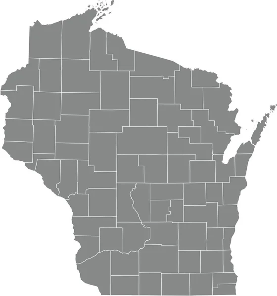
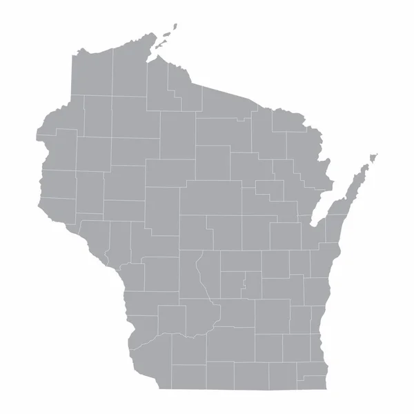
Gray Vector Administrative Map Of The Federal State Of Wisconsin, USA With White Borders Of Its Counties

Vector, 0.69MB, 4751 × 5090 eps
stock vector minnesota federal state road vector map with flag

Minnesota Federal State Road Vector Map With Flag

Vector, 1.94MB, 3100 × 3463 eps
stock vector Madison City map vector

Madison City Map Vector

Vector, 0.74MB, 7087 × 4726 eps
stock vector black outline Wisconsin map- vector illustration

Black Outline Wisconsin Map- Vector Illustration

Vector, 6.46MB, 4000 × 4000 eps
stock vector Wisconsin map shape, united states of america. Flat concept icon symbol vector illustration .

Wisconsin Map Shape, United States Of America. Flat Concept Icon Symbol Vector Illustration .

Vector, 0.3MB, 4096 × 4096 eps
stock vector Set 3 of 5 Division United States into counties, political and geographic subdivisions of a states, Highly detailed vector maps with names and territory nicknames

Set 3 Of 5 Division United States Into Counties, Political And Geographic Subdivisions Of A States, Highly Detailed Vector Maps With Names And Territory Nicknames

Vector, 10.09MB, 9585 × 4010 eps
stock vector white abstract outline of Wisconsin map

White Abstract Outline Of Wisconsin Map

Vector, 1.56MB, 4000 × 4000 eps
stock vector Set 3 of 5 Highly detailed vector silhouettes of USA state maps

Set 3 Of 5 Highly Detailed Vector Silhouettes Of USA State Maps

Vector, 9.07MB, 8858 × 3738 eps
stock vector Accurate map of Wisconsin

Accurate Map Of Wisconsin

Vector, 0.52MB, 4000 × 5000 eps
Page 1 >> Next