photo free
Home Images Vectors Videos

Stock image Yucatan Border

stock vector Yucatan blank outline map set

Yucatan Blank Outline Map Set

Vector, 1.65MB, 5833 × 4167 eps
stock vector Yucatan blank outline map set

Yucatan Blank Outline Map Set

Vector, 1.65MB, 5868 × 4144 eps
stock vector Vector monochrome set of seamless borders, native american frames. The endless pattern of the peoples of Central and South America, the Aztecs, the Maya, the Incas.

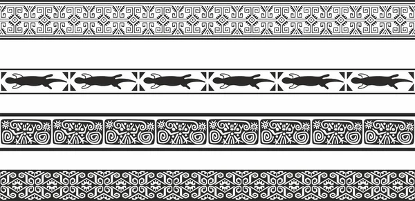
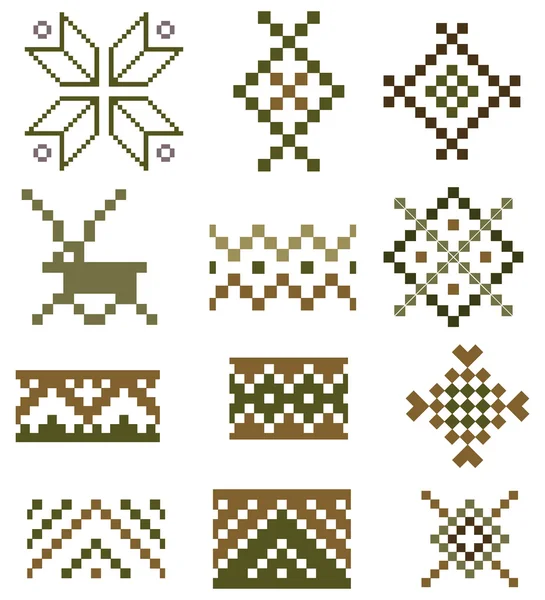
Vector Monochrome Set Of Seamless Borders, Native American Frames. The Endless Pattern Of The Peoples Of Central And South America, The Aztecs, The Maya, The Incas.

Vector, 16.93MB, 10631 × 5161 eps
stock vector Ethnic patterns set

Ethnic Patterns Set

Vector, 0.48MB, 2083 × 2292 eps
stock vector gulf of mexico road vector map

Gulf Of Mexico Road Vector Map

Vector, 0MB, 4000 × 3833 zip
stock vector Mexican Aztec round circular border frame in a range of sizes.

Mexican Aztec Round Circular Border Frame In A Range Of Sizes.

Vector, 4.67MB, 7200 × 7200 eps
stock image Jungle trail bordered by trees, leading to the famous pyramid in Cobe. Mexico, Yucatan.

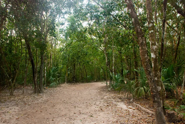
Jungle Trail Bordered By Trees, Leading To The Famous Pyramid In Cobe. Mexico, Yucatan.

Image, 10.67MB, 3702 × 2478 jpg
stock vector Ancient mayan pattern

Ancient Mayan Pattern

Vector, 5.27MB, 6250 × 6250 eps
stock vector gulf of mexico road vector map.

Gulf Of Mexico Road Vector Map.

Vector, 2.34MB, 4042 × 3100 eps
stock vector riviera maya road vector map, quintana roo, mexico

Riviera Maya Road Vector Map, Quintana Roo, Mexico

Vector, 0.85MB, 3100 × 4280 eps
stock image ancient maya circle flowers

Ancient Maya Circle Flowers

Image, 4.18MB, 9600 × 3300 jpg
stock vector Ancient maya circle flowers, black and white

Ancient Maya Circle Flowers, Black And White

Vector, 0.42MB, 9600 × 3300 eps
stock vector Mexico Map - Vintage Vector Illustration

Mexico Map - Vintage Vector Illustration

Vector, 3.42MB, 7226 × 5500 eps
stock vector Mexico province map, state Yucatan Peninsula vector map silhouette isolated on white background. High detailed silhouette illustration.

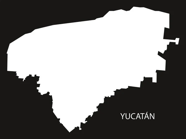
Mexico Province Map, State Yucatan Peninsula Vector Map Silhouette Isolated On White Background. High Detailed Silhouette Illustration.

Vector, 0.24MB, 6001 × 5334 eps
stock vector Mexico Map - Vintage Vector Illustration

Mexico Map - Vintage Vector Illustration

Vector, 3.42MB, 7167 × 5500 eps
stock image Maya decoration in a temple

Maya Decoration In A Temple

Image, 23.06MB, 4000 × 6016 jpg
stock image Usumacinta river

Usumacinta River

Image, 10.91MB, 4021 × 3084 jpg
stock vector Mexico Map - Vector Illustration

Mexico Map - Vector Illustration

Vector, 3.48MB, 7224 × 5500 eps
stock vector Mexico Map - Vector Illustration

Mexico Map - Vector Illustration

Vector, 3.43MB, 7167 × 5500 eps
stock vector all Flags of regions of Mexico. Vector illustraion

All Flags Of Regions Of Mexico. Vector Illustraion

Vector, 34.88MB, 7286 × 4000 eps
stock vector planned route of the Mayan Train in Mexico

Planned Route Of The Mayan Train In Mexico

Vector, 0.69MB, 3789 × 3100 eps
stock vector riviera maya and the Holbox island road vector map

Riviera Maya And The Holbox Island Road Vector Map

Vector, 0.99MB, 3100 × 5170 eps
stock vector Yucatan Peninsula political map. Large peninsula in southeastern Mexico and adjectants portions of Belize and Guatemala, separating the Gulf of Mexico and Caribbean Sea. With El Salvador and Honduras.

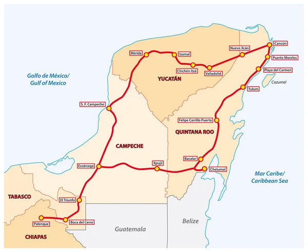
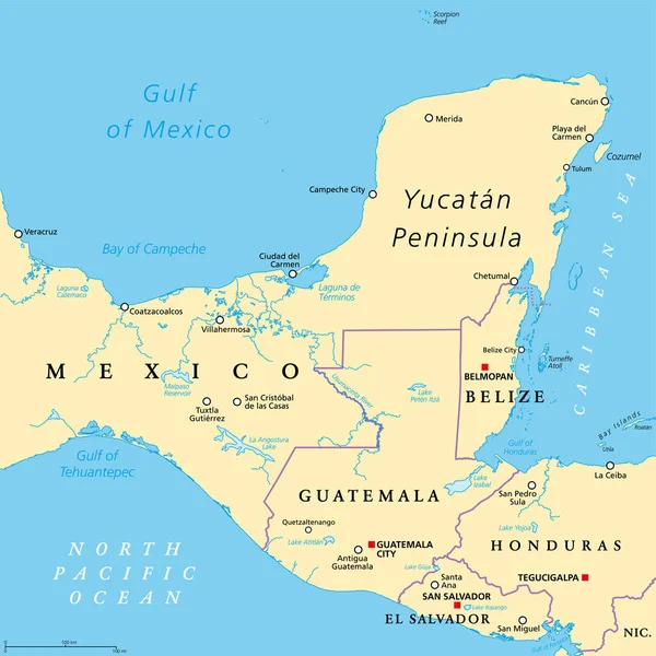
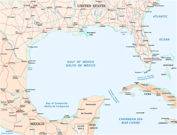
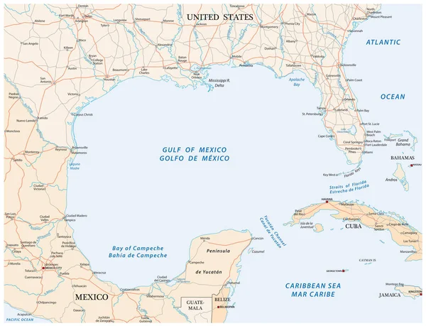
Yucatan Peninsula Political Map. Large Peninsula In Southeastern Mexico And Adjectants Portions Of Belize And Guatemala, Separating The Gulf Of Mexico And Caribbean Sea. With El Salvador And Honduras.

Vector, 4.94MB, 6000 × 6000 eps
stock image Quintana Roo Mexico 21. December 2021 Driving on the highway thru the Caseta de Cobro toll booth house of Quintana Roo and Lazaro Cardenas Mexico.

Quintana Roo Mexico 21. December 2021 Driving On The Highway Thru The Caseta De Cobro Toll Booth House Of Quintana Roo And Lazaro Cardenas Mexico.

Image, 17.26MB, 5851 × 3901 jpg
stock vector Yucatan Mexico Map black inverted silhouette

Yucatan Mexico Map Black Inverted Silhouette

Vector, 5.78MB, 6694 × 5000 eps
stock vector Guatemala political map

Guatemala Political Map

Vector, 2.54MB, 7382 × 8555 eps
stock image Top view of flag Republic of Yucatan, Mexico. retro flag with grunge texture. United Mexican States travel and patriot concept. no flagpole. Plane design, layout. Flag background

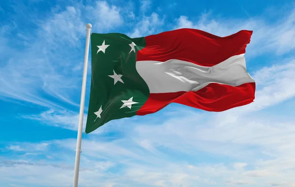
Top View Of Flag Republic Of Yucatan, Mexico. Retro Flag With Grunge Texture. United Mexican States Travel And Patriot Concept. No Flagpole. Plane Design, Layout. Flag Background

Image, 24.16MB, 6000 × 3000 jpg
stock vector Location of Mesoamerica, political map. Historical region and cultural area in southern North America and most of Central America, from Mexico to Costa Rica, where pre Columbian societies flourished.

Location Of Mesoamerica, Political Map. Historical Region And Cultural Area In Southern North America And Most Of Central America, From Mexico To Costa Rica, Where Pre Columbian Societies Flourished.

Vector, 4.2MB, 9000 × 5773 eps
stock image Caribbean sea view from blue pool rear woman

Caribbean Sea View From Blue Pool Rear Woman

Image, 9.55MB, 5184 × 4744 jpg
stock image flag of Republic of Yucatan , Mexico at cloudy sky background on sunset, panoramic view. Mexican travel and patriot concept. copy space for wide banner. 3d illustration

Flag Of Republic Of Yucatan , Mexico At Cloudy Sky Background On Sunset, Panoramic View. Mexican Travel And Patriot Concept. Copy Space For Wide Banner. 3d Illustration

Image, 4.54MB, 6144 × 2160 jpg
stock vector Mexico Map - Info Graphic Vector Illustration

Mexico Map - Info Graphic Vector Illustration

Vector, 12.61MB, 8700 × 4865 eps
stock vector Mexico Map - Vintage Vector Illustration

Mexico Map - Vintage Vector Illustration

Vector, 3.19MB, 6917 × 5500 eps
stock vector Aztec Empire with tributary provinces, maximum extent of Triple Alliance, history map. Tenochtitlan, Tetzcoco and Tlacopan at the time of Spanish conquest, 1519. With today state and country borders.

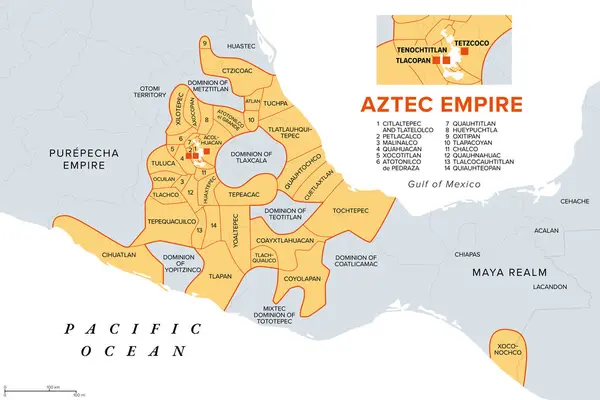
Aztec Empire With Tributary Provinces, Maximum Extent Of Triple Alliance, History Map. Tenochtitlan, Tetzcoco And Tlacopan At The Time Of Spanish Conquest, 1519. With Today State And Country Borders.

Vector, 2.54MB, 9000 × 6000 eps
stock image flag of Republic of Yucatan , Mexico at cloudy sky background on sunset, panoramic view. Mexican travel and patriot concept. copy space for wide banner. 3d illustration

Flag Of Republic Of Yucatan , Mexico At Cloudy Sky Background On Sunset, Panoramic View. Mexican Travel And Patriot Concept. Copy Space For Wide Banner. 3d Illustration

Image, 9.1MB, 5760 × 3654 jpg
stock vector Yucatan state map, administrative division of the country of Mexico. Vector illustration.

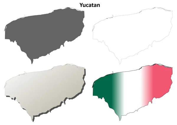
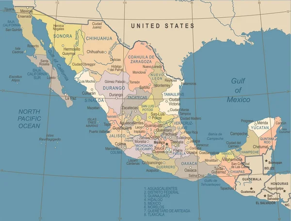
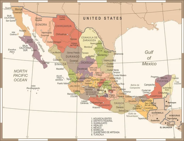
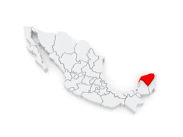
Yucatan State Map, Administrative Division Of The Country Of Mexico. Vector Illustration.

Vector, 5.27MB, 8334 × 8334 eps
stock image Map of Yucatan. Mexico.

Map Of Yucatan. Mexico.

Image, 3.13MB, 5600 × 4200 jpg
stock image Yucatan red highlighted in map of Mexico

Yucatan Red Highlighted In Map Of Mexico

Image, 4.84MB, 9013 × 6100 jpg
stock image Map of Yucatan. Mexico.

Map Of Yucatan. Mexico.

Image, 1.2MB, 5600 × 4200 jpg
stock vector Yucatan state outline map set

Yucatan State Outline Map Set

Vector, 2.36MB, 6000 × 3000 eps
stock image Map of Yucatan. Mexico.

Map Of Yucatan. Mexico.

Image, 1.85MB, 5600 × 4200 jpg
stock vector Yucatan region location within Mexico 3d isometric map

Yucatan Region Location Within Mexico 3d Isometric Map

Vector, 10.48MB, 4000 × 4000 eps
stock vector Mexico region silhouettes set and blank map of the country isolated on white background. Vector illustration design

Mexico Region Silhouettes Set And Blank Map Of The Country Isolated On White Background. Vector Illustration Design

Vector, 2.36MB, 5500 × 4000 eps
Page 1 >> Next