Home
Images
Vectors
Videos
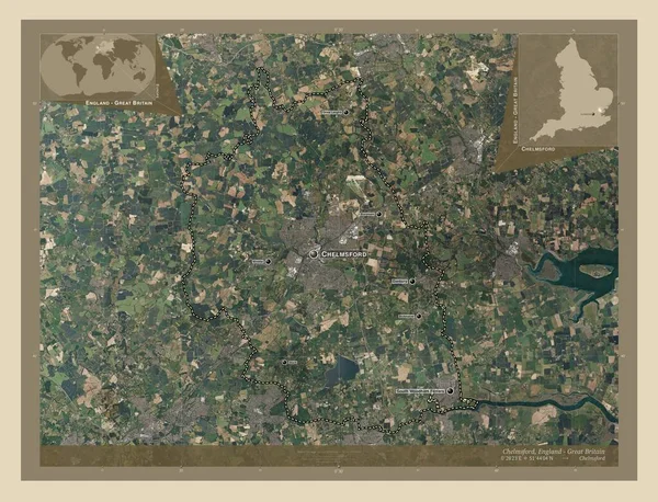
Stock image Chelmsford, non metropolitan district of England - Great Britain. High resolution satellite map. Locations and names of major cities of the region. Corner auxiliary location maps
Published:
Apr.21, 2023 13:01:15
Author:
Yarr65
Views:
0
Downloads:
0
File type:
image
/
jpg
File size:
11.55 MB
Orginal size:
4930
x
3770
px
Available sizes:
S
(500 x 382)
M
(1000 x 765)
L
(2000 x 1529)
XL
(4930 x 3770)
EL0
(4930 x 3770)
Level:
bronze
Download Image
Image topics:
Shape
Nature
Border
Contour
Earth
Planet
World
Stock
Ocean
Science
Capital
Europe
Outline
Country
Map
Geography
Continent
Land
Zoom
London
Region
Territory
Atlas
Legend
Stereographic
Chelmsford
GBR
Danbury
Boreham
Administrative Division
Great Leighs
Bicknacre
South Woodham Ferrers
Writtle
England Great Britain
Non Metropolitan District
Similar stock images
Milton Keynes, Unitary Authority Of England - Great Britain. High Resolution Satellite Map. Locations And Names Of Major Cities Of The Region. Corner Auxiliary Location Maps
4930 × 3770
Brentwood, Non Metropolitan District Of England - Great Britain. High Resolution Satellite Map. Locations And Names Of Major Cities Of The Region. Corner Auxiliary Location Maps
4930 × 3770
Chelmsford, Non Metropolitan District Of England - Great Britain. High Resolution Satellite Map. Locations Of Major Cities Of The Region. Corner Auxiliary Location Maps
4930 × 3770
North West Leicestershire, Non Metropolitan District Of England - Great Britain. High Resolution Satellite Map. Locations And Names Of Major Cities Of The Region. Corner Auxiliary Location Maps
4930 × 3770
West Berkshire, County Of England - Great Britain. High Resolution Satellite Map. Locations Of Major Cities Of The Region. Corner Auxiliary Location Maps
4930 × 3770
West Berkshire, County Of England - Great Britain. High Resolution Satellite Map. Locations And Names Of Major Cities Of The Region. Corner Auxiliary Location Maps
4930 × 3770
Chelmsford, Non Metropolitan District Of England - Great Britain. High Resolution Satellite Map. Corner Auxiliary Location Maps
4930 × 3770
Swindon, Unitary Authority Of England - Great Britain. High Resolution Satellite Map. Locations And Names Of Major Cities Of The Region. Corner Auxiliary Location Maps
4930 × 3770