Home
Images
Vectors
Videos
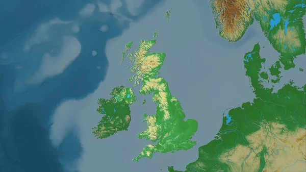
Stock image Ireland Island in the Celtic Sea on a colored elevation map
Published:
Sep.11, 2024 13:56:37
Author:
zelwanka
Views:
0
Downloads:
0
File type:
image
/
jpg
File size:
3.6 MB
Orginal size:
2880
x
1620
px
Available sizes:
S
(500 x 281)
M
(1000 x 563)
L
(2000 x 1125)
XL
(2880 x 1620)
EL0
(2880 x 1620)
Level:
beginner
Download Image
Image topics:
Colored
Shape
Nature
Border
Physical
Contour
Earth
Planet
World
Ocean
Science
Europe
Elevation
Outline
Country
Map
Geography
Continent
Ireland
Land
Zoom
Island
Region
Territory
Atlas
Irl
Stereographic
Irlanda
Irlande
United Kingdom
North Atlantic Ocean
Celtic Sea
Ireland Island
Copeland Islands
Inner Seas Off The West Coast Of Scotland
Similar stock images
United Kingdom Area On The Topographic Relief Map In The Stereographic Projection - Raw Composition Of Raster Layers
2880 × 1620
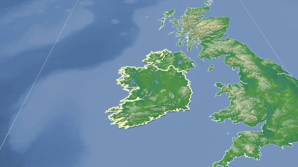
Ireland And Its Neighborhood. Distant Oblique Perspective - Shape Outlined. Color Physical Map
2880 × 1620
Close-up Of The Ireland Border Area On A Topographic Map. Capital Point. Bevelled Edges Of The Country Shape.
3840 × 2160
Extended Area Of Ireland With Country Outline, International And Regional Borders. Topographic Relief Map. 3D Rendering
3000 × 2000
United Kingdom Extruded On The Physical Orthographic Map. Capital, Administrative Borders And Graticule
3840 × 2160
Extended Area Of Outlined Ireland. Topographic Relief Map. 3D Rendering
3000 × 2000
England - Great Britain Outlined On A Colored Elevation Map With Lakes And Rivers
2688 × 1512
England - Great Britain Outlined On A Low Resolution Satellite Map
2688 × 1512