Home
Images
Vectors
Videos
Stock image Latvia highlighted on a high resolution satellite map map with the country's capital point, cartographic grid, distance scale and map border coordinates
Published:
Dec.28, 2023 13:25:07
Author:
zelwanka
Views:
0
Downloads:
0
File type:
image
/
jpg
File size:
3.66 MB
Orginal size:
2880
x
1620
px
Available sizes:
S
(500 x 281)
M
(1000 x 563)
L
(2000 x 1125)
XL
(2880 x 1620)
EL0
(2880 x 1620)
Level:
beginner
Download Image
Image topics:
Shape
Nature
Border
Contour
Earth
Planet
World
Ocean
Science
Capital
Europe
Imagery
Outline
Country
Map
Geography
Continent
Land
Zoom
Satellite
Region
Territory
Outlined
Latvia
Atlas
Highlighted
Legend
Coordinates
Riga
Stereographic
LVA
Distance Scale
Administrative Division
Cartographic Grid
Similar stock images
Kurzeme, Province Of Latvia. High Resolution Satellite Map. Locations Of Major Cities Of The Region. Corner Auxiliary Location Maps
4930 × 3770
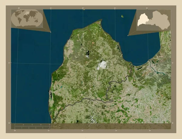
Kurzeme, Province Of Latvia. High Resolution Satellite Map. Corner Auxiliary Location Maps
4930 × 3770
Kurzeme, Province Of Latvia. High Resolution Satellite Map. Locations And Names Of Major Cities Of The Region. Corner Auxiliary Location Maps
4930 × 3770
Central Ostrobothnia, Region Of Finland. Low Resolution Satellite Map. Locations Of Major Cities Of The Region. Corner Auxiliary Location Maps
4930 × 3770
Central Ostrobothnia, Region Of Finland. High Resolution Satellite Map. Locations And Names Of Major Cities Of The Region. Corner Auxiliary Location Maps
4930 × 3770
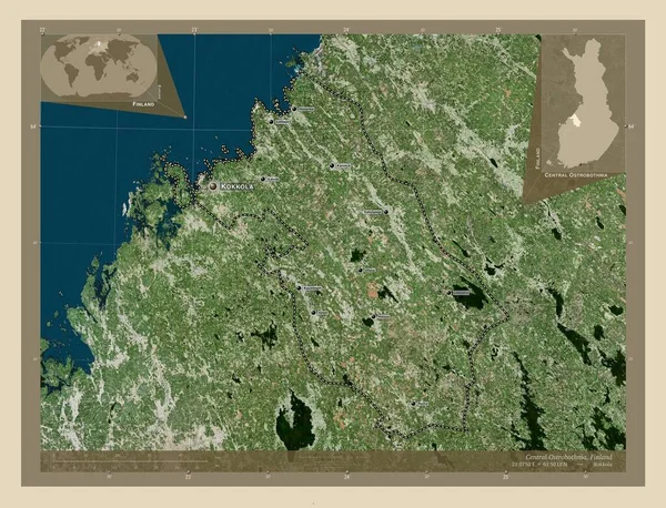
Central Ostrobothnia, Region Of Finland. Low Resolution Satellite Map. Corner Auxiliary Location Maps
4930 × 3770
Central Ostrobothnia, Region Of Finland. High Resolution Satellite Map. Corner Auxiliary Location Maps
4930 × 3770
Central Ostrobothnia, Region Of Finland. Low Resolution Satellite Map. Locations And Names Of Major Cities Of The Region. Corner Auxiliary Location Maps
4930 × 3770