Home
Images
Vectors
Videos
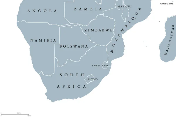
Stock image Ryazan, Russia - July 08, 2018: Country of Botswana on the google maps service
Published:
Oct.05, 2018 16:04:04
Author:
sharafmaksumov
Views:
1
Downloads:
0
File type:
image
/
jpg
File size:
18.22 MB
Orginal size:
5184
x
3456
px
Available sizes:
S
(500 x 333)
M
(1000 x 667)
L
(2000 x 1333)
XL
(5184 x 3456)
EL0
(5184 x 3456)
Level:
bronze
Download Image
Image topics:
Color
Background
Graphic
Travel
City
Screen
Monitor
Pc
Contour
World
Globe
Country
Map
Geography
Continent
Land
Editorial
Topography
Political
Atlas
Illustrative
Botswana
Google Maps
Similar stock images
Southern Africa Region Political Map
9666 × 6444
Ryazan, Russia - July 08, 2018: Country Of Botswana On The Google Maps Service
5184 × 3456
Angola From Space On Model Of Planet Earth With Country Borders. 3D Illustration. Elements Of This Image Furnished By NASA.
5000 × 3750
Blue-gray Detailed Map Of South Africa Administrative Divisions And Location On The Globe. Vector Illustration
5304 × 6912
ESwatini On Planet Earth With Country Borders And Highly Detailed Planet Surface. 3D Illustration. Elements Of This Image Furnished By NASA.
5000 × 3750
Close-up Of The Namibia Border Area On A Topographic Map. Capital Point. Outline Around The Country Shape.
3840 × 2160
Ryazan, Russia - July 08, 2018: Country Of Angola On The Google Maps Service
3456 × 5184
Close-up Of The Namibia Border Area Highlighting With A Dark Overlay On A Topographic Map. Capital Point. Outline Around The Country Shape.
3840 × 2160