Home
Images
Vectors
Videos
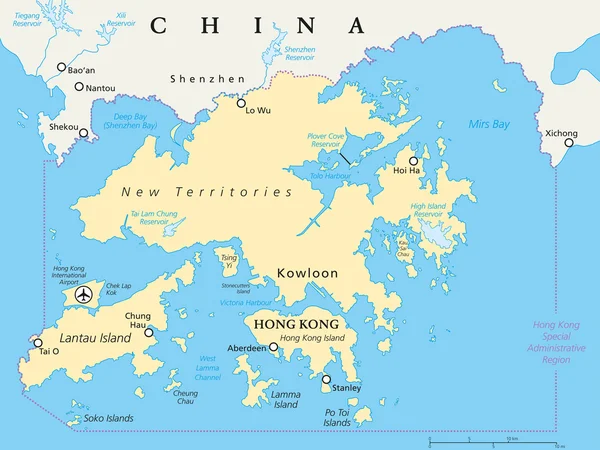
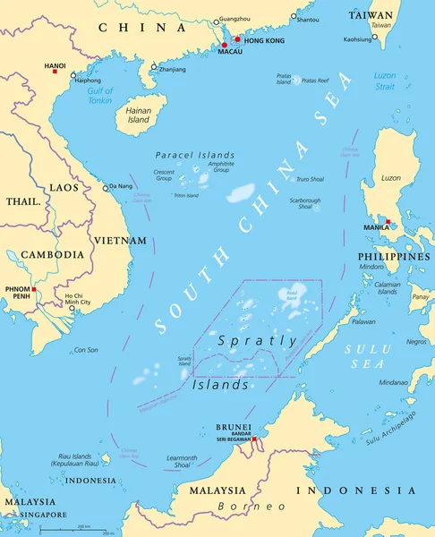
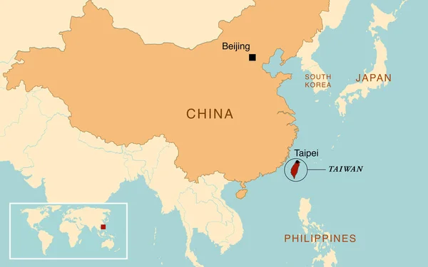
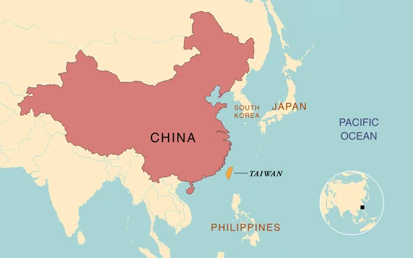
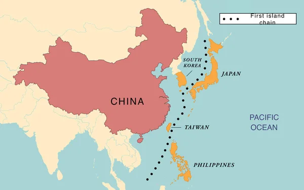
Stock image The first island chain between Japan, South Korea, Taiwan, Philippines and China
Published:
Apr.06, 2023 10:56:59
Author:
dkaramit
Views:
9
Downloads:
2
File type:
image
/
jpg
File size:
1.06 MB
Orginal size:
3200
x
2000
px
Available sizes:
S
(500 x 313)
M
(1000 x 625)
L
(2000 x 1250)
XL
(3200 x 2000)
EL0
(3200 x 2000)
Level:
beginner
Download Image
Image topics:
Illustration
Peace
Usa
Crisis
China
Map
Cartography
Geography
National
Asia
War
Army
Conflict
Battle
Countries
Trade
Island
Political
Politics
Beijing
Territory
Claim
Dispute
Controversy
Taiwan
Taipei
Geographical
Territorial
Trading War
Similar stock images
Hong Kong And Vicinity Political Map
7991 × 6000
South China Sea Islands, Political Map. Islands, Atolls, Cays, Shoals, Reefs And Sandbars. Partially Claimed By China And Other Neighboring States. Paracel And Spratly Islands. Illustration. Vector.
7165 × 8833
Map Of The Territorial Dispute Between China And Taiwan
3200 × 2000
Map Of The Territorial Dispute Between China And Taiwan
3200 × 2000
Position Map Of The Mariana Trench In Oceania
3100 × 2957
East Asia Map - Green Hue Colored On Dark Background. High Detailed Political Map Of Eastern Region With Country, Capital, Ocean And Sea Names Labeling
6000 × 4500
Hainan, Southernmost Province Of China, And Surrounding Area, Gray Political Map. Hainan Island, And Paracel Islands In The South China Sea, South Of The Leizhou Peninsula, And East Of Gulf Of Tonkin.
6979 × 6000
East Asia Map - Brown Orange Hue Colored On Dark Background. High Detailed Political Map Of Eastern Region With Country, Ocean And Sea Names Labeling
6000 × 4500