Home
Images
Vectors
Videos
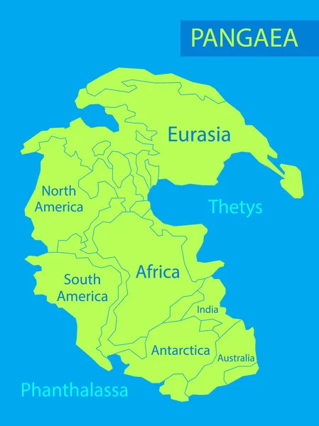
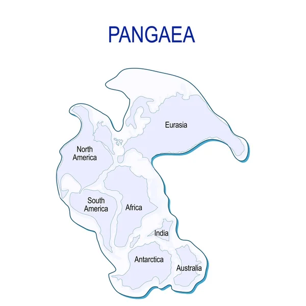
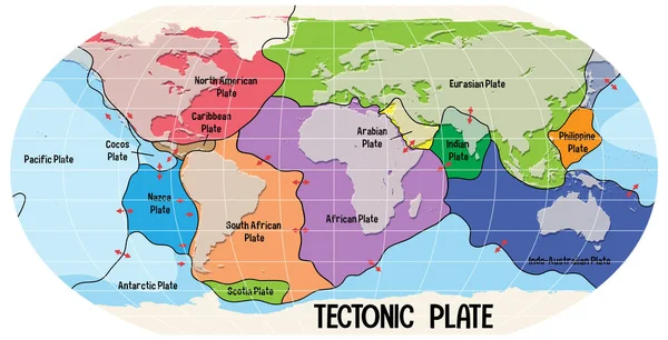
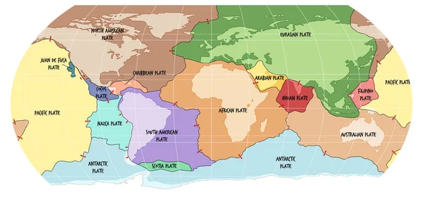
Stock vector 3D Isometric Flat Vector Illustration of Paleozoic And Mesozoic Eras, Continental Drift. Item 4
Published:
May.27, 2024 00:00:54
Author:
tarik_vision
Views:
3
Downloads:
0
File type:
vector
/
eps
File size:
0.79 MB
Orginal size:
5000
x
5000
px
Available sizes:
S
(500 x 500)
M
(1000 x 1000)
L
(2000 x 2000)
XL
(5000 x 5000)
VECT
(5000 x 5000)
EL0
(5000 x 5000)
Level:
silver
Download Vector
Vector topics:
Vector
Background
Graphic
Illustration
Design
Years
Plate
Cartoon
3d
Time
Concept
Icon
Age
Flat
Earth
Planet
World
Ice
Globe
Map
Africa
Continent
Geology
Continental
Evolution
Creation
India
Era
Super
Period
Drift
Ago
Cretaceous
Isometric
Permian
Quaternary
Tectonic
Mesozoic
Geomorphology
Laurasia
Paleozoic
Triassic
Tethys
Gondwana
Pangaea
Supercontinent
Pangea
Gondwanaland
Panthalassa
Similar stock vectors
Pangaea Or Pangea. Vector Illustration Of Supercontinent That Existed During The Late Paleozoic And Early Mesozoic Eras. Map Of Green Ancient Continent And Ocean In Flat Style. Poster. Education
5000 × 6667
Pangaea
5000 × 6138
Map Of Pangaea With Modern Continental Borders. Continental Drift On The Planet Earth. Millions Years Ago. Vector Illustration For Educational And Science Use
4228 × 4228
Globe With Supercontinent Pangaea, Modern Continental Borders, And Superocean Panthalassa. Pangea Maps. Continental Drift Theory. Planet Earth Millions Years Ago. Vector Illustration For Educational, Physics, Geology, And Science Use
5000 × 3455
World Map Showing Tectonic Plates Boundaries Illustration
6599 × 3367
Somalia Map, Stylish Location Icon With Somalia Map And Flag.
5000 × 5000
Locator Map Showing The Location Of The Country Lesotho In Africa. The Country Is Highlighted With A Red Polygon. Small Countries Are Also Marked With A Red Circle. The Map Shows Yellow Land Areas, Blue Sea, State Borders And A Blue Grid Lines. No La
2400 × 2400
World Map Showing Tectonic Plates Boundaries Illustration
6989 × 3417