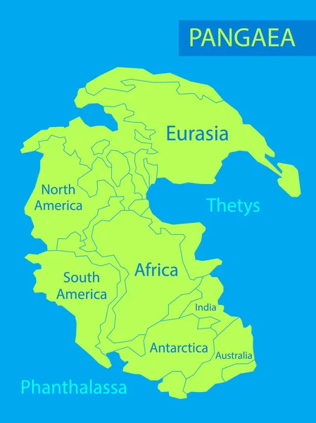
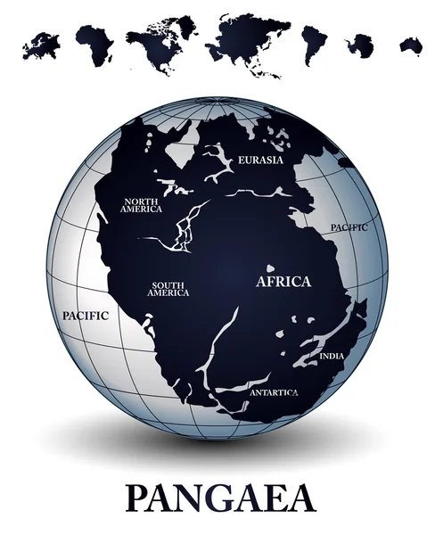
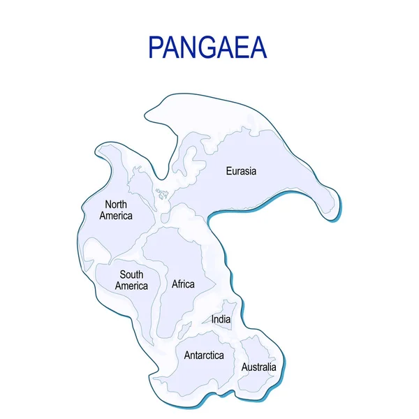
Stock vector Map of Pangaea with modern continental borders. Continental drift on the planet Earth. millions years ago. vector illustration for educational and science use
Published: Oct.23, 2018 11:40:41
Author: edesignua
Views: 764
Downloads: 5
File type: vector / eps
File size: 0.48 MB
Orginal size: 4228 x 4228 px
Available sizes:
Level: silver