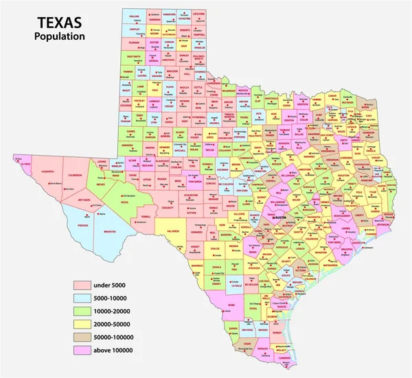
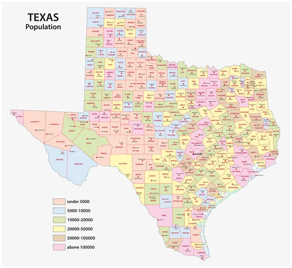
Stock vector administrative county map of the federal state of texas by population density
Published: Jul.12, 2019 09:08:35
Author: Lesniewski
Views: 111
Downloads: 3
File type: vector / eps
File size: 3.15 MB
Orginal size: 4856 x 4468 px
Available sizes:
Level: bronze