Home
Images
Vectors
Videos
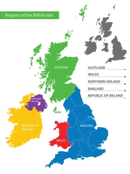
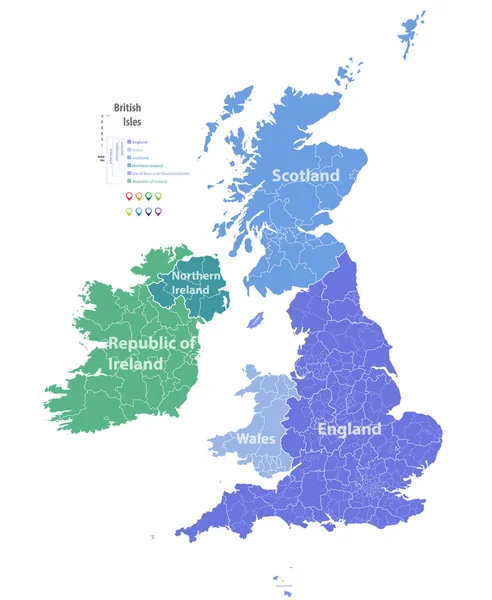
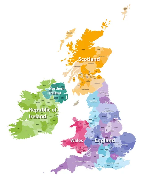
Stock vector Color detailed map of the regions and countries of the British Isles for your design
Published:
Nov.20, 2019 16:08:19
Author:
martinova4
Views:
36
Downloads:
5
File type:
vector
/
eps
File size:
1.81 MB
Orginal size:
5947
x
7951
px
Available sizes:
S
(374 x 500)
M
(748 x 1000)
L
(1496 x 2000)
XL
(5947 x 7951)
VECT
(5947 x 7951)
EL0
(5947 x 7951)
Level:
beginner
Download Vector
Vector topics:
Vector
Illustration
Business
Man
European
Border
Flag
City
Earth
Northern
Europe
Map
Cartography
National
Ireland
Land
State
Topography
Island
Government
Political
Politics
United
Commonwealth
Kingdom
Britain
London
English
British
England
Yorkshire
Wales
Scotland
County
Staffordshire
Topographic
Hampshire
Regions
Cheshire
Devon
Belfast
North West
South West
Northern Ireland
West Midlands
South East
North East
Monarchia
East Of England
And Painting
Similar stock vectors
United Kingdom Map With Territories And Flags Of England, Scotland, Northern Ireland And Wales 3D Illustration
5000 × 6500
United Kingdom
4621 × 7056
Vector Map Of British Isles
5979 × 7292
United Kingdom And Regions Of England
5079 × 5079
British Isles Map Colored By Countries And Regions
5664 × 7292
United Kingdom Map With Pin Of Country Capital. Two Types Of United Kingdom Map With Neighboring Countries.
5300 × 6150
Detailed Vector Map Of The Regions Of The British Isles, In The Color Of The British Flag
5192 × 6496
United Kingdom Map Divided On Regions For Infographic Great Britain
4500 × 4500