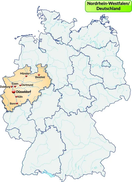
Stock vector Detailed map of the State of North Rhine - Westphalia (Germany) with borders of municipalities, subdistricts, districts, and provinces. Vector illustration

Published: Apr.27, 2017 08:41:15
Author: Dorky
Views: 419
Downloads: 2
File type: vector / eps
File size: 9.18 MB
Orginal size: 5000 x 5000 px
Available sizes:
Level: beginner