Home
Images
Vectors
Videos
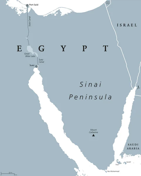
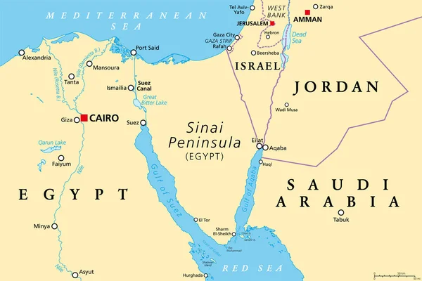
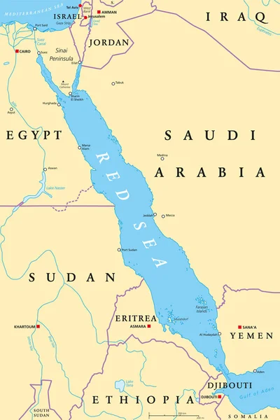
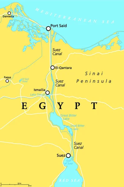
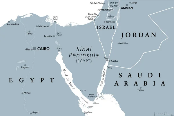
Stock vector Egypt, Sinai Peninsula political map
Published:
Jun.21, 2017 10:30:14
Author:
Furian
Views:
1675
Downloads:
4
File type:
vector
/
eps
File size:
3.04 MB
Orginal size:
7138
x
8888
px
Available sizes:
S
(402 x 500)
M
(803 x 1000)
L
(1606 x 2000)
XL
(7138 x 8888)
VECT
(7138 x 8888)
EL0
(7138 x 8888)
Level:
silver
Download Vector
Vector topics:
Red
Vector
Illustration
Labeling
Travel
Sea
Mount
Map
Cartography
Geography
Africa
Egypt
Mediterranean
Asia
Port
Canal
Gulf
Israel
Strait
English
Said
Catherine
Atlas
Arabia
Peninsula
Eilat
Sinai
Saudi
Sharm
Sheikh
Tiran
Suez
Red Sea
Middle East
Mediterranean Sea
Saudi Arabia
Sinai Peninsula
Suez Canal
Political Map
Port Said
Land Bridge
Ras Muhammad
Mount Catherine
Similar stock vectors
Sinai Peninsula, Egypt, Political Map
7138 × 8888
Sinai Peninsula Region, Political Map. A Peninsula In Egypt, Located Between The Mediterranean Sea And The Red Sea, Land Bridge Between Asia And Africa. With Parts Of Israel, Jordan And Saudi Arabia.
9000 × 6000
Map Of The Red Sea With Its Neighboring Countries.
3100 × 4514
Red Sea Region Political Map
6518 × 9777
Suez Canal, Political Map. An Artificial Sea-level Waterway In Egypt, Connecting The Mediterranean Sea To The Red Sea, Dividing Africa And Asia. It Extends From Port Said To Suez. Illustration. Vector
3622 × 4000
Ancient Egypt Map Gray Colored
6685 × 9666
Arab Republic Of Egypt - Vector Map
5810 × 6473
Sinai Peninsula, Gray Political Map. Peninsula In Egypt, Located Between Mediterranean And Red Sea, A Land Bridge Between The Continents Asia And Africa. With Parts Of Israel, Jordan And Saudi Arabia.
9000 × 6000