Home
Images
Vectors
Videos
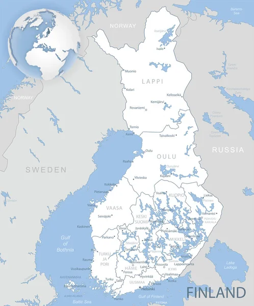
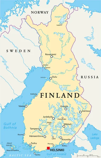
Stock vector Finland political map
Published:
Feb.27, 2017 10:30:02
Author:
Furian
Views:
59
Downloads:
0
File type:
vector
/
eps
File size:
2.48 MB
Orginal size:
6374
x
9999
px
Available sizes:
S
(319 x 500)
M
(637 x 1000)
L
(1275 x 2000)
XL
(6374 x 9999)
VECT
(6374 x 9999)
EL0
(6374 x 9999)
Level:
silver
Download Vector
Vector topics:
Vector
Illustration
Isolated
Labeling
Travel
Gray
Coastline
Sweden
Capital
Scandinavia
Northern
Europe
Russia
Country
Map
Cartography
Geography
Land
State
Destination
Republic
Finland
Helsinki
English
Atlas
Norway
White Background
Northern Europe
Aland Islands
Political Map
Fennoscandia
Cruise Destination
Similar stock vectors
Blue-gray Detailed Map Of Finland Administrative Divisions And Location On The Globe.
5203 × 6269
Sweden Political Map
6221 × 10111
Murmansk Oblast, Kola Peninsula, Gray Political Map. Federal Subject Of Russia, Part Of Lapland Region, Bordering Norway And Finland. With Murmansk, Most Important Port City Of Russia On Arctic Ocean.
9000 × 6000
Norway Map - Vintage Vector Illustration
5500 × 6783
Finland Political Map
5742 × 9000
Saint Petersburg Area, Gray Political Map. Second-largest City In Russia, Formerly Known As Petrograd And Later Leningrad. Situated On The Neva River, At The Head Of Gulf Of Finland In The Baltic Sea.
9000 × 6000
Baltic Sea Area Countries Political Map
7264 × 8999
Gulf Of Finland And Gulf Of Riga Region, Gray Political Map. The Nordic Countries Finland, Estonia And Latvia With Their Capitals, And The Seaway From The Baltic Sea To Saint Petersburg, Russia.
8979 × 6000