Home
Images
Vectors
Videos
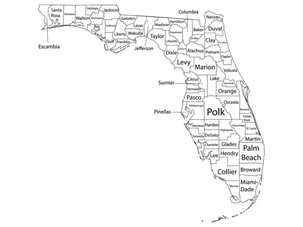
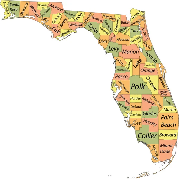
Stock vector Florida state counties, gray political map. Florida, a state in the Southeastern region of the United States, subdivided into 67 counties. Map with boundaries and county names. Illustration. Vector
Published:
Jun.17, 2024 18:29:35
Author:
Furian
Views:
0
Downloads:
0
File type:
vector
/
eps
File size:
3.2 MB
Orginal size:
6316
x
6000
px
Available sizes:
S
(500 x 475)
M
(1000 x 950)
L
(2000 x 1900)
XL
(6316 x 6000)
VECT
(6316 x 6000)
EL0
(6316 x 6000)
Level:
silver
Download Vector
Vector topics:
Vector
Illustration
Isolated
Travel
Border
Gray
Us
Usa
Coast
Coastline
Country
District
Map
Cartography
Geography
Land
Overview
Swing
State
America
Boundary
Island
Political
Administrative
Gulf
Atlantic
Destination
States
Division
Federal
Atlas
Florida
Nation
FL
Subdivision
County
Mapping
Names
Southeastern
Miami
Counties
Seminole
Miami Dade
Infographic
United States
Gulf Of Mexico
Palm Beach
Florida Keys
Subdivided
Swing States
Similar stock vectors
Pastel Vector Map Of The Federal State Of Florida, USA With Black Borders And Names Of Its Counties
5003 × 4989
BLUE CMYK Color Detailed Flat Map Of The Federal State Of FLORIDA, UNITED STATES OF AMERICA On Transparent Background
5100 × 4880
Map Of The U. S. State Of Florida
3000 × 2897
White Outline Counties Map With Counties Names Of US State Of Florida
4800 × 3600
Florida Highly Detailed Vector Map With County Names,main Cities And Roads.
5000 × 4805
Orange Map Of US Federal State Of Florida (Sunshine State)
5000 × 4784
High Quality Map Of Florida Is A State Of United States Of America With Borders Of The Counties
4000 × 4000
Map Of Florida
5000 × 4000