Home
Images
Vectors
Videos
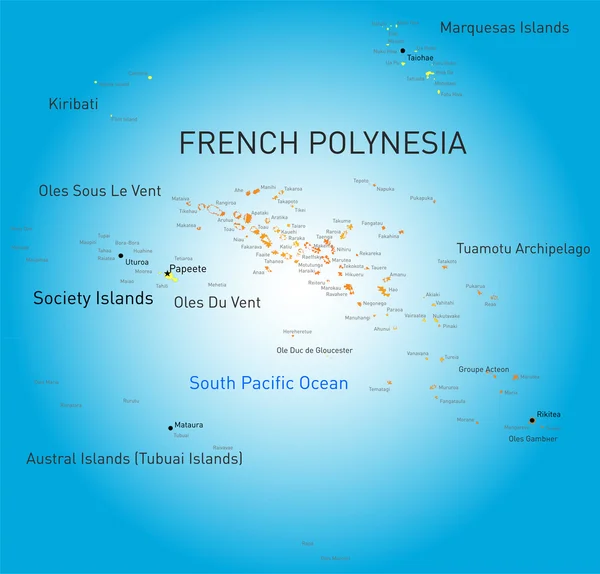
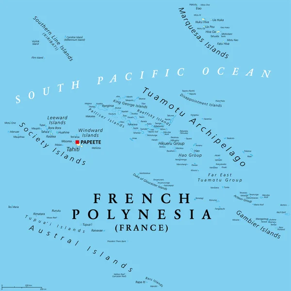
Stock vector French Polynesia, political map. Overseas collectivity of France, and its sole overseas country, in the South Pacific Ocean, with 121 islands and atolls, and capital Papeete, on the island of Tahiti.
Published:
Apr.11, 2023 17:00:29
Author:
Furian
Views:
131
Downloads:
2
File type:
vector
/
eps
File size:
5.97 MB
Orginal size:
6000
x
6000
px
Available sizes:
S
(500 x 500)
M
(1000 x 1000)
L
(2000 x 2000)
XL
(6000 x 6000)
VECT
(6000 x 6000)
EL0
(6000 x 6000)
Level:
silver
Download Vector
Vector topics:
Group
Vector
Illustration
Travel
French
Tropical
France
Ocean
Capital
South
Sailing
Cruise
Country
Map
Cartography
Geography
Pacific
Land
Overview
State
Island
Reef
Destination
Overseas
Atlas
Dependency
Atoll
Nation
Polynesia
Tahiti
Mapping
Kiribati
Collectivity
Archipelago
Papeete
Infographic
Pacific Ocean
South Pacific
Coral Reef
Bora Bora
French Polynesia
Political Map
Society Islands
Tuamotu
Marquesas
Tuamotu Archipelago
Marquesas Islands
Austral Islands
Gambier Islands
Aceton Group
Similar stock vectors
French Polynesia
6049 × 5788
Marquesas Islands, Political Map. Group Of Volcanic Islands, In French Polynesia, An Overseas Collectivity Of France, In The South Pacific Ocean, With Capital Taiohae, On The Island Nuka Hiva. Vector
6000 × 6000
Society Islands, Political Map. Group Of Volcanic Islands, In French Polynesia, An Overseas Collectivity Of France, In The South Pacific Ocean. Archipelago, Divided Into Leeward And Windward Islands.
9000 × 4391
Republic Of Fiji Vector Map With Flag
3600 × 3542
Barbados, Grenada, Saint Lucia And Saint Vincent Political Map
8777 × 7301
Maluku Islands Vector Map
3100 × 3340
Map Of The Dutch Saba Bank National Park In The Caribbean Sea
3764 × 3100
Dutch Caribbean Political Map
8777 × 7227