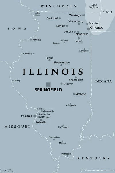
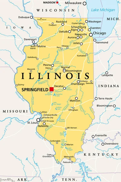
Stock vector Illinois, IL, political map, with capital Springfield and metropolitan area Chicago. State in the Midwestern region of United States, nicknamed Land of Lincoln, Prairie State, and Inland Empire State.
Published: May.13, 2022 10:34:47
Author: Furian
Views: 115
Downloads: 10
File type: vector / eps
File size: 4.08 MB
Orginal size: 6000 x 9000 px
Available sizes:
Level: silver