Home
Images
Vectors
Videos
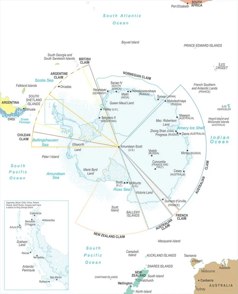
Stock vector illustration of geography, International Date Line map, line of demarcation, defines the boundary between calendar dates, Crossing the date line eastbound decreases the date by one day
Published:
Jul.16, 2023 06:23:40
Author:
beelineonl@gmail.com
Views:
2
Downloads:
1
File type:
vector
/
eps
File size:
5.76 MB
Orginal size:
6504
x
4253
px
Available sizes:
S
(500 x 327)
M
(1000 x 654)
L
(2000 x 1308)
XL
(6504 x 4253)
VECT
(6504 x 4253)
EL0
(6504 x 4253)
Level:
beginner
Download Vector
Vector topics:
Vector
Illustration
Design
Day
Minute
Time
Date
Calendar
Clock
Concept
Night
School
Global
Learning
Education
Earth
Planet
World
Usa
Science
Europe
Globe
Hours
Russia
Study
Country
Map
Geography
Latitude
Longitude
Worldwide
University
Traveling
Scientific
America
International
Boundary
Educational
Tomorrow
Yesterday
Alaska
Internationally
World Map
Pacific Ocean
Time Zone
Calendar Day
Political Border
Longitude Line
Antimeridian
Similar stock vectors
Antarctic Region Map - Vector Illustration
5500 × 6780
Pacific Ocean Map White Color
5166 × 3904
Continental Drift Chronological Movement, Historical Timeline With Earth Continents: Pangaea, Laurasia, Gondwana.
5174 × 5401
Tectonic Plates World Map Collection Illustration
8327 × 2878
Insular Area Vector Map Of The United States.
4078 × 3100
Globe Centered To New Zealand Country Highlighted With Green Color On World Map Satellite World
5482 × 5482
World Map Showing Tectonic Plates Boundaries Illustration
7084 × 3464
Design Schematic Vector Map Of The Bermuda Triangle.
5786 × 4000