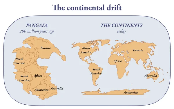
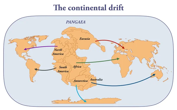
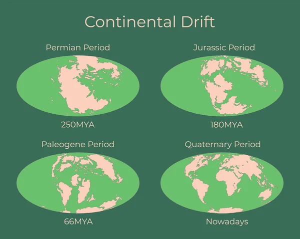
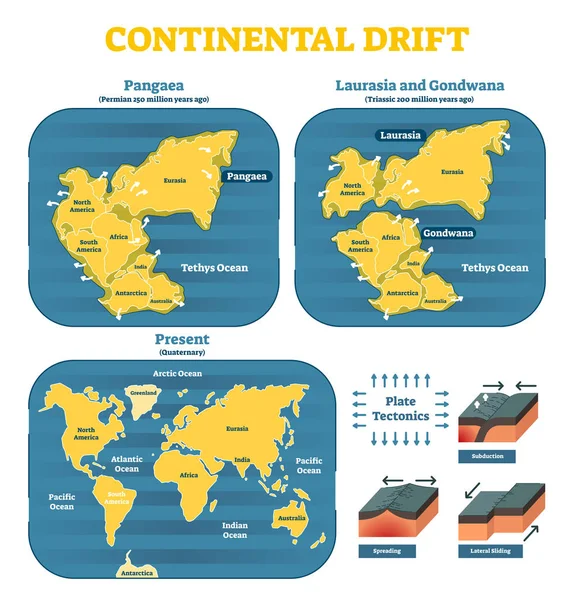
Stock vector Continental drift chronological movement, historical timeline with earth continents: Pangaea, Laurasia, Gondwana.
Published: Mar.01, 2018 08:47:06
Author: VectorMine
Views: 1074
Downloads: 27
File type: vector / eps
File size: 7.05 MB
Orginal size: 5174 x 5401 px
Available sizes:
Level: silver