Home
Images
Vectors
Videos
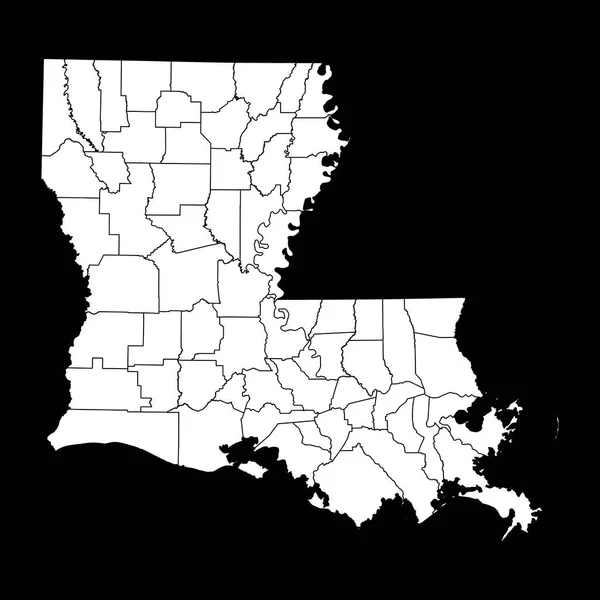
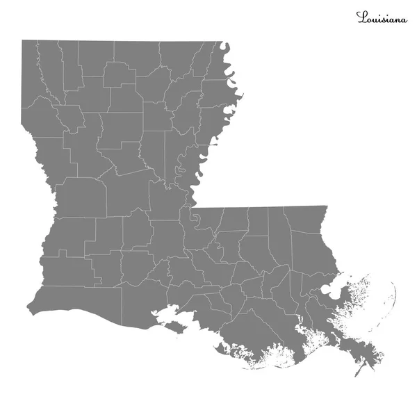
Stock vector Louisiana, U.S. state, political map with borders and names of parishes. State in the Deep South and South Central regions of the United States, subdivided into 64 parishes. Nicknamed Pelican State.
Published:
Aug.17, 2024 10:53:03
Author:
Furian
Views:
0
Downloads:
0
File type:
vector
/
eps
File size:
4.66 MB
Orginal size:
6000
x
6000
px
Available sizes:
S
(500 x 500)
M
(1000 x 1000)
L
(2000 x 2000)
XL
(6000 x 6000)
VECT
(6000 x 6000)
EL0
(6000 x 6000)
Level:
silver
Download Vector
Vector topics:
Vector
Illustration
Travel
Border
Structure
Usa
Country
Map
Cartography
Geography
Land
Overview
State
America
Boundary
Administrative
Destination
States
Region
Division
Southern
Federal
Atlas
Americas
Parish
Subdivision
County
La
Mapping
Names
Orleans
Creole
Louisiana
Bayou
Counties
Parishes
Infographic
United States
Gulf Of Mexico
Baton Rouge
Subdivided
Deep South
Political Map
Pelican State
The Boot
Lower South
South Central
East Baton Rouge
Tangipahoa
Similar stock vectors
Georgia Counties, Political Map. State In The Southeastern Region Of The United States, Subdivided Into 159 Counties. Nicknamed Peach State, And Empire State Of The South. Map With County Names.
6000 × 6936
Louisiana State Map With Counties. Vector Illustration.
8334 × 8334
Mississippi USA Map State Icon
3544 × 5246
State Louisiana Map On Transparent Background. Louisiana Map With Regions In Gray For Your Web Site Design, Logo, App, UI. USA. EPS10.
5000 × 5000
Louisiana USA Map State Icon
5246 × 3544
High Quality Map State Of United States
4000 × 4000
Black Highlighted Location Map Of The Humphreys County Inside Gray Map Of The Federal State Of Mississippi, USA
3853 × 6206
Black Highlighted Location Map Of The Quitman County Inside Gray Map Of The Federal State Of Mississippi, USA
3853 × 6206