Home
Images
Vectors
Videos
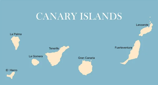
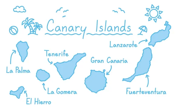
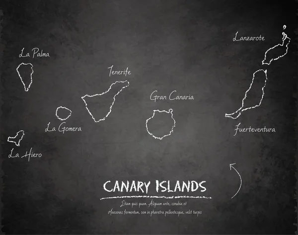
Stock vector Map of Canary Islands, Spain, with labels of each island - El Hierro, La Palma, La Gomera, Tenerife, Gran Canaria, Fuerteventura and Lanzarote. Vector silhouette on white background
Published:
May.10, 2017 05:54:12
Author:
pyty
Views:
324
Downloads:
6
File type:
vector
/
eps
File size:
0.53 MB
Orginal size:
4800
x
3600
px
Available sizes:
S
(500 x 375)
M
(1000 x 750)
L
(2000 x 1500)
XL
(4800 x 3600)
VECT
(4800 x 3600)
EL0
(4800 x 3600)
Level:
silver
Download Vector
Vector topics:
Yellow
White
Vector
Background
Illustration
Isolated
Holiday
Label
Travel
Summer
Orange
Brown
Santa
Silhouette
Border
Symbol
City
Global
Contour
Clip
World
Ocean
Detailed
Outline
Country
Map
Cartography
Icons
Geography
National
Spain
Location
Gran
Atlantic
Destination
Islands
Canary
Geographical
Canary Islands
Similar stock vectors
Map Of Canary Islands, Spain, With Labels Of Each Island - El Hierro, La Palma, La Gomera, Tenerife, Gran Canaria, Fuerteventura And Lanzarote. Black Vector Silhouette On White Background
4800 × 3600
Map Of Canary Islands, Spain, With Labels Of Each Island - El Hierro, La Palma, La Gomera, Tenerife, Gran Canaria, Fuerteventura And Lanzarote. Black Vector Silhouette On White Background
4800 × 3600
World Map With Canary Islands
5577 × 3000
Canary Islands Map Hand Drawing Doodle Outline Blue Isolated Travelling Concept
5779 × 3500
Canary Islands Map Blackboard Chalkboard Vector
4370 × 3447
Vector Contour Dotted Map Of El Hierro Island With Name
5517 × 3600
World Map With Canary Islands
5577 × 3000
High Detailed Vector Map Of Canary Islands With Navigation Pins.
5867 × 5867