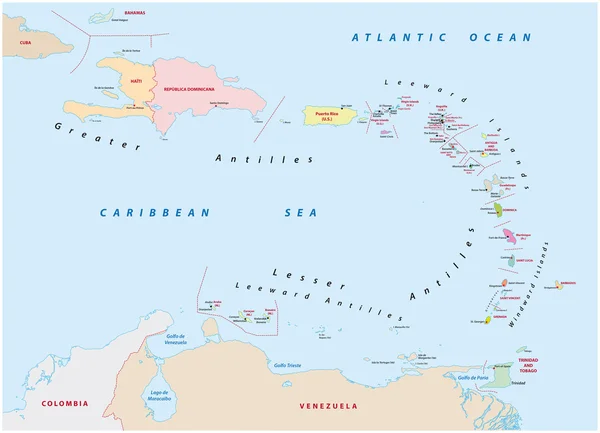
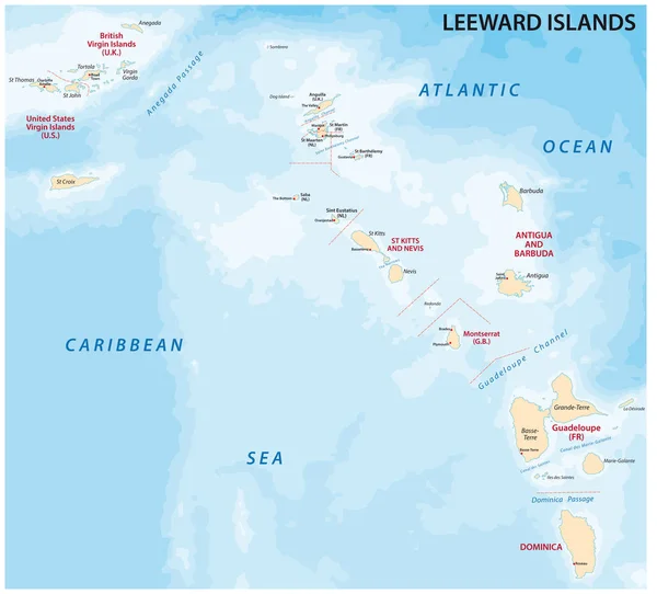
Stock vector Map of leeward islands, Caribbean island group
Published: Jan.15, 2018 12:00:37
Author: Lesniewski
Views: 260
Downloads: 1
File type: vector / eps
File size: 1.82 MB
Orginal size: 3601 x 3257 px
Available sizes:
Level: bronze