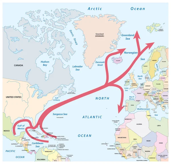
Stock vector Map of the Gulf and North Atlantic stream in the North Atlantic Ocean
Published: Jan.30, 2017 10:38:02
Author: Lesniewski
Views: 1297
Downloads: 17
File type: vector / eps
File size: 2.9 MB
Orginal size: 3225 x 3100 px
Available sizes:
Level: bronze