Home
Images
Vectors
Videos
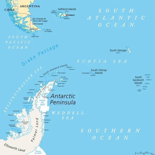
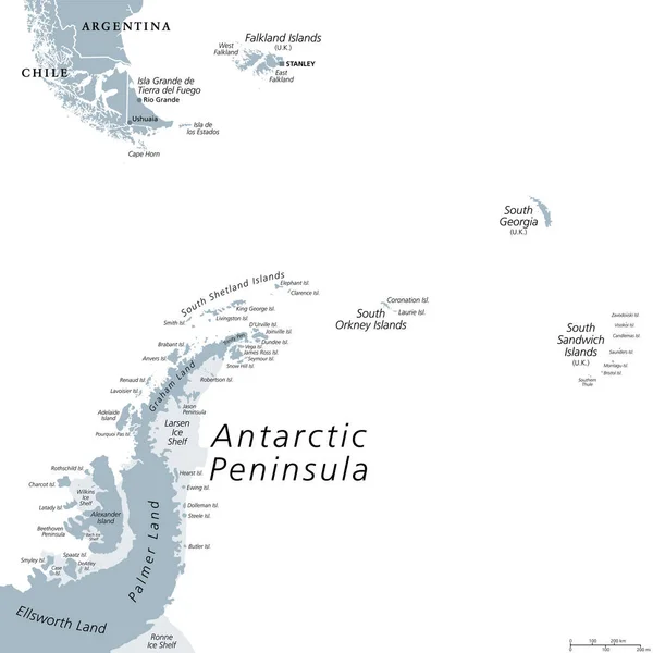
Stock vector Drake Passage, political map. Mar de Hoces, Hoces Sea, body of water between Cape Horn and Antarctica Peninsula. Connect South Atlantic Ocean with South Pacific Ocean, extends into Southern Ocean.
Published:
Jul.24, 2022 11:59:11
Author:
Furian
Views:
66
Downloads:
2
File type:
vector
/
eps
File size:
3.33 MB
Orginal size:
5988
x
9000
px
Available sizes:
S
(333 x 500)
M
(665 x 1000)
L
(1331 x 2000)
XL
(5988 x 9000)
VECT
(5988 x 9000)
EL0
(5988 x 9000)
Level:
silver
Download Vector
Vector topics:
Vector
Illustration
Travel
Ocean
South
Cruise
Country
Map
Cartography
Geography
Pacific
Continent
Strategic
Maritime
International
Island
Political
Passage
Antarctic
Polar
Atlantic
Destination
Atlas
Antarctica
Peninsula
Drake
Waterway
Chile
Argentina
Mapping
Falkland
Patagonia
Stanley
Ushuaia
South America
Falkland Islands
Body Of Water
Tierra Del Fuego
Southern Ocean
Ice Shelf
Antarctic Peninsula
South Shetland Islands
Drake Passage
Cape Horn
Choke Point
Larsen Ice Shelf
Chokepoint
Mar De Hoces
Hoces Sea
Similar stock vectors
Plate Tectonics PORTUGUESE NAMES
9000 × 5495
Antarctic Peninsula Area, Political Map. From Southern Patagonia And Falkland Islands, To South Georgia And The South Sandwich Islands, South Orkney Islands, And Drake Passage, To Antarctic Peninsula.
6000 × 6000
Schematic Vector Map Of The Bermuda Triangle.
6490 × 4000
Plate Tectonics German
9000 × 5495
Detailed Vector Map Of Bahamas With Country Borders, County Names, Main Roads And A Highly Detailed State Silhouette.
4916 × 5000
Antarctic Region Political Map
6000 × 8169
Panama Highly Detailed Vector Map With Administrative Regions, Main Cities And Roads.
5500 × 2522
Antarctic Peninsula Area, Gray Political Map. From Southern Patagonia And Falkland Islands, To South Georgia, And The South Sandwich Islands, And To South Orkney Islands, And Antarctic Peninsula.
6000 × 6000