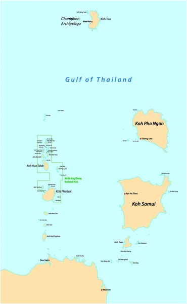
Stock vector Map of the islands of Koh Samui and Koh Pha Ngan in the Gulf of Thailand

Published: Jan.10, 2020 10:33:16
Author: Lesniewski
Views: 21
Downloads: 1
File type: vector / eps
File size: 0.93 MB
Orginal size: 3100 x 4968 px
Available sizes:
Level: bronze