Home
Images
Vectors
Videos
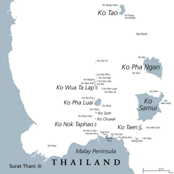
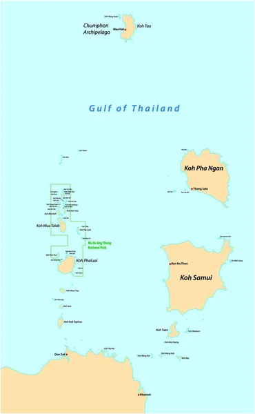
Stock vector Map of the islands of Koh Samui and Koh Pha Ngan in the Gulf of Thailand, Thailand
Published:
Dec.03, 2021 14:03:16
Author:
PantherMediaSeller
Views:
1
Downloads:
0
File type:
vector
/
zip
File size:
0 MB
Orginal size:
3714
x
4000
px
Available sizes:
S
(464 x 500)
M
(929 x 1000)
L
(1857 x 2000)
XL
(3714 x 4000)
VECT
(3714 x 4000)
EL0
(3714 x 4000)
Level:
platinum
Download Vector
Vector topics:
In
Map
Thailand
Gulf
Of
Islands
The
And
Koh
Samui
Pha
Ngan
Similar stock vectors
Map Of The Islands Of Koh Samui And Koh Pha Ngan In The Gulf Of Thailand
3100 × 4968
From Ko Samui To Ko Tao, Political Map. Popular Tourist And Travel Destinations With Numerous Islands Off The Coast Of Thailand, Geographically In The Chumphon Province And Surat Thani Province.
6000 × 6000
Phuket, Largest Island Of Thailand, Gray Political Map, With Surrounding Area. Popular Tourist Region, With Plenty Of Islands, South Of Malay Peninsula, In The Andaman Sea, North Of Strait Of Malacca.
6000 × 6000
Phuket, Largest Island Of Thailand, Political Map With Surrounding Area. Popular Tourist Region With Plenty Of Islands, South Of Malay Peninsula, In The Andaman Sea And North Of The Strait Of Malacca.
6000 × 6000
From Ko Samui To Ko Tao, Gray Political Map. Popular Tourist And Travel Destinations With Numerous Islands Off The Coast Of Thailand, Geographically In The Chumphon Province And Surat Thani Province.
6000 × 6000
Vector Map Of The Country Of The State Of America
3938 × 4000
Thailand Political Map, From Ko Tao And Ko Samui To Phuket And Phi Phi Islands. Travel Destinations West And East Of Malay Peninsula, Off The Coast Of Thailand, With Most Important Islands And Cities.
7962 × 6000
Outline Thailand Map
3516 × 6504