Home
Images
Vectors
Videos
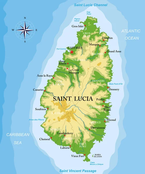
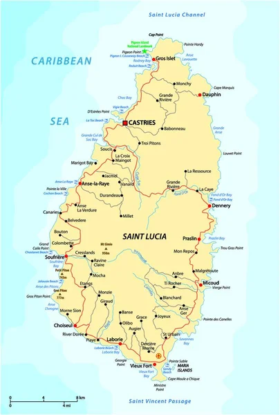
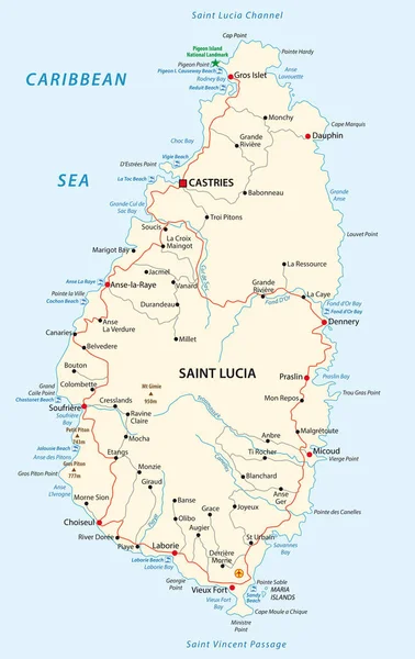
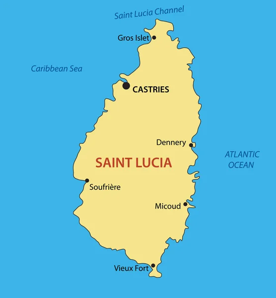
Stock vector Map of the West Indian island state of Saint Lucia
Published:
Jul.26, 2024 06:31:59
Author:
Lesniewski
Views:
0
Downloads:
0
File type:
vector
/
eps
File size:
3.85 MB
Orginal size:
3100
x
4570
px
Available sizes:
S
(339 x 500)
M
(678 x 1000)
L
(1357 x 2000)
XL
(3100 x 4570)
VECT
(3100 x 4570)
EL0
(3100 x 4570)
Level:
bronze
Download Vector
Vector topics:
Color
Vector
Background
Graphic
Illustration
Design
Travel
Abstract
Flag
River
Contour
Scale
Bay
Coastline
Tourism
Town
Navigation
Peak
Outline
Map
Cartography
Geography
State
Topography
Location
America
Island
Political
Airport
Cape
Geographic
Commonwealth
Region
English
Independent
Nation
County
Mapping
Geographical
Antilles
Castries
Infographic
Caribbean Sea
West Indies
St Lucia
Saint Lucia
Caribbian
Windward Islands
Similar stock vectors
Road Vector Map Of The West Indian Island State Of Saint Lucia
3100 × 4575
Saint Lucia Island Highly Detailed Physical Map
6249 × 7500
Road Vector Map Of The West Indian Island State Of Saint Lucia
3710 × 4000
Saint Lucia Road And Beach Vector Map
3100 × 4913
Saint Lucia - Vector Map
3290 × 3550
Highly Detailed Vector Map Of The Caribbean Island Of Saint Lucia With Main Cities,regions And Roads.
4146 × 5000
Saint Lucia Political Map
6000 × 8835
Vector Road Map Of Canary Island Lanzarote
3100 × 3744