Home
Images
Vectors
Videos
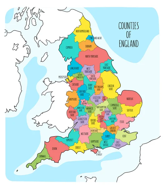
Stock vector Political Map of England
Published:
May.18, 2015 13:05:07
Author:
pablofdezr1984
Views:
6233
Downloads:
4
File type:
vector
/
eps
File size:
7.44 MB
Orginal size:
4810
x
6000
px
Available sizes:
S
(401 x 500)
M
(802 x 1000)
L
(1603 x 2000)
XL
(4810 x 6000)
VECT
(4810 x 6000)
EL0
(4810 x 6000)
Level:
bronze
Download Vector
Vector topics:
Red
Vector
Background
Illustration
Shape
Border
Flag
Banner
Europe
Outline
Country
Map
Cartography
State
Great
Political
United
Kingdom
Britain
London
England
Isle
Counties
Similar stock vectors
Hand Drawn Map Of England And The British Isles. Colorful Hand Drawn Vector Illustration
6000 × 6800
Map Of Yorkshire And The Humber
7006 × 6706
Map Of England
7021 × 6720
Political Map Of England With Regions And Their Capitals
5500 × 6050
Illustration Of The England Divisions
5000 × 4759
Hand Drawn Map Of England With Regions. Colorful Hand Drawn Vector Illustration
6000 × 6800
Map Of West Midlands England
7006 × 6706
England Administrative Divisions
3666 × 3477