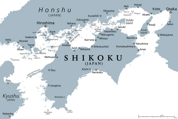
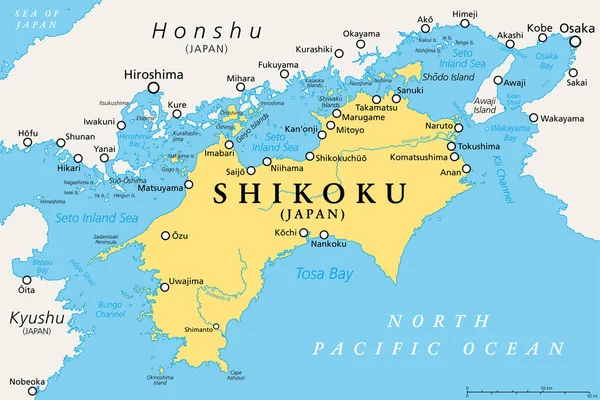
Stock vector Shikoku, political map. Region and smallest of the four main islands of Japan, northeast of Kyushu, and south of Honshu, separated by the Seto Inland Sea. Shikoku region consists of four prefectures.
Published: May.20, 2023 14:03:03
Author: Furian
Views: 31
Downloads: 0
File type: vector / eps
File size: 4.39 MB
Orginal size: 9000 x 6000 px
Available sizes:
Level: silver