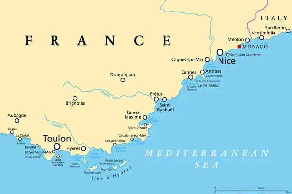
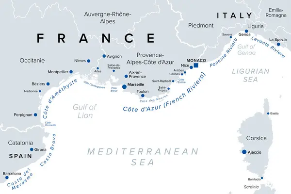
Stock vector Southern France coasts, political map. Southernmost part of France, bordering the Mediterranean Sea. Map with Provence and French Riviera, Corsica and part of Liguria and Italian Riviera, and Corsica.
Published: Jul.12, 2024 18:38:16
Author: Furian
Views: 0
Downloads: 0
File type: vector / eps
File size: 2.49 MB
Orginal size: 9000 x 6000 px
Available sizes:
Level: silver