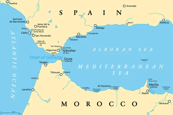
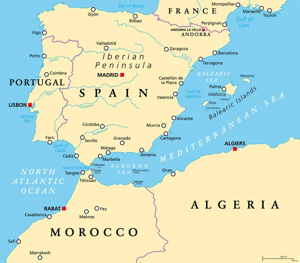
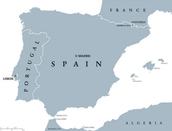
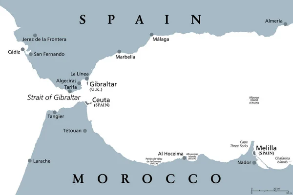
Stock vector Strait of Gibraltar, gray political map. Also known as Straits of Gibraltar. A narrow strait, connecting Atlantic Ocean to Mediterranean Sea, separating the Iberian Peninsula from Morocco and Africa.
Published: Jul.06, 2022 13:50:38
Author: Furian
Views: 28
Downloads: 1
File type: vector / eps
File size: 1.76 MB
Orginal size: 9000 x 6000 px
Available sizes:
Level: silver