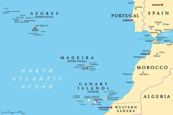
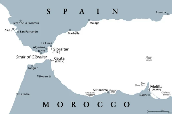
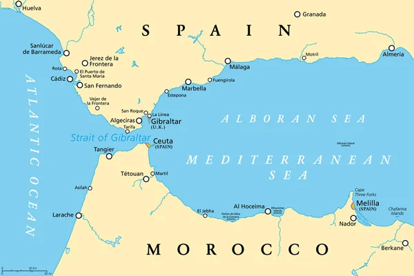
Stock vector Strait of Gibraltar, political map. Also known as Straits of Gibraltar. Narrow strait, connecting the Atlantic Ocean to the Mediterranean Sea, separating the Iberian Peninsula from Morocco and Africa.
Published: Jul.01, 2022 11:26:17
Author: Furian
Views: 899
Downloads: 2
File type: vector / eps
File size: 2.82 MB
Orginal size: 9000 x 6000 px
Available sizes:
Level: silver