Home
Images
Vectors
Videos
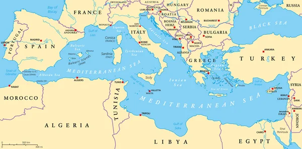
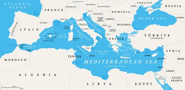
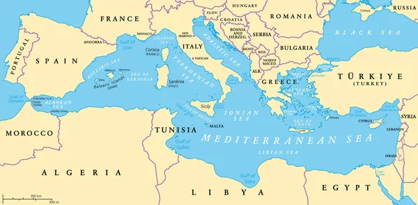
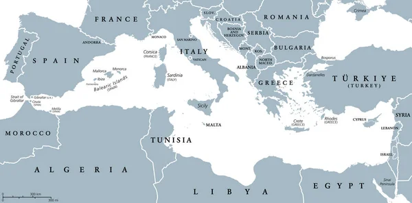
Stock vector The Mediterranean Sea subdivisions, political map with straits, countries and the Black Sea. Connected to the Atlantic Ocean, surrounded by the Mediterranean Basin, almost completely enclosed by land.
Published:
Jul.10, 2022 14:49:44
Author:
Furian
Views:
69
Downloads:
0
File type:
vector
/
eps
File size:
3.19 MB
Orginal size:
9000
x
4387
px
Available sizes:
S
(500 x 244)
M
(1000 x 487)
L
(2000 x 975)
XL
(9000 x 4387)
VECT
(9000 x 4387)
EL0
(9000 x 4387)
Level:
silver
Download Vector
Vector topics:
Illustration
Travel
Sea
Europe
Cruise
Country
Map
Cartography
Geography
Africa
Continent
Land
Mediterranean
Marmara
Island
Political
Gulf
Bosporus
Sardinia
Adriatic
Anatolia
Region
Strait
Basin
Ionian
Atlas
Sicily
Subdivision
Crete
Aegean
Ligurian
Balearic
Libyan
Mediterranea
Gibraltar
Levant
Dardanelles
Tyrrhenian
Thracian
Ceuta
Melilla
Mediterranean Sea
Black Sea
North Africa
Southern Europe
Suez Canal
Iberian Peninsula
Alboran
Myrtoan
Icarian
Similar stock vectors
The Mediterranean Sea, Political Map With Subdivisions, Straits, Islands And Countries. Connected To The Atlantic Ocean, Surrounded By The Mediterranean Basin, Almost Completely Enclosed By Land.
9000 × 4442
The Mediterranean Sea, Gray Political Map With International Borders, Countries And Islands. Connected To The Atlantic Ocean, Surrounded By The Mediterranean Basin, Almost Completely Enclosed By Land.
9000 × 4442
3D Europe Map
4000 × 2250
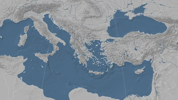
Greece And Its Neighborhood. Distant Oblique Perspective - No Outline. Satellite Imagery
2880 × 1620
Mediterranean Sea Region Countries Map
11500 × 5676
Small Outline Map Of The Mediterranean Sea
4727 × 3100
Greece And Its Neighborhood. Distant Oblique Perspective - No Outline. Grayscale Elevation Map
2880 × 1620
Mediterranean Sea Region Political Map
8987 × 4436