Home
Images
Vectors
Videos
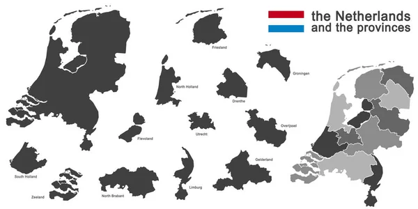
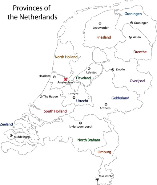
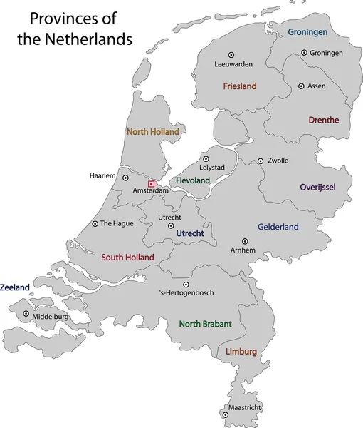
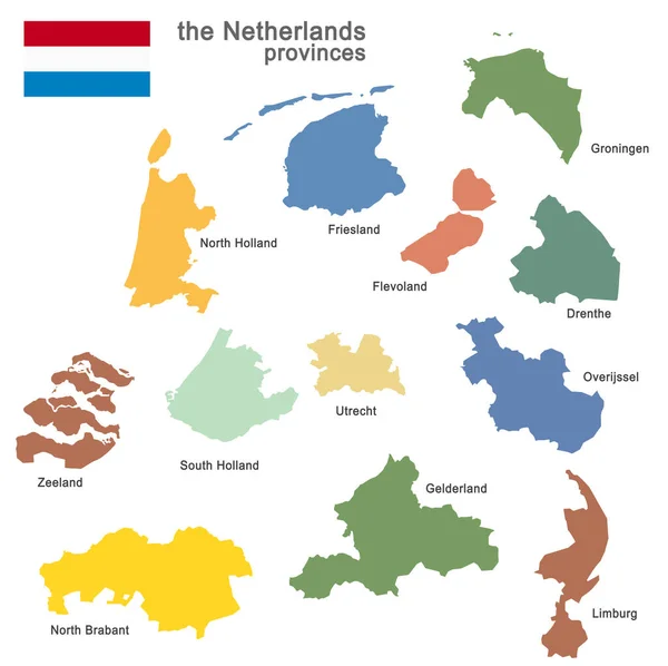
Stock vector the Netherlands and provinces
Published:
Jul.02, 2015 16:36:06
Author:
opicobello
Views:
137
Downloads:
6
File type:
vector
/
eps
File size:
1.38 MB
Orginal size:
5079
x
5079
px
Available sizes:
S
(500 x 500)
M
(1000 x 1000)
L
(2000 x 2000)
XL
(5079 x 5079)
VECT
(5079 x 5079)
EL0
(5079 x 5079)
Level:
silver
Download Vector
Vector topics:
Vector
Isolated
Detail
European
Silhouette
Border
School
Contour
Euro
Holland
Template
North
Europe
South
Outline
Country
West
Map
Geography
Plan
Republic
Democracy
Export
Islands
Region
Import
Frontier
Dutch
ámsterdam
Alliance
Provinces
Regions
Brabant
Optional
Limburg
Gelderland
Zeeland
Friesland
Dutchman
Drenthe
Utrecht
Groningen
Flevoland
Overijssel
European Union
The Netherlands
Web Design
Holland Map
In Detail
Association Of States
Similar stock vectors
Silhouette Of The Netherlands And The Regions
11693 × 5846
Political Map Of Netherlands Isolated On White Background
6000 × 6264
Outline Netherlands Map
4604 × 5404
Amsterdam, Netherlands. Detailed Country Map With Location Pin On Capital City. Black Silhouette And Outline Maps Isolated On White Background. EPS Vector
9376 × 7293
Netherlands Map
4604 × 5404
Colored Silhouettes Of The Netherlands And The Regions
8350 × 8327
Vector Halftone Mosaic And Solid Map Of North Holland
4042 × 3958
Netherlands Map
7000 × 7000