Home
Images
Vectors
Videos
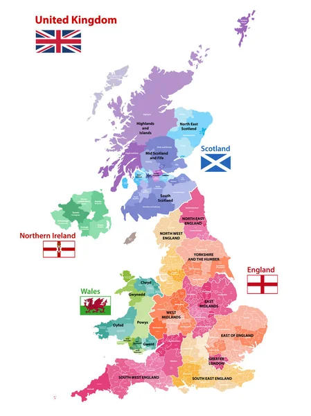
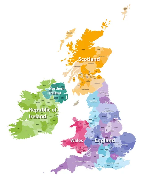
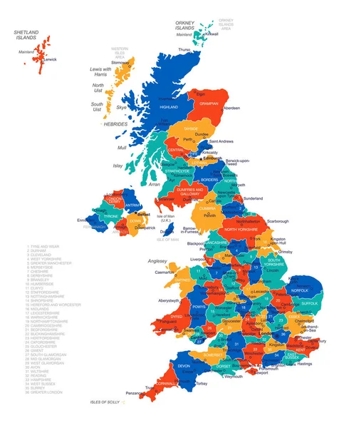
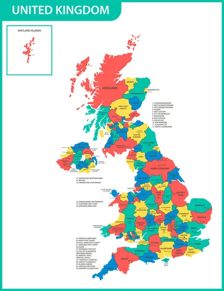
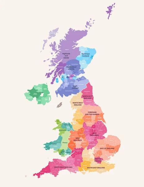
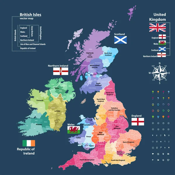
Stock vector vector map of British Isles administrative divisions colored by countries and regions. Districts and counties maps and flags of United Kingdom,Northern Ireland, Wales, Scotland and Republic of Ireland
Published:
Dec.18, 2017 13:27:40
Author:
Jktu_21
Views:
1418
Downloads:
17
File type:
vector
/
eps
File size:
11.71 MB
Orginal size:
7292
x
7292
px
Available sizes:
S
(500 x 500)
M
(1000 x 1000)
L
(2000 x 2000)
XL
(7292 x 7292)
VECT
(7292 x 7292)
EL0
(7292 x 7292)
Level:
silver
Download Vector
Vector topics:
Vector
Travel
Flag
North
Northern
Europe
East
South
Country
West
Map
Ireland
Mid
Britain
Region
Highlands
English
England
Yorkshire
Merseyside
Midlands
Wales
Scotland
County
Derbyshire
Fife
Cheshire
Essex
Glasgow
Munster
Derry
Suffolk
Gwent
Ulster
Antrim
Lothian
Great Britain
United Kingdom
Republic Of Ireland
Leinster
Northern Ireland
Glamorgan
Leicestershire
Greater London
Powys
Tyne And Wear
Dyfed
British Isles
Connacht
Greater Manchester
Similar stock vectors
Vector Map Of United Kingdom Colored By Countries, Counties And Regions
5458 × 7292
Vector Map Of UK With Administrative Divisions. Editable And Clearly Labeled Layers.
4000 × 4800
British Isles Map Colored By Countries And Regions
5664 × 7292
United Kingdom Map - Vector Illustration
4641 × 5675
The Detailed Map Of The United Kingdom With Regions Or States And Cities, Capitals. Actual Current Relevant UK, Great Britain Administrative Devision.
5000 × 6500
United Kingdom Map, Flag And Navigation Labels - Illustration.
5400 × 6965
United Kingdom Administrative Districts High Detailed Vector Map Colored By Regions With Editable And Labelled Layers
6454 × 8333
Blue-green Detailed Map Of United Kingdom And Administrative Divisions With Country Flag And Location On The Globe.
5329 × 6332