Home
Images
Vectors
Videos
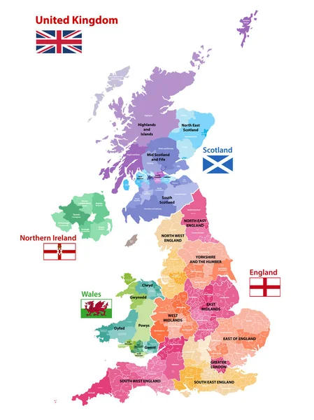
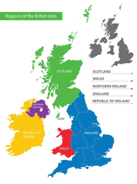
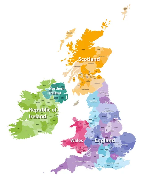
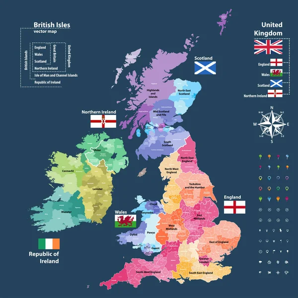
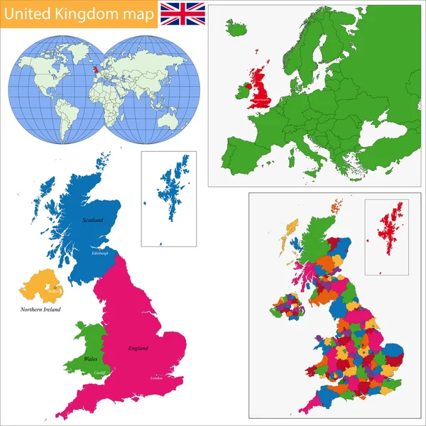
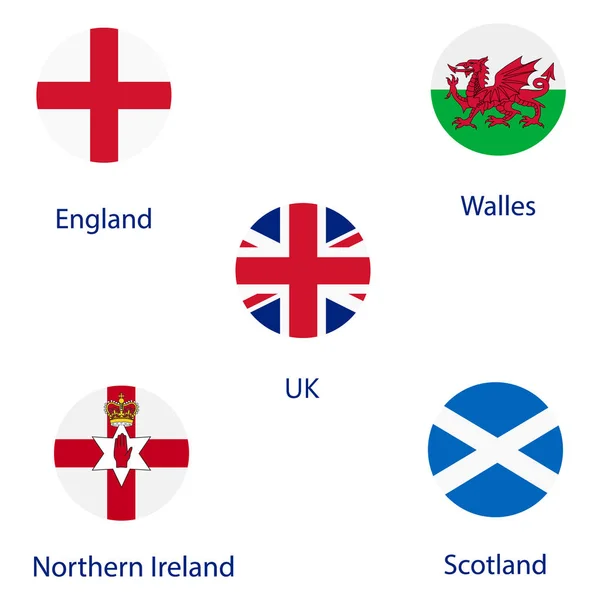
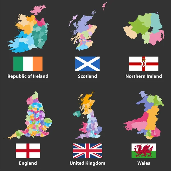
Stock vector vector maps and flags of Republic of Ireland, Scotland, Northern Ireland, England, United Kingdom and Wales
Published:
Dec.18, 2017 13:27:40
Author:
Jktu_21
Views:
145
Downloads:
1
File type:
vector
/
eps
File size:
6.59 MB
Orginal size:
7305
x
7305
px
Available sizes:
S
(500 x 500)
M
(1000 x 1000)
L
(2000 x 2000)
XL
(7305 x 7305)
VECT
(7305 x 7305)
EL0
(7305 x 7305)
Level:
silver
Download Vector
Vector topics:
Vector
Illustration
Travel
Flag
Europe
Country
District
Map
Area
National
Ireland
Preserve
Borders
Republic
Region
British
England
Metropolitan
Wales
Scotland
County
Unitary
Great Britain
United Kingdom
Northern Ireland
Administrative Divisions
Similar stock vectors
United Kingdom Countries, UK Regions
4351 × 5000
Vector Map Of United Kingdom Colored By Countries, Counties And Regions
5458 × 7292
Color Detailed Map Of The Regions And Countries Of The British Isles For Your Design
5947 × 7951
British Isles Map Colored By Countries And Regions
5664 × 7292
Vector Map Of British Isles Administrative Divisions Colored By Countries And Regions. Districts And Counties Maps And Flags Of United Kingdom,Northern Ireland, Wales, Scotland And Republic Of Ireland
7292 × 7292
United Kingdom Map
7004 × 7004
UK Map And Flags
4000 × 4000
UK Country Flags
4000 × 4000