Home
Images
Vectors
Videos
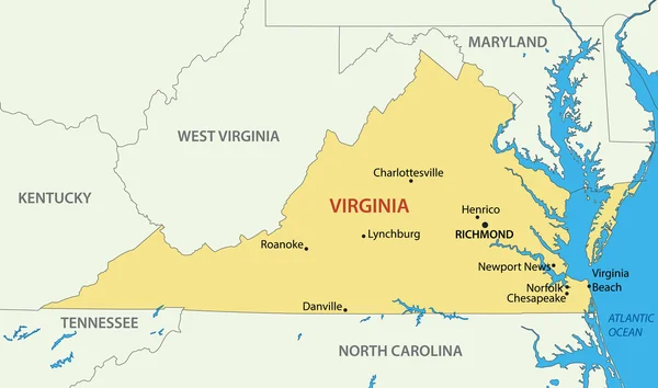
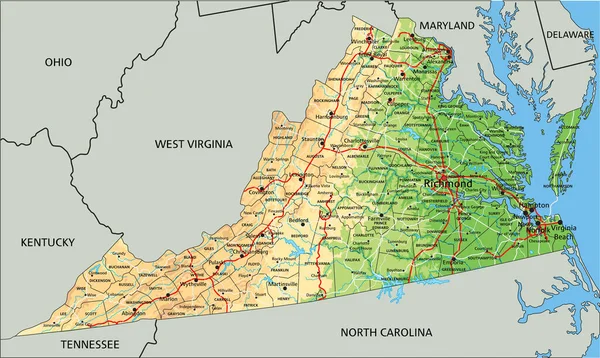
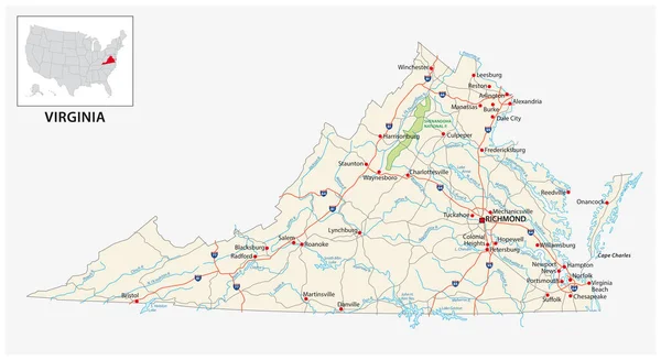
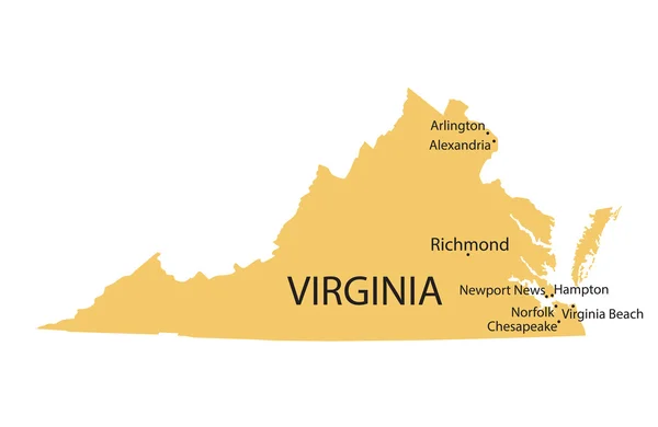
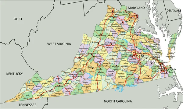
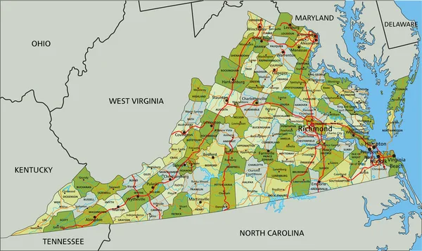
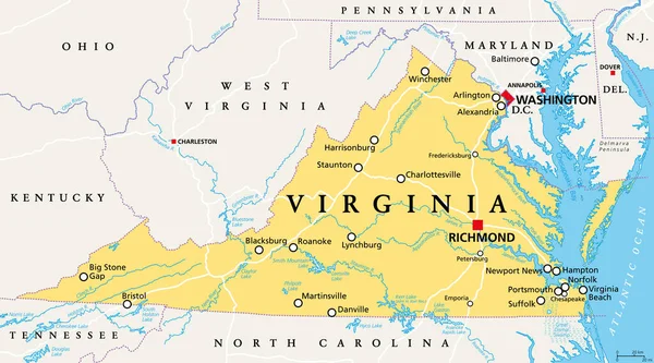
Stock vector Virginia, VA, political map. Commonwealth of Virginia. State in Southeastern and Mid-Atlantic region of the United States. Capital Richmond. Old Dominion. Mother of Presidents. Illustration. Vector.
Published:
Oct.13, 2020 12:22:45
Author:
Furian
Views:
244
Downloads:
22
File type:
vector
/
eps
File size:
5.44 MB
Orginal size:
9000
x
4999
px
Available sizes:
S
(500 x 278)
M
(1000 x 555)
L
(2000 x 1111)
XL
(9000 x 4999)
VECT
(9000 x 4999)
EL0
(9000 x 4999)
Level:
silver
Download Vector
Vector topics:
Vector
Illustration
Us
Usa
Beach
Capital
Country
District
Map
Cartography
Geography
Dc
State
America
Atlantic
United
Commonwealth
States
Washington
Tennessee
Atlas
Americas
Maryland
Potomac
Virginia
Columbia
Delaware
Va
Kentucky
Alexandria
Ohio
Norfolk
Richmond
Arlington
Suffolk
Baltimore
Charleston
Hampton
Annapolis
Portsmouth
North Carolina
United States
West Virginia
Political Map
Chesapeake Bay
Virginia Map
Newport News
Old Dominion
Mother Of Presidents
Similar stock vectors
Commonwealth Of Virginia - Vector Map
5618 × 3318
Virginia, VA, Gray Political Map. Commonwealth Of Virginia. State In Southeastern And Mid-Atlantic Region Of United States. Capital Richmond. Old Dominion. Mother Of Presidents. Illustration. Vector.
9000 × 4999
High Detailed Virginia Physical Map With Labeling.
5550 × 3318
High Detailed Virginia Physical Map With Labeling.
5550 × 3318
Road Map Of The US American State Of Virginia
5680 × 3100
Yellow Map Of Virginia With Indication Of Largest Cities
5000 × 3250
Virginia - Highly Detailed Editable Political Map With Labeling.
5550 × 3318
Highly Detailed Editable Political Map With Separated Layers. Virginia
5550 × 3318