Home
Images
Vectors
Videos
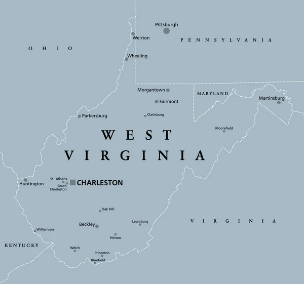
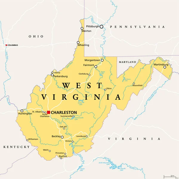
Stock vector West Virginia, WV, political map. State in the Appalachian region of Southern United States of America. Part of Mid-Atlantic Southeast Region. Capital Charleston. Mountain State. Illustration. Vector.
Published:
Oct.15, 2020 08:01:45
Author:
Furian
Views:
20
Downloads:
9
File type:
vector
/
eps
File size:
3.98 MB
Orginal size:
6000
x
6000
px
Available sizes:
S
(500 x 500)
M
(1000 x 1000)
L
(2000 x 2000)
XL
(6000 x 6000)
VECT
(6000 x 6000)
EL0
(6000 x 6000)
Level:
silver
Download Vector
Vector topics:
Vector
Illustration
Travel
Mountain
Border
River
Us
Usa
Capital
South
Country
West
Map
Cartography
Geography
Land
Overview
State
Pittsburgh
America
United
States
Southern
Appalachian
Atlas
WV
Americas
Maryland
Potomac
Virginia
Mapping
Columbus
Wheeling
Kentucky
Pennsylvania
Ohio
Charleston
Huntington
Infographic
The South
United States
West Virginia
Political Map
Kanawha
Parkersburg
Morgantown
Weirton
West Virginia Map
Mountain State
Bluestone Lake
Similar stock vectors
West Virginia - Vector Map
4546 × 3837
West Virginia, WV, Gray Political Map. State In The Appalachian Region Of The Southern United States And In The Mid-Atlantic Southeast Region. Capital Charleston. Mountain State. Illustration. Vector.
6412 × 6000
Road Map Of The US American State Of West Virginia
3933 × 3100
West Virginia Vector Accurate High Detailed State Map With Commu
5001 × 4482
Road Map Of The US American State Of West Virginia
4000 × 3848
Blue Map Of West Virginia With Indication Of Charleston
4000 × 4000
State West Virginia Map On Transparent Background. Blank Map Of West Virginia With Regions In Gray For Your Web Site Design, Logo, App, UI. USA. EPS10.
5000 × 5000
Commonwealth Of Kentucky - Vector Map
6168 × 3359