Home
Images
Vectors
Videos
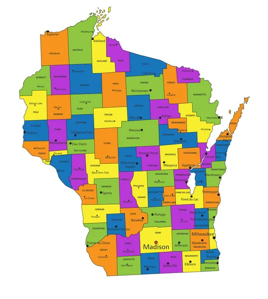
Stock vector Wisconsin - Highly detailed editable political map with labeling.
Published:
May.05, 2023 06:11:54
Author:
delpieroo
Views:
2
Downloads:
0
File type:
vector
/
eps
File size:
8.24 MB
Orginal size:
4168
x
4646
px
Available sizes:
S
(449 x 500)
M
(897 x 1000)
L
(1794 x 2000)
XL
(4168 x 4646)
VECT
(4168 x 4646)
EL0
(4168 x 4646)
Level:
bronze
Download Vector
Vector topics:
Blue
Vector
Background
Colored
Illustration
Label
Travel
Sea
Road
Pastel
City
Contour
American
Us
Usa
Ocean
Town
Capital
South
Outline
Country
District
Map
Cartography
Geography
National
Continent
Land
State
Topography
Political
Interstate
Atlantic
Politics
Geographic
Editable
Territory
Atlas
County
Mapping
Rivers
Shaded
Wisconsin
Badger
Madison
Milwaukee
Lake Michigan
United States Of America
Lake Superior
Dairyland
Similar stock vectors
Highly Detailed Editable Political Map With Separated Layers. Wisconsin.
4168 × 4646
High Detailed Wisconsin Physical Map With Labeling.
4168 × 4646
Highly Detailed Editable Political Map With Separated Layers. Minnesota.
4101 × 5010
Minnesota - Highly Detailed Editable Political Map With Labeling.
4101 × 5010
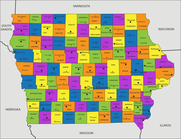
Colorful Iowa Political Map With Clearly Labeled, Separated Layers. Vector Illustration.
4352 × 3356
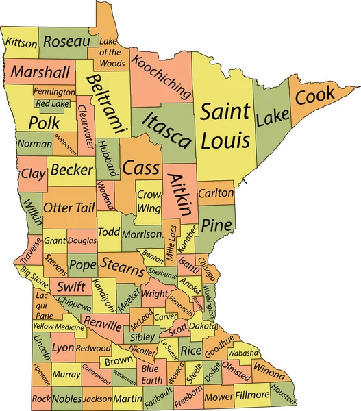
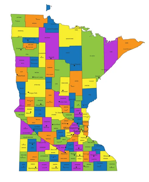
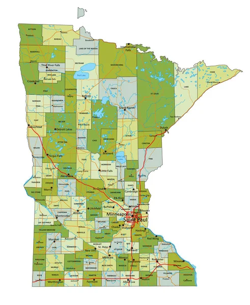
Pastel Vector Map Of The Federal State Of Minnesota, USA With Black Borders And Name Tags Of Its Counties
4664 × 5306
Colorful Wisconsin Political Map With Clearly Labeled, Separated Layers. Vector Illustration.
4168 × 4646
Colorful Minnesota Political Map With Clearly Labeled, Separated Layers. Vector Illustration.
4097 × 5005