photo free
Home Images Vectors Videos

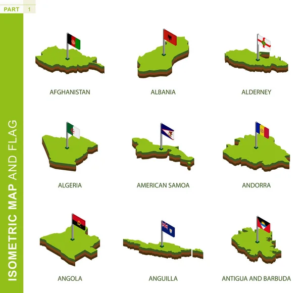
Stock image Angola Infographic

stock vector Angola Map. Large group of people form to create a shape of Angola Map. vector illustration.

Angola Map. Large Group Of People Form To Create A Shape Of Angola Map. Vector Illustration.

Vector, 29.25MB, 5000 × 3500 eps
stock vector Colorful hand drawn political map of Africa with five regions

Colorful Hand Drawn Political Map Of Africa With Five Regions

Vector, 9.21MB, 6001 × 6001 eps
stock vector Cabinda, Angola. Infographic design. Time and Date. Weather widgets template. Infographic isolated on white.

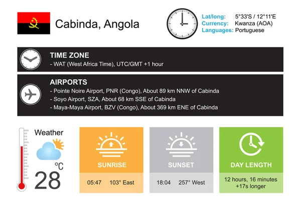
Cabinda, Angola. Infographic Design. Time And Date. Weather Widgets Template. Infographic Isolated On White.

Vector, 3.33MB, 6067 × 4192 eps
stock vector Abstract mash line and point scales on dark background with Map of angola. Wire frame 3D mesh polygonal network line, design sphere, dot and structure. communications map of angola. Vector illustration.

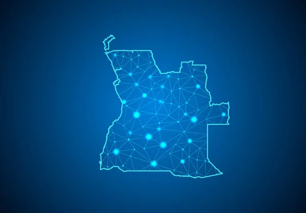
Abstract Mash Line And Point Scales On Dark Background With Map Of Angola. Wire Frame 3D Mesh Polygonal Network Line, Design Sphere, Dot And Structure. Communications Map Of Angola. Vector Illustration.

Vector, 1.08MB, 5003 × 3502 eps
stock vector Angola infographics, statistical data, Angola information, vector illustration

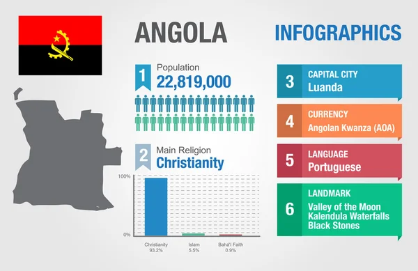
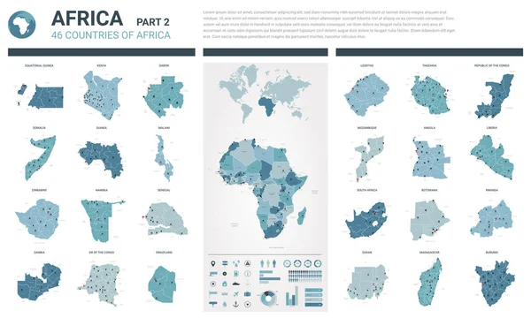
Angola Infographics, Statistical Data, Angola Information, Vector Illustration

Vector, 3.25MB, 5842 × 3792 eps
stock vector Vector maps set.  High detailed 46 maps of African countries wit

Vector Maps Set. High Detailed 46 Maps Of African Countries Wit

Vector, 12.15MB, 6000 × 3600 eps
stock vector Set of Infographic Elements for the Country of Angola

Set Of Infographic Elements For The Country Of Angola

Vector, 12.51MB, 6667 × 5000 eps
stock image Set of Infographic Elements for the Country of Angola

Set Of Infographic Elements For The Country Of Angola

Image, 2.21MB, 6667 × 5000 jpg
stock vector Energy industry and ecology of Angola

Energy Industry And Ecology Of Angola

Vector, 3.53MB, 6400 × 6400 eps
stock vector Angola political map of administrative divisions - provinces. 3D map in shades of orange color.

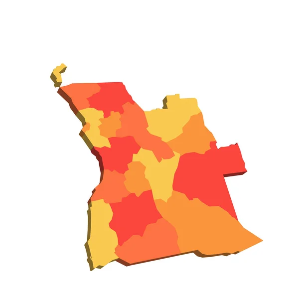
Angola Political Map Of Administrative Divisions - Provinces. 3D Map In Shades Of Orange Color.

Vector, 0.28MB, 8000 × 8000 eps
stock vector Angola map on a world map with flag and map pointer. Vector illustration

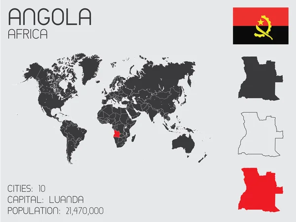
Angola Map On A World Map With Flag And Map Pointer. Vector Illustration

Vector, 2.45MB, 4167 × 4167 eps
stock vector Map of Africa with separated countries.

Map Of Africa With Separated Countries.

Vector, 7.18MB, 6001 × 4265 eps
stock vector Detailed vector map of Angola and capital city Luanda

Detailed Vector Map Of Angola And Capital City Luanda

Vector, 3.29MB, 5867 × 5867 eps
stock vector Set of 9 isometric map and flag, 3D vector isometric shape.

Set Of 9 Isometric Map And Flag, 3D Vector Isometric Shape.

Vector, 5.49MB, 5170 × 5000 eps
stock vector Road and administrative vector map of Botswana

Road And Administrative Vector Map Of Botswana

Vector, 2.87MB, 4705 × 4699 eps
stock vector Africa colorful vector map

Africa Colorful Vector Map

Vector, 0.46MB, 8000 × 8000 eps
stock vector Colorful hand drawn political map of Africa.

Colorful Hand Drawn Political Map Of Africa.

Vector, 7.22MB, 6001 × 6001 eps
stock vector Colorful hand drawn political map of Africa.

Colorful Hand Drawn Political Map Of Africa.

Vector, 9.25MB, 6001 × 6001 eps
stock vector Colorful hand drawn political map of Africa.

Colorful Hand Drawn Political Map Of Africa.

Vector, 6.98MB, 6001 × 5713 eps
stock vector Hand drawn political map of Africa.

Hand Drawn Political Map Of Africa.

Vector, 8.19MB, 6001 × 6001 eps
stock vector administrative vector map of Republic of Angola with flag

Administrative Vector Map Of Republic Of Angola With Flag

Vector, 0.97MB, 3376 × 3100 eps
stock vector Building logo made from the flag of Angola

Building Logo Made From The Flag Of Angola

Vector, 4.26MB, 5000 × 3368 eps
stock vector Map of the administrative divisions of Namibia

Map Of The Administrative Divisions Of Namibia

Vector, 2.55MB, 3100 × 3147 eps
stock image Angola Map Made Of High Quality Premium Golden Metallic Copper Brass Pillars 3D Illustration

Angola Map Made Of High Quality Premium Golden Metallic Copper Brass Pillars 3D Illustration

Image, 2.38MB, 2975 × 2100 jpg
stock image Angola Map Made Of High Quality Premium Golden Shiny Metallic Beads Or Balls 3D Illustration

Angola Map Made Of High Quality Premium Golden Shiny Metallic Beads Or Balls 3D Illustration

Image, 3.89MB, 2975 × 2100 jpg
stock vector Water map of the African country Namibia

Water Map Of The African Country Namibia

Vector, 2.59MB, 3281 × 3100 eps
stock vector Republic of the Congo, political map. Also known as the Congo, is a country located on the western coast of Central Africa, to the west of the Congo River, with the capital Brazzaville. Vector.

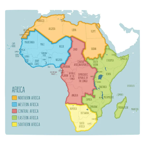
Republic Of The Congo, Political Map. Also Known As The Congo, Is A Country Located On The Western Coast Of Central Africa, To The West Of The Congo River, With The Capital Brazzaville. Vector.

Vector, 4.96MB, 6000 × 6838 eps
stock vector Angola map Infographic map design, Vector illustration.

Angola Map Infographic Map Design, Vector Illustration.

Vector, 0.76MB, 4859 × 3402 eps
stock image Angola Map Pink And Blue Abstract Glowing Particles Bubbles Balls Digital Map 3D Illustration

Angola Map Pink And Blue Abstract Glowing Particles Bubbles Balls Digital Map 3D Illustration

Image, 2.31MB, 2975 × 2100 jpg
Page 1 >> Next