Home
Images
Vectors
Videos
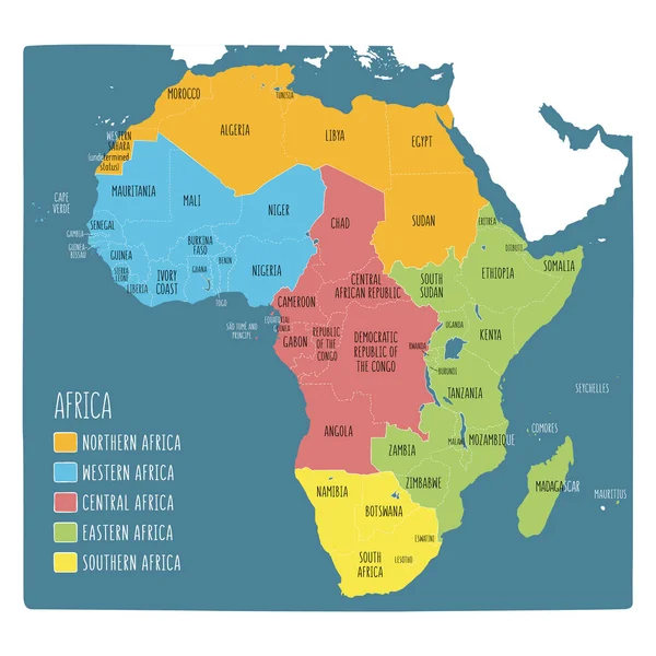
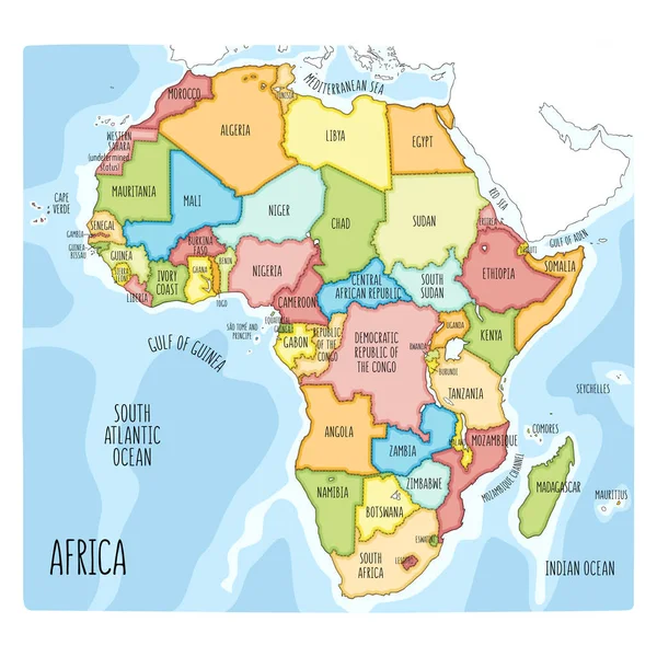
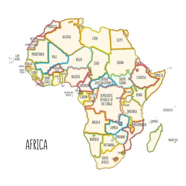
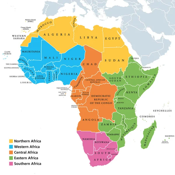
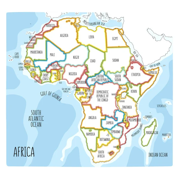
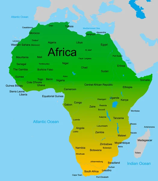
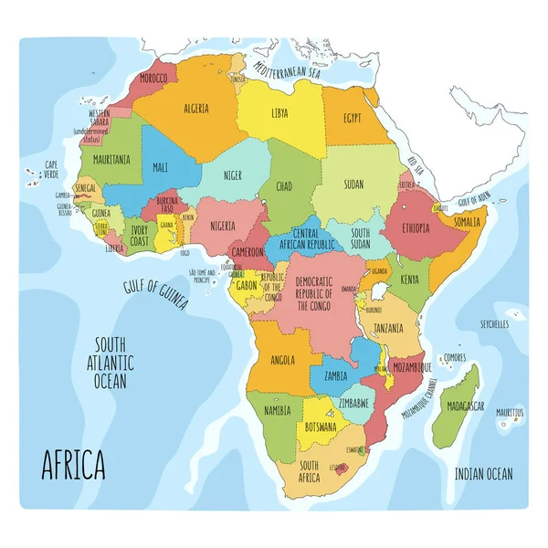
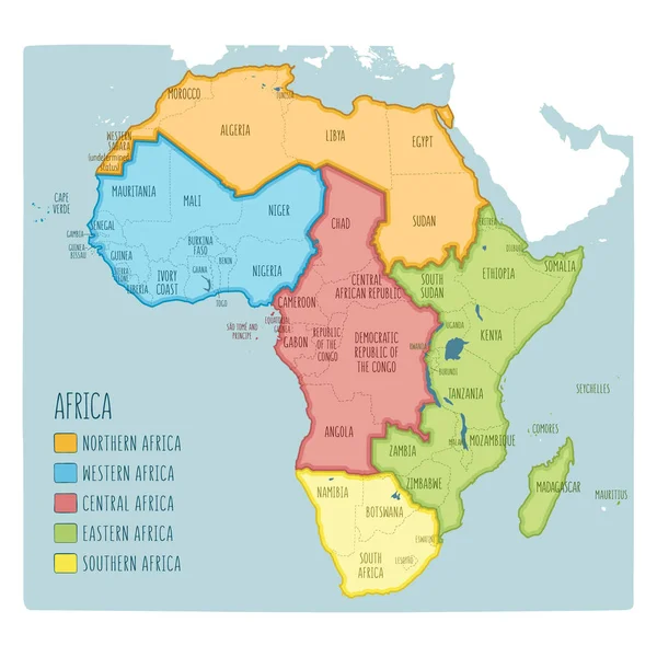
Stock vector Colorful hand drawn political map of Africa with five regions
Published:
Mar.27, 2019 08:33:45
Author:
LaraFields
Views:
532
Downloads:
4
File type:
vector
/
eps
File size:
9.21 MB
Orginal size:
6001
x
6001
px
Available sizes:
S
(500 x 500)
M
(1000 x 1000)
L
(2000 x 2000)
XL
(6001 x 6001)
VECT
(6001 x 6001)
EL0
(6001 x 6001)
Level:
beginner
Download Vector
Vector topics:
Color
Vector
Background
Graphic
Illustration
Labeling
Travel
Line
Border
Cartoon
Kids
African
World
Northern
South
Sketch
Eastern
Country
Map
Cartography
Geography
Africa
Algeria
Continent
Egypt
Land
State
Countries
Illustrations
Political
Region
Division
Doodle
Central
English
Atlas
Nation
Morocco
Libya
Regions
Ethiopia
Cameroon
Angola
Sudan
Infographic
South Africa
Hand Drawn
Political Map
Africa Map
English Labeling
Similar stock vectors
Colorful Hand Drawn Political Map Of Africa With Five Regions
6001 × 6001
Colorful Hand Drawn Political Map Of Africa.
6001 × 6001
Colorful Hand Drawn Political Map Of Africa.
6001 × 6001
Africa Regions Map With Single Countries
8033 × 8033
Colorful Hand Drawn Political Map Of Africa.
6001 × 6001
Map Of African Continent
4287 × 4899
Colorful Hand Drawn Political Map Of Africa.
6001 × 6001