photo free
Home Images Vectors Videos

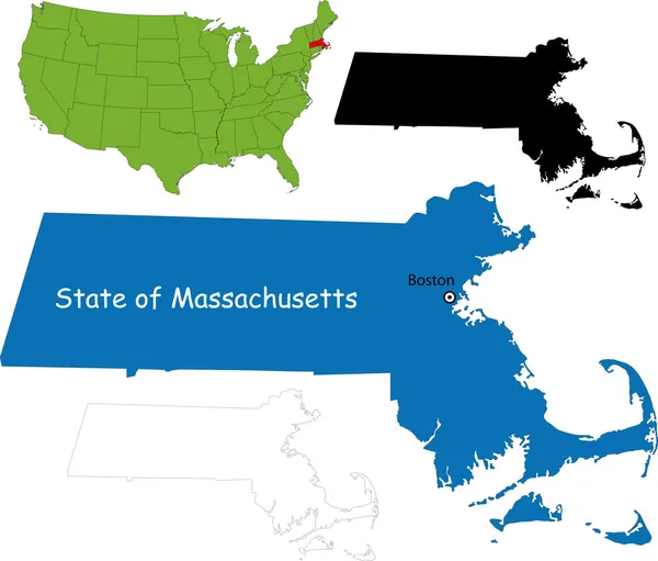
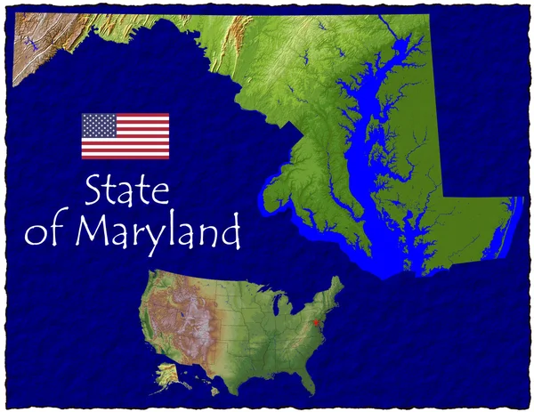
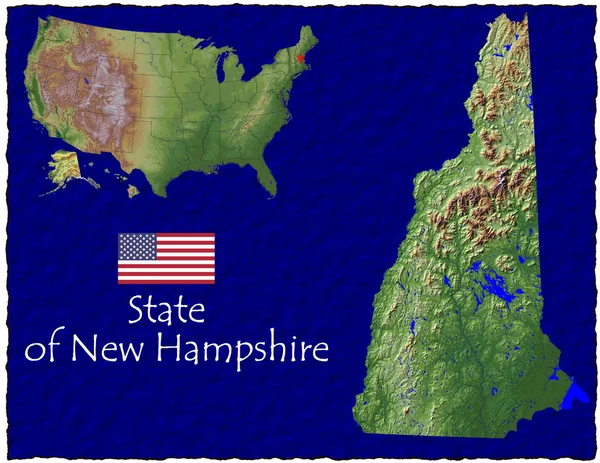
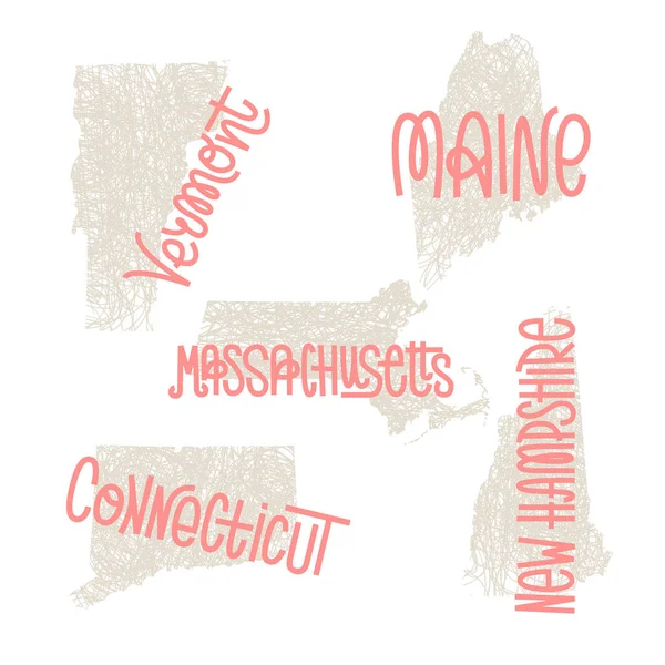
Stock image Hampshire Massachusetts

stock vector Massachusetts map

Massachusetts Map

Vector, 4.33MB, 5502 × 4691 eps
stock vector USA State counties emblem map

USA State Counties Emblem Map

Vector, 0MB, 5136 × 5168 zip
stock vector United States of America highly detailed physical map,in vector format,with all the relief forms,states and big cities.

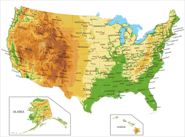
United States Of America Highly Detailed Physical Map,in Vector Format,with All The Relief Forms,states And Big Cities.

Vector, 7.79MB, 5000 × 3714 eps
stock image Virginia, USA hi res aerial view

Virginia, USA Hi Res Aerial View

Image, 8.16MB, 3300 × 2550 jpg
stock vector new england states map

New England States Map

Vector, 1.11MB, 3100 × 3966 eps
stock image Texas, USA hi res aerial view

Texas, USA Hi Res Aerial View

Image, 8.96MB, 3300 × 2550 jpg
stock image Montana, USA hi res aerial view

Montana, USA Hi Res Aerial View

Image, 9.04MB, 3300 × 2550 jpg
stock vector Massachusetts, political map with capital Boston. Commonwealth of Massachusetts, MA. Most populous state in the New England region of the United States. The Bay State. English. Illustration. Vector.

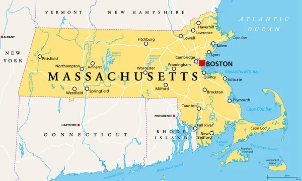
Massachusetts, Political Map With Capital Boston. Commonwealth Of Massachusetts, MA. Most Populous State In The New England Region Of The United States. The Bay State. English. Illustration. Vector.

Vector, 4.72MB, 9000 × 5401 eps
stock image Maryland, USA hi res aerial view

Maryland, USA Hi Res Aerial View

Image, 7.4MB, 3300 × 2550 jpg
stock image House with beautiful Fall colors in New England in USA

House With Beautiful Fall Colors In New England In USA

Image, 3.98MB, 3800 × 5694 jpg
stock image New Hampshire, USA hi res aerial view

New Hampshire, USA Hi Res Aerial View

Image, 8.01MB, 3300 × 2550 jpg
stock image Connecticut, USA hi res aerial view

Connecticut, USA Hi Res Aerial View

Image, 8.01MB, 3300 × 2550 jpg
stock image Maine, USA hi res aerial view

Maine, USA Hi Res Aerial View

Image, 8.32MB, 3300 × 2550 jpg
stock image Illinois, USA hi res aerial view

Illinois, USA Hi Res Aerial View

Image, 8.72MB, 3300 × 2550 jpg
stock image Florida, USA hi res aerial view

Florida, USA Hi Res Aerial View

Image, 7.06MB, 3300 × 2550 jpg
stock image Kansas, USA hi res aerial view

Kansas, USA Hi Res Aerial View

Image, 13.13MB, 3300 × 3300 jpg
stock image Alabama, USA hi res aerial view

Alabama, USA Hi Res Aerial View

Image, 8.71MB, 3300 × 2550 jpg
stock image State of Wyoming, USA, hi res aerial view

State Of Wyoming, USA, Hi Res Aerial View

Image, 9.42MB, 3300 × 2550 jpg
stock vector Map of the United States of America

Map Of The United States Of America

Vector, 2.33MB, 5000 × 3123 ai
stock image Minnesota, USA hi res aerial view

Minnesota, USA Hi Res Aerial View

Image, 8.91MB, 3300 × 2550 jpg
stock image Iowa, USA hi res aerial view

Iowa, USA Hi Res Aerial View

Image, 13.41MB, 3300 × 3300 jpg
stock image Louisiana, USA hi res aerial view

Louisiana, USA Hi Res Aerial View

Image, 9.16MB, 3300 × 2550 jpg
stock image New Mexico, USA hi res aerial view

New Mexico, USA Hi Res Aerial View

Image, 9.11MB, 3300 × 2550 jpg
stock image California, USA  hi res aerial view

California, USA Hi Res Aerial View

Image, 8.47MB, 3300 × 2550 jpg
stock vector Vector map of the East Coast, United States

Vector Map Of The East Coast, United States

Vector, 2.64MB, 3100 × 5493 eps
stock vector new york administrative map

New York Administrative Map

Vector, 1.37MB, 4539 × 3390 eps
stock image Beautiful lake and colourful trees of New England at foliage sea

Beautiful Lake And Colourful Trees Of New England At Foliage Sea

Image, 5.15MB, 2891 × 2301 jpg
stock vector Vermont, VT, political map with capital Montpelier, borders, cities, rivers and lakes. Northeastern state in the New England region of the United States. The Green Mountain State. Illustration. Vector

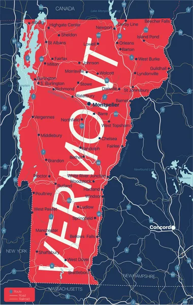
Vermont, VT, Political Map With Capital Montpelier, Borders, Cities, Rivers And Lakes. Northeastern State In The New England Region Of The United States. The Green Mountain State. Illustration. Vector

Vector, 3.13MB, 6000 × 8465 eps
stock image New York state, USA hi res aerial view

New York State, USA Hi Res Aerial View

Image, 8.14MB, 3300 × 2550 jpg
stock image Pennsylvania, USA hi res aerial view

Pennsylvania, USA Hi Res Aerial View

Image, 11.19MB, 3300 × 2550 jpg
stock image Michigan, USA hi res aerial view

Michigan, USA Hi Res Aerial View

Image, 7.34MB, 3300 × 2550 jpg
stock vector Vermont state detailed editable map

Vermont State Detailed Editable Map

Vector, 1.17MB, 4129 × 6500 eps
stock vector Massachusetts, gray political map, with capital Boston. Commonwealth of Massachusetts, MA. Most populous state in the New England region of United States. The Bay State. English. Illustration. Vector.

Massachusetts, Gray Political Map, With Capital Boston. Commonwealth Of Massachusetts, MA. Most Populous State In The New England Region Of United States. The Bay State. English. Illustration. Vector.

Vector, 2.72MB, 9000 × 5358 eps
stock image Beautiful Fall colors with farm house in New England in USA

Beautiful Fall Colors With Farm House In New England In USA

Image, 5.8MB, 3800 × 5693 jpg
stock image Kentucky, USA hi res aerial view

Kentucky, USA Hi Res Aerial View

Image, 9.29MB, 3300 × 2550 jpg
stock image Beautiful lake and colourful trees of New England at foliage sea

Beautiful Lake And Colourful Trees Of New England At Foliage Sea

Image, 8.63MB, 3005 × 2252 jpg
stock vector USA 50 States with State Names and Capital

USA 50 States With State Names And Capital

Vector, 6.29MB, 2500 × 2000 eps
stock image Swift river covered bridge in the white mountains

Swift River Covered Bridge In The White Mountains

Image, 19.93MB, 6016 × 4016 jpg
stock vector United states of America political map with drop shadow on white background

United States Of America Political Map With Drop Shadow On White Background

Vector, 1.28MB, 5000 × 3750 eps
stock image Beautiful lake and colourful trees of New England at foliage sea

Beautiful Lake And Colourful Trees Of New England At Foliage Sea

Image, 26.15MB, 8571 × 2927 jpg
stock image New England Window

New England Window

Image, 11.1MB, 4198 × 6204 jpg
stock image Colorado State bird

Colorado State Bird

Image, 3.78MB, 4050 × 4050 jpg
stock image House with beautiful Fall colors in New England in USA

House With Beautiful Fall Colors In New England In USA

Image, 3.18MB, 5694 × 3800 jpg
stock image Old-fashioned fence

Old-fashioned Fence

Image, 4.39MB, 4288 × 2848 jpg
stock image Albany cover bridge on the kancamagus highway

Albany Cover Bridge On The Kancamagus Highway

Image, 12.61MB, 5523 × 3687 jpg
stock vector Vermont, Maine, Massachusetts, Connecticut, New Hampshire USA st

Vermont, Maine, Massachusetts, Connecticut, New Hampshire USA St

Vector, 14.58MB, 5000 × 5000 eps
stock image Georgia, USA hi res aerial view

Georgia, USA Hi Res Aerial View

Image, 9.01MB, 3300 × 2550 jpg
stock image Missouri State bird

Missouri State Bird

Image, 3.88MB, 4050 × 4050 jpg
stock vector Drawing of a map of New England states comprising six states in Northeastern United States, Connecticut, Maine, Massachusetts, New Hampshire, Rhode Island and Vermont on isolated background.

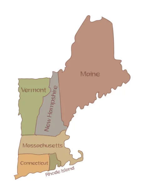
Drawing Of A Map Of New England States Comprising Six States In Northeastern United States, Connecticut, Maine, Massachusetts, New Hampshire, Rhode Island And Vermont On Isolated Background.

Vector, 4.63MB, 5000 × 6250 eps
stock image South Carolina State bird

South Carolina State Bird

Image, 3.81MB, 4050 × 4050 jpg
Page 1 >> Next