photo free
Home Images Vectors Videos

Stock image Lincoln Vector Map

stock vector USA Symbols - Icon set

USA Symbols - Icon Set

Vector, 0.6MB, 3997 × 5618 eps
stock vector Map of Lincoln in Nebraska in blue. Contains layered vector with roads water, parks, etc.

Map Of Lincoln In Nebraska In Blue. Contains Layered Vector With Roads Water, Parks, Etc.

Vector, 26.75MB, 2400 × 2400 eps
stock vector Map of Lincoln in Nebraska in grayscale. Contains layered vector with roads water, parks, etc.

Map Of Lincoln In Nebraska In Grayscale. Contains Layered Vector With Roads Water, Parks, Etc.

Vector, 21.82MB, 2400 × 2400 eps
stock vector Port Lincoln (South Australia) outline map set

Port Lincoln (South Australia) Outline Map Set

Vector, 0.34MB, 6000 × 3000 eps
stock vector Road map of Lincoln in Nebraska. Contains layered vector with roads water, parks, etc.

Road Map Of Lincoln In Nebraska. Contains Layered Vector With Roads Water, Parks, Etc.

Vector, 21.3MB, 2400 × 2400 eps
stock vector American-style character with a beard, glasses, mustache and glasses. logo on a white background

American-style Character With A Beard, Glasses, Mustache And Glasses. Logo On A White Background

Vector, 3.07MB, 5000 × 5000 eps
stock vector American-style character with a beard, glasses, mustache and glasses. logo on a white background

American-style Character With A Beard, Glasses, Mustache And Glasses. Logo On A White Background

Vector, 3.07MB, 5000 × 5000 eps
stock vector The Montana State county map with labels

The Montana State County Map With Labels

Vector, 9.08MB, 5000 × 3200 eps
stock vector USA map puzzle - One state-one puzzle piece - Nebraska, Lincoln

USA Map Puzzle - One State-one Puzzle Piece - Nebraska, Lincoln

Vector, 8.01MB, 2200 × 2200 eps
stock vector United States of America isolated map and Nebraska State territory. vector USA political map. geographic banner template

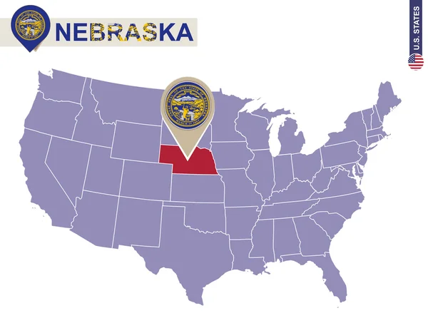
United States Of America Isolated Map And Nebraska State Territory. Vector USA Political Map. Geographic Banner Template

Vector, 0.76MB, 6000 × 4000 eps
stock vector North Dakota County Map

North Dakota County Map

Vector, 2.77MB, 5864 × 3000 ai
stock vector Nebraska line art map

Nebraska Line Art Map

Vector, 2.48MB, 5000 × 5000 eps
stock vector The black and white Louisiana State County Maps

The Black And White Louisiana State County Maps

Vector, 8.32MB, 3504 × 6204 eps
stock vector Nebraska County Map

Nebraska County Map

Vector, 0.76MB, 6000 × 3000 ai
stock vector Washington map

Washington Map

Vector, 4.82MB, 5202 × 4787 eps
stock vector The Louisiana State County Map with labels

The Louisiana State County Map With Labels

Vector, 9.49MB, 5000 × 4600 eps
stock vector Nebraska, NE, political map with the capital Lincoln and the largest city Omaha. Triply landlocked State in the Midwestern subregion of the United States of America, nicknamed Cornhusker State. Vector

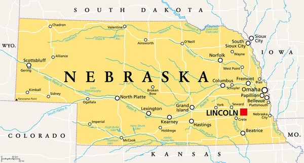
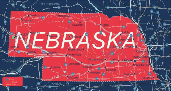
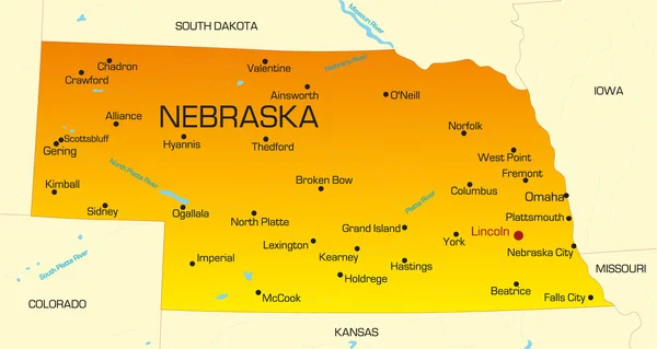
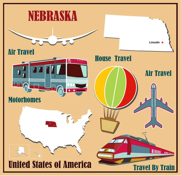
Nebraska, NE, Political Map With The Capital Lincoln And The Largest City Omaha. Triply Landlocked State In The Midwestern Subregion Of The United States Of America, Nicknamed Cornhusker State. Vector

Vector, 2.78MB, 9000 × 4854 eps
stock vector The Missouri State county map with labels

The Missouri State County Map With Labels

Vector, 9.94MB, 5000 × 5000 eps
stock vector The black and white Maine State County Maps

The Black And White Maine State County Maps

Vector, 8.39MB, 5000 × 3500 eps
stock vector Nebraska state detailed editable map

Nebraska State Detailed Editable Map

Vector, 0.96MB, 7069 × 3773 eps
stock vector Nebraska. Collection of four vector hearts with flag. Heart silhouette

Nebraska. Collection Of Four Vector Hearts With Flag. Heart Silhouette

Vector, 8.1MB, 5000 × 5000 eps
stock vector Illinois, IL, political map, with capital Springfield and metropolitan area Chicago. State in the Midwestern region of United States, nicknamed Land of Lincoln, Prairie State, and Inland Empire State.

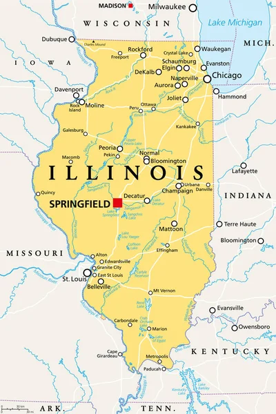
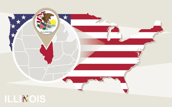
Illinois, IL, Political Map, With Capital Springfield And Metropolitan Area Chicago. State In The Midwestern Region Of United States, Nicknamed Land Of Lincoln, Prairie State, And Inland Empire State.

Vector, 4.08MB, 6000 × 9000 eps
stock vector Nebraska county map

Nebraska County Map

Vector, 0.8MB, 6000 × 3000 ai
stock vector Honoring Our Presidents on Washington Birthday Vector

Honoring Our Presidents On Washington Birthday Vector

Vector, 0.37MB, 6949 × 5000 ai
stock vector Iowa, IA, political map, with the capital Des Moines and most important cities, rivers and lakes. State in the Midwestern region of the United States of America, nicknamed The Hawkeye State. Vector.

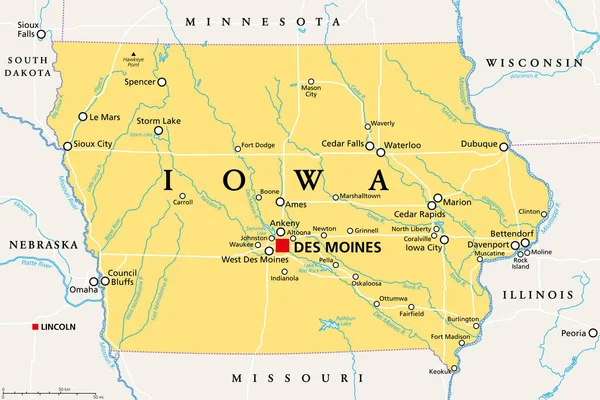
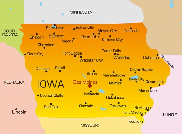
Iowa, IA, Political Map, With The Capital Des Moines And Most Important Cities, Rivers And Lakes. State In The Midwestern Region Of The United States Of America, Nicknamed The Hawkeye State. Vector.

Vector, 3.33MB, 9000 × 6000 eps
stock vector Nebraska

Nebraska

Vector, 0.82MB, 6692 × 3566 eps
stock vector Nebraska State on USA Map. Nebraska flag and map.

Nebraska State On USA Map. Nebraska Flag And Map.

Vector, 2.27MB, 5000 × 3663 eps
stock vector Greatest American Symbols

Greatest American Symbols

Vector, 5.51MB, 4528 × 5000 eps
stock vector vector map of United States of America with largest cities' skylines outlines

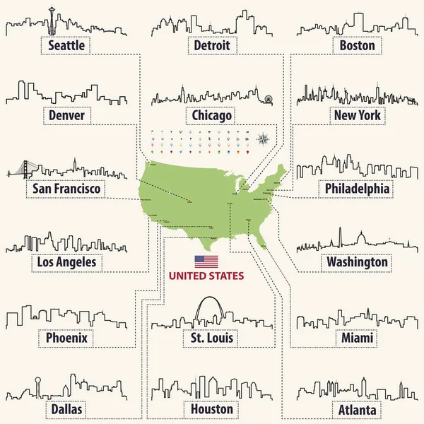
Vector Map Of United States Of America With Largest Cities' Skylines Outlines

Vector, 6.64MB, 7292 × 7292 eps
stock vector Idaho County Map

Idaho County Map

Vector, 0.62MB, 3333 × 5000 ai
stock vector Highly detailed vector silhouettes of US state maps, Division United States into counties, political and geographic subdivisions of a states, West North Central - North Dakota, South Dakota, Nebraska - set 7 of 17

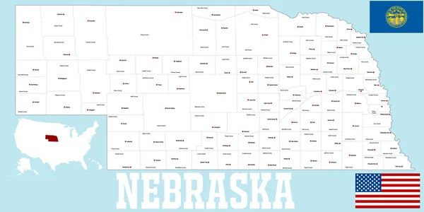
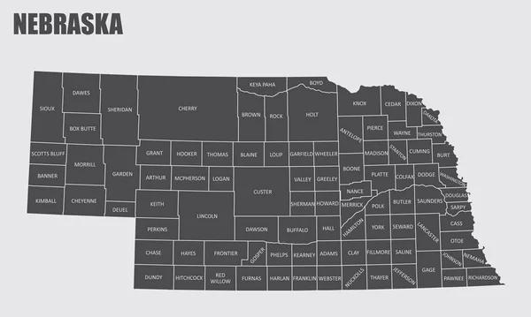
Highly Detailed Vector Silhouettes Of US State Maps, Division United States Into Counties, Political And Geographic Subdivisions Of A States, West North Central - North Dakota, South Dakota, Nebraska - Set 7 Of 17

Vector, 6.36MB, 9608 × 4501 eps
stock vector United States National Holidays - Presidents Day Vector Set

United States National Holidays - Presidents Day Vector Set

Vector, 0.58MB, 5878 × 5000 ai
stock vector United States National Holidays - Presidents Day Vector Set

United States National Holidays - Presidents Day Vector Set

Vector, 0.58MB, 5878 × 5000 ai
stock vector 37 of 50 states of the United States with a name, nickname, and

37 Of 50 States Of The United States With A Name, Nickname, And

Vector, 0.74MB, 7311 × 4112 eps
stock vector The Nebraska State County Map with labels

The Nebraska State County Map With Labels

Vector, 9.48MB, 5000 × 3000 eps
stock vector Iowa

Iowa

Vector, 0.79MB, 4981 × 3672 eps
stock vector 2017 Solar Eclipse Geometry Across Nebraska Cities Map vector Illustration

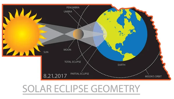
2017 Solar Eclipse Geometry Across Nebraska Cities Map Vector Illustration

Vector, 1.32MB, 6707 × 3825 eps
stock vector Honoring Our Presidents on Washington Birthday Vector

Honoring Our Presidents On Washington Birthday Vector

Vector, 0.37MB, 6949 × 5000 ai
stock vector 2017 Solar Eclipse Geometry Across Oregon Cities Map vector Illustration

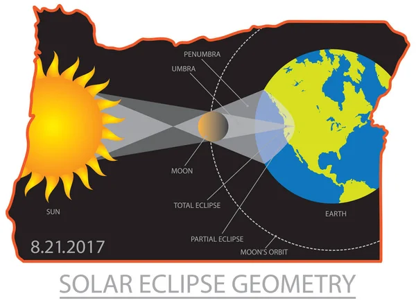
2017 Solar Eclipse Geometry Across Oregon Cities Map Vector Illustration

Vector, 1.51MB, 5759 × 4200 eps
stock vector Usa presidents, mount rushmore flat line illustration, concept vector isolated icon

Usa Presidents, Mount Rushmore Flat Line Illustration, Concept Vector Isolated Icon

Vector, 0.97MB, 2560 × 2560 eps
stock vector Presidents Day Vector Set

Presidents Day Vector Set

Vector, 0.54MB, 6096 × 5000 ai
stock vector USA map with magnified Illinois State. Illinois flag and map.

USA Map With Magnified Illinois State. Illinois Flag And Map.

Vector, 2.58MB, 5000 × 3125 eps
stock vector vector illustration of largest United States city skylines in black and white color palette. Navigation, location and travel icons; flag and map of United States of America

Vector Illustration Of Largest United States City Skylines In Black And White Color Palette. Navigation, Location And Travel Icons; Flag And Map Of United States Of America

Vector, 14.11MB, 7292 × 7292 eps
stock vector North Dakota County Map

North Dakota County Map

Vector, 0.66MB, 5000 × 3077 ai
stock vector Flat map of Nebraska in the U.S. for air travel by car and train.

Flat Map Of Nebraska In The U.S. For Air Travel By Car And Train.

Vector, 2.28MB, 3000 × 2929 eps
stock vector happy presidents day poster with set icons

Happy Presidents Day Poster With Set Icons

Vector, 2.72MB, 5315 × 5415 eps
stock vector vector illustration of largest United States city skylines. Navigation, location and travel icons; flag and map of United States of America

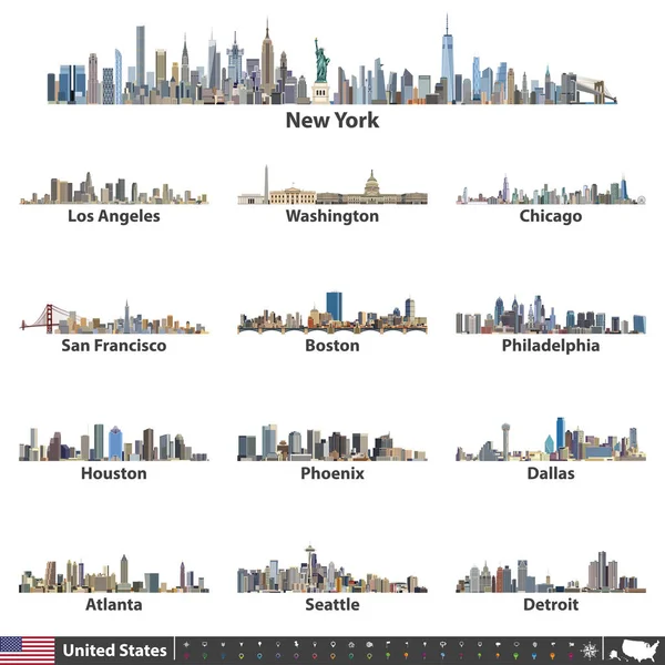
Vector Illustration Of Largest United States City Skylines. Navigation, Location And Travel Icons; Flag And Map Of United States Of America

Vector, 14.7MB, 7292 × 7292 eps
stock vector United States largest cities skylines in tints of blue color palette. Vector illustration

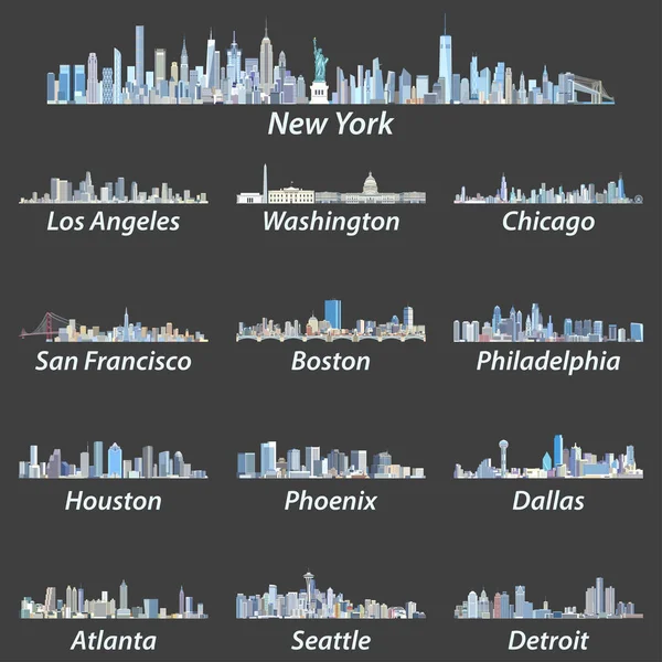
United States Largest Cities Skylines In Tints Of Blue Color Palette. Vector Illustration

Vector, 14.32MB, 7292 × 7292 eps
stock vector 2017 Solar Eclipse Across Oregon Cities Map vector Illustration

2017 Solar Eclipse Across Oregon Cities Map Vector Illustration

Vector, 1.26MB, 6138 × 3930 eps
stock vector Flat design, Cartoon Illustration of Abraham Lincoln and George Washington and icons, President's Day

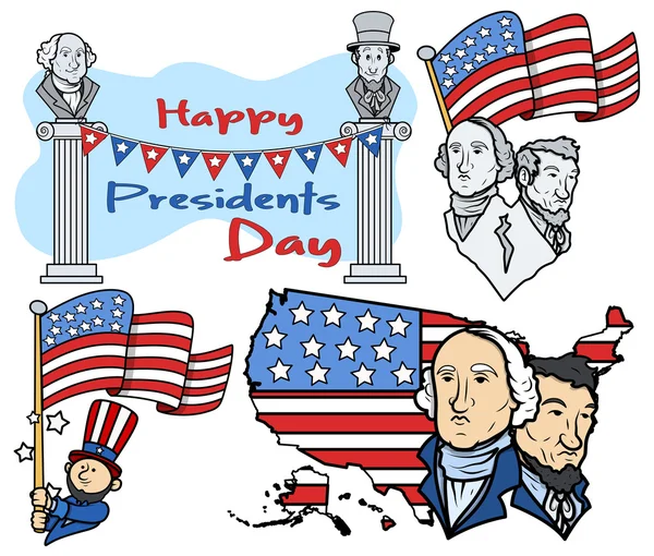
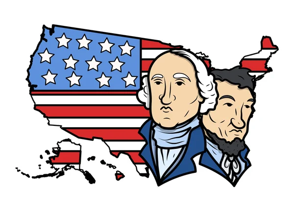
Flat Design, Cartoon Illustration Of Abraham Lincoln And George Washington And Icons, President's Day

Vector, 5.84MB, 3958 × 3958 eps
Page 1 >> Next