photo free
Home Images Vectors Videos

Stock image Tinian

stock image Aerial view, Tinian coastline

Aerial View, Tinian Coastline

Image, 5.52MB, 3872 × 2592 jpg
stock image Tinian Island in the Philippine Sea, belonging to United States, isolated on a bilevel elevation map, with distance scale

Tinian Island In The Philippine Sea, Belonging To United States, Isolated On A Bilevel Elevation Map, With Distance Scale

Image, 0.3MB, 2160 × 2160 jpg
stock image Taga Beach, Tinian, Northern Mariana Islands

Taga Beach, Tinian, Northern Mariana Islands

Image, 6.71MB, 4592 × 2584 jpg
stock image World War 11 Runway Able airfield, Tinian, Northern Mariana Islands

World War 11 Runway Able Airfield, Tinian, Northern Mariana Islands

Image, 10.8MB, 3900 × 2613 jpg
stock image Mysterious latte-stones on the island of Tinian

Mysterious Latte-stones On The Island Of Tinian

Image, 12.08MB, 4000 × 3000 jpg
stock image Brown tree snake (Boiga irregularis)

Brown Tree Snake (Boiga Irregularis)

Image, 2.21MB, 5685 × 3794 jpg
stock image The B-29 Superfortress Enola Gay sits on display at the Steven F. Udvar-Hazy Center in Chantilly, Virginia.

The B-29 Superfortress Enola Gay Sits On Display At The Steven F. Udvar-Hazy Center In Chantilly, Virginia.

Image, 11.41MB, 6023 × 4015 jpg
stock image Geyser at Tinian Blow hole

Geyser At Tinian Blow Hole

Image, 7.19MB, 3872 × 2592 jpg
stock image Flame Tree flowering, Tinian, Northern Mariana Islands

Flame Tree Flowering, Tinian, Northern Mariana Islands

Image, 10.76MB, 4592 × 2584 jpg
stock vector Saipan and Tinian, Northern Mariana Islands, gray political map. Islands of the Mariana Archipelago. Unincorporated territory and commonwealth of United States with administrative center Capitol Hill.

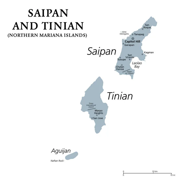
Saipan And Tinian, Northern Mariana Islands, Gray Political Map. Islands Of The Mariana Archipelago. Unincorporated Territory And Commonwealth Of United States With Administrative Center Capitol Hill.

Vector, 1.42MB, 6000 × 6000 eps
stock image Tinian Island in the Philippine Sea - belonging to United States. Described location diagram with yellow shape of the island and sample maps of its surroundings

Tinian Island In The Philippine Sea - Belonging To United States. Described Location Diagram With Yellow Shape Of The Island And Sample Maps Of Its Surroundings

Image, 1.86MB, 3840 × 2160 jpg
stock image Tinian Island in the Philippine Sea on a satellite image taken in December 14, 2018

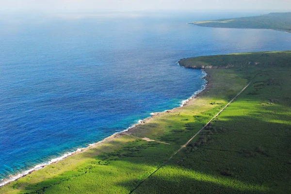
Tinian Island In The Philippine Sea On A Satellite Image Taken In December 14, 2018

Image, 4.13MB, 2880 × 1620 jpg
stock image The World War II bomber Enola Gay on Tinian Island

The World War II Bomber Enola Gay On Tinian Island

Image, 13.37MB, 5238 × 3558 jpg
stock image Tinian Island in the Philippine Sea on a topographic, OSM Humanitarian style map

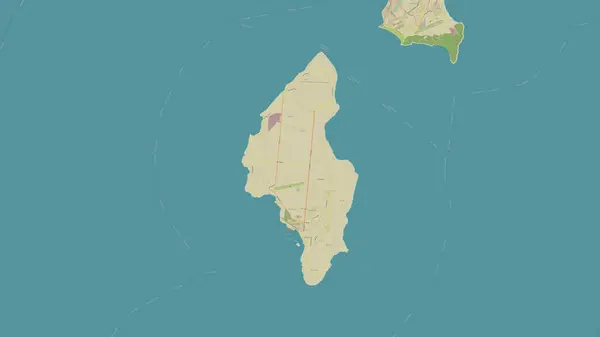
Tinian Island In The Philippine Sea On A Topographic, OSM Humanitarian Style Map

Image, 0.59MB, 2880 × 1620 jpg
stock vector Turkish cuisine national food vector authentic restaurant menu. Turkish iskender and shish kebab, lamb meat kofte, fried carrot balls and fatty mussels in batter, green pepper dolma and soup illa

Turkish Cuisine National Food Vector Authentic Restaurant Menu. Turkish Iskender And Shish Kebab, Lamb Meat Kofte, Fried Carrot Balls And Fatty Mussels In Batter, Green Pepper Dolma And Soup Illa

Vector, 7.92MB, 7409 × 4859 eps
stock vector Guam and Northern Mariana Islands, gray political map. Two separate unincorporated territories of the United States of America in the Micronesia subregion of the Western Pacific Ocean. Illustration.

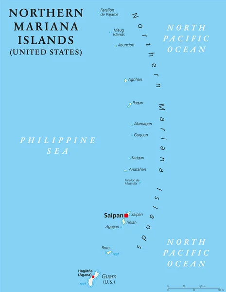
Guam And Northern Mariana Islands, Gray Political Map. Two Separate Unincorporated Territories Of The United States Of America In The Micronesia Subregion Of The Western Pacific Ocean. Illustration.

Vector, 2.02MB, 6000 × 8996 eps
stock image Tinian Island in the Philippine Sea on a colored elevation map

Tinian Island In The Philippine Sea On A Colored Elevation Map

Image, 0.97MB, 2880 × 1620 jpg
stock image A boy somersaults off the edge of the Taga Beach cliff on Tinian, Northern Mariana Islands in February 2015. Taga Beach is the most popular destination in the island.

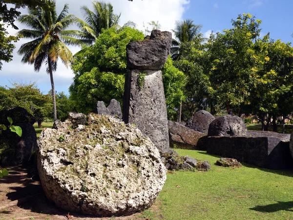
A Boy Somersaults Off The Edge Of The Taga Beach Cliff On Tinian, Northern Mariana Islands In February 2015. Taga Beach Is The Most Popular Destination In The Island.

Image, 3.16MB, 2592 × 3440 jpg
stock image The B-29 Superfortress Enola Gay sits on display at the Steven F. Udvar-Hazy Center in Chantilly, Virginia.

The B-29 Superfortress Enola Gay Sits On Display At The Steven F. Udvar-Hazy Center In Chantilly, Virginia.

Image, 8.91MB, 6240 × 3510 jpg
stock image Tinian Island in the Philippine Sea, belonging to United States, isolated on a topographic, OSM Humanitarian style map, with distance scale

Tinian Island In The Philippine Sea, Belonging To United States, Isolated On A Topographic, OSM Humanitarian Style Map, With Distance Scale

Image, 0.55MB, 2160 × 2160 jpg
stock image Tinian Island in the Philippine Sea, belonging to United States, isolated on a satellite image taken in January 28, 2020, with distance scale

Tinian Island In The Philippine Sea, Belonging To United States, Isolated On A Satellite Image Taken In January 28, 2020, With Distance Scale

Image, 1MB, 2160 × 2160 jpg
stock vector Northern Mariana Islands political map

Northern Mariana Islands Political Map

Vector, 2.05MB, 6444 × 9666 eps
stock vector Northern Mariana Islands political map

Northern Mariana Islands Political Map

Vector, 2.47MB, 6974 × 8999 eps
stock vector Guam and Northern Mariana Islands, political map. Two separate unincorporated territories of the United States of America in the Micronesia subregion of the Western Pacific Ocean. Illustration. Vector

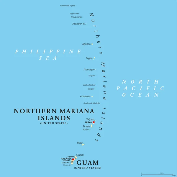
Guam And Northern Mariana Islands, Political Map. Two Separate Unincorporated Territories Of The United States Of America In The Micronesia Subregion Of The Western Pacific Ocean. Illustration. Vector

Vector, 3.12MB, 6000 × 6000 eps
Page 1 >> Next